Hokule'a Log: The Voyage Home
2000
Hokule'a Sails from Tahiti to Hawaii
January - March, 2000
By Sam Low
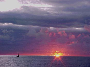
Photo
by Maka |
Kinohi loa
This is just the kinohi loa - the beginning - of a long voyage
of words. It is dedicated to my aumakua and my kupuna in general
and especially to my father, to Clorinda, to Pinky and Laura.
My father's ashes were laid in deep swirling pools of water
in the Atlantic more than 35 years ago - blood of Hawaii nurtured
by blood of New England - joined in the moana that knows no
boundaries. I am two spirits - of the anuanu land, the cold
one, and the nopu, the hot - of the ohana of my mother and father.
Their love for each other joined those two worlds. May this
work which we all together take on - from the valley of Niu
to the sand plains of Martha's Vineyard - strengthen that union.
Aloha
The heiau browed the hill, gift of many ancient hands, strong
with mana like bleached bone wrapped in tapa. The knowledge
came with a price, was a gift encumbered with obligations. He
accepted them with ha'aha'a - humility. He would soon stand
with naked soles upon the smooth planks of the canoe - the leader
of yet another seeking, accompanied by his aumakua and his ohana,
his comrades, entrusted to each other, sliding through danger.
But first this. Alone. The request for pomaika'i - blessing
- and for alaka'ina - guidance - and for koa - courage. Before
they joined, each man of the crew would seek pono - balance
- with the aina they must leave. Stored up separately and alone
in places unique to each, powerfully joined when they assembled
as a crew, ancestral mana - now throbbed from the stones of
the heiau into the soles of his feet as he stood there beneath
the hooded eyes of the heiau - waiting for the moment to enter.
Departure
In the harbor - ice like pancakes. On the ship - decks rimed
with salt stirred by yesterday's wind. Sloops and schooners
- moored in ice - wear mustaches. Sleeping.
A longshoreman exits a building, windows sheathed in condensed
warmth. "Ain't seen it like this for a long time. It's
the wind chill - forty below." Pigeons huddle on the building's
roof.
Seagulls squat on lily pads of ice. The air is still. A plume
of chimney smoke rises like a white pine tree. The ship glides
through slush. I slide away from one island home - to another.
A faint sun. Sky joins sea in a dull crease - a deeper band
of gray - as if at the ocean's extremity the atmosphere was
bent upon itself like a piece of tin. The island, receding,
is dark. Then lighter. Then gone.
Tautira: Hokule'a's Home in Tahiti
I first visited Pape'ete in 1966 when it was a somnolent seaside
town with a few yachts tied to the quay along the main street.
There were low buildings along the street and a famous bar,
called Quinns, which had a rough reputation. Today, few places
are left from that earlier time. There are the grand avenues
where the old French Colonial buildings still stand and the
Hotel Royal Pape'ete which was once the best but is now overshadowed
by many new one on the city's outskirts. Office buildings rise
above boutiques and restaurants. The bars are fancy in the French
manner, which means expensive and with an "I could care
less if you sit there waiting for your drink" attitude
which passes for an island weltzschmertz.
The Banyan trees that I remember still cast pools of shade
along the park beside the main street and locals with tattoos
still sit under them watching life pass by and talking in a
mix of Tahitian and French. The popping of motor scooters is
familiar but it's now almost drowned out by the roar of big
diesel tourist busses and Mercedes trucks and the street is
clouded with fumes. Pape'ete has become a place that, if you
know better, you leave as soon as possible.
Hokule'a's home port in Tahitian waters is the village of Tautira,
an hour's drive from Pape'ete on a road that winds through a
landscape of utilitarian architecture, burgeoning strip malls,
gas stations, lotissemonts - a French-Polynesian version of
suburban sprawl. Following the road, the hubbub of uncontrolled
development subsides. The air clears of fumes. Mountain peaks
jostle toward the shore - presenting waterfalls and vistas into
deep valleys. In Tautira, the road ends.
Robert Louis Stevenson visited Tautira in 1888 on a cruise
through the South Seas. "One November night in the village
of Tautira," he wrote to a friend, "we sat at the
high table in the hall of assembly, hearing the natives sing.
It was dark in the hall, and very warm; though at times the
land wind blew a little shrewdly through the chinks, and at
times, through the larger openings, we could see the moonlight
on the lawn... You are to conceive us, therefore, in strange
circumstances and very pleasing; in a strange land and climate,
the most beautiful on earth; surrounded by a foreign race that
all travelers have agreed to be the most engaging... We came
forth again at last, in a cloudy moonlight, on the forest lawn
which is the street of Tautira. The Pacific roared outside upon
the reef. Here and there one of the scattered palm-built lodges
shone out under the shadow of the wood, the lamplight bursting
through the crannies of the wall."
Tautira has changed since then, of course. The "palm-built
lodges" are long gone, replaced by neat bungalows of wood
or cinderblock with metal roofs. But the mountains of the Vai
Te Pi Ha Valley still rise above the village and the Pacific
still roars upon the reef and the swells still make a solid
white line on an azure gin-clear sea. In the lagoon it is calm.
There are stands of tall coconut palm along the shore along
with ironwood, milo, mango and ulu trees with leaves that open
like human hands, yellow in the palm, dark green at the finger
tips. Small fishing skiffs are parked in many lawns. There is
a public water tap by the Mairie - the Mayor's office - and
many village women come here to wash their clothes; hanging
them out to dry in the yard - pareos of many colors and designs.
Driving into the village, the valley opens wide, revealing peaks
deep inside, masked in cloud. The slopes are light green with
ferns. Mango trees stand above the ferns and lower there are
hala trees in groves. Tautira remains, as Stevenson wrote more
than a hundred years ago, "a strange land and climate,
the most beautiful on earth."
Nainoa Thompson first visited Tautira in 1976 as a crewmember
aboard Hokule'a. There he met Puaniho Tauotaha, one of the village
elders - a fisherman, canoe paddler, and canoe carver - a man
of immense physical and spiritual strength.
"You could be in the canoe house," Nainoa remembers,
"and there was laughter and singing and people talking
but when Puaniho got up to speak there was complete silence.
I didn't know what he was saying but it felt like an oration.
And if he wasn't doing that he never said anything. When he
coached the canoe paddlers he hardly said a word. He was an
extremely quiet man. Very religious, very disciplined. He was
the edge of the old times."
After her famous maiden voyage to Tahiti, Hokule'a sailed from
village to village along the coast. Wherever she stopped, the
crew was hosted like visiting royalty. Nainoa had yet to sail
aboard the canoe on a long voyage and although he had prepared
for the return trip he was nervous and he was embarrassed by
the attention.
"We would prance into these parties and sit down and they
would feed us food and beer all night as if we were very special
people - which we were not," he remembers. "We sailed
into Tautira, the last stop in Tahiti, and we anchored and I
had just had enough. I told Kawika, the captain, 'I will stay
aboard the canoe.' The current was strong. We had two anchors
and the bottom was coral and they were not going to hold well
so I was worried. 'We are so close to leaving,' I thought, 'what
if the anchors drag and we damage the canoe?'"
Kawika agreed that Nainoa could stay aboard while the rest
of the crew went to the party in the village. That afternoon,
Nainoa enjoyed the solitude. The canoe bobbed serenely at her
anchorage. The sun began to settle over the nearby mountains.
"Finally, the sun went down behind Tahiti Nui," Nainoa
remembers, "and I saw this little girl, maybe four or five
years old, on the beach. She had a flower in her ear and she
was waving to me to come on shore. She just kept on waving.
So I went on shore and she grabbed me with hands so small that
she could just hold two of my fingers. She took me by the hand
and led me down the road and into a simple house with a dirt
floor. They had put in some picnic tables and they had the whole
crew in there and they were feeding them shrimp and steak and
all kinds of food. Somebody would stand behind you and if your
beer glass got half empty they would fill it up. Puaniho came
in. He was the stroker for the old time canoe paddlers. He sat
down. He had powerful eyes. He was poor in material things but
he was a very strong and powerful man. He couldn't speak English
and I couldn't speak French or Tahitian. We sat there and we
spent the evening with him. It was just overwhelming how much
the people of the village give when they had so little to give.
They didn't have a floor in their house, much less beer and
steak to share. I felt awkward. Here was this Hawaiian group
who really didn't know a damn thing about sailing and they were
treating us as if we were special people."
"We sailed back to Pape'ete and we were staying in a hostel,"
Nainoa continues. "Two days before we left I was sleeping
in my room and about four o'clock in the morning I woke up.
Puaniho's wife was pulling me by my toes and waving to me to
go outside. So I got my clothes on and we went outside. She
couldn't speak any English and so she just signaled to get in
her truck. We drove all the way back to Tautira, early in the
morning, as the sun came up. We went to every house, every house,
and we stopped and they filled that truck up with food. By the
time we drove back to Pape'ete I was sitting on a mound of food
- banana, taro, mango, uru - everything. There was no verbal
communication. Puaniho drove right up to the canoe. He knew
exactly what he was going to do. They put all the food aboard
and then he drove off."
"Somehow Puaniho knew that I was nervous about the trip.
I was even considering not going. The next day he came back
and he had carved a wooden cross, a necklace, and he gave it
to me. That was when I knew that I had to go."
When Nainoa returned to Hawai'i aboard Hokule'a in 1976, he
told his grandmother, Clorinda Lucas, and his parents, Pinky
and Laura Thompson about Puaniho and the hospitality the crew
had received in Tautira.
"I told that story to my grandmother and to my mom and
dad and you can imagine what that meant to them. They knew that
I was afraid - that I felt that I was not prepared. And these
Tahitians knew what to do to care for me and the crew by giving
us what they could - their food and their aloha."
In 1977, Nainoa invited Tautira's Maire Nui Canoe Club to Hawai'i
to compete in the Moloka'i Race. About fifty people arrived.
Pinky and Laura moved out of their home in the Niu Valley as
did Nainoa and his sister Lita and her husband Bruce Blankenfeld.
They converted the Hui Nalu canoe shed into a dormitory with
bunk beds on loan from the National Guard. For a month Nainoa
and his family hosted their Tahitian guests. It was the beginning
of many such exchanges between the people of Hawaii and Tautira.
Maire Nui won the race. "All the other crews were competing
for second place," Nainoa remembers. They returned twice
more, winning each time, and retired the famous Outrigger Canoe
Club cup which now sits in the house of Sane Matehau Salmon
- Hokule'a's host whenever she visits Tautira.
"If you understand how anxious my parents and grandmother
were during the 1976 voyage, you can understand how grateful
they were for the hospitality shown to us by the people of Tautira.
And you can understand how they would move out of their house
and give it to them and feed them for a month. That's why Sane
says 'This we will never forget and this is why we will always
take care of you when you visit Tahiti.' And then you can also
understand why Hokule'a has to come back to Tautira whenever
we come to Tahiti."
"For me, Tautira is not just a beautiful physical place.
It's a symbol for the kinds of values that are important,"
Nainoa says. "I learned from the people of Tautira that
there are other ways to measure wealth besides the things that
you accumulate. The people of Tautira are extremely happy when
they see that we are happy. When they give to you they feel
rich themselves. That is what Tautira is all about."
Thursday, January 27, 2000
It's simmering in the flat skirt of land beneath Tautira's
towering peaks. Crevices etched in the peaks by rainy season
waterfalls are dry. The lagoon is a mirror and the surf is a
light scrim lining the reef. Puffy cumulus clouds crenellate
the horizon as cirrus and mare's tails glide almost imperceptibly
overhead. There's not a breath of wind.
In the morning, we receive flu shots from doctor Ming-Lei Tim
Sing and Kaui Pelekane, a nurse at Queen's Hospital in Honolulu.
Chad Baybayan presides at our first meeting as a crew.
"Have all the halyards been checked for wear and replaces
where necessary?" he asks Kamaki Worthington, a crew member
on the voyage to Rapa Nui who remained in Tahiti to care for
the canoe.
"The halyards are done," Kamaki says, "and the
sails are tied on and ready. The number twenty-nine is on the
fore mast and the thirty-two is on the mizzen."
"How about the radios?"
"The handhelds work fine and we tested the transponders
and the single sideband."
The transponder is a radio transmitter that sends a signal
to Honolulu via satellite where it is decoded at the University
of Hawaii to provide a record of Hokule'a's track across the
ocean.
"Good work," says Chad.
"Mike and Kahua will check out the radios today,"
he continues, assigning each of us our tasks, "and call
PSAT this morning."
"Ka'iulani and I will make sure the water is loaded aboard."
"Sam, you inventory the documentation gear."
"Bruce and Snake, you check the fishing equipment. Pomai
and Terry will check the galley, and Bruce - can you make a
list of the fresh food we'll have to take aboard?"
Whenever Hokule'a arrives in Tautira, her crew is fed and housed
by the villagers, with assignments arranged by Sane Matehau,
mayor for the last 23 years and a prosperous building contractor.
Sane appears to be in his early fifties. He is a physically
strong man, barrel-chested, with a round open face that is often
creased with pleasure. He wears his hair in a modified brush
cut. His girth is ample. He is a man who naturally commands
attention. Sane has six brothers and three sisters - a huge
family that has become our 'ohana in Tautra.
Our Tautira Hosts
Edmon and Lurline - Shantell, Sam and Pomai
Vaihirua - Maka
Tepe'a and Toimata - Bruce
Ota and Terrevarua - Tava, Kamaki and Chad
Sikke and Linda Matehau - Mailing and Kona
Franco and Laiza Toofa - Kaui Pelekane
Jaqueline and Sabu - Marco
Sylvain and Lydia Atchong - Terry
Mereille and Manuia Marutaata - Ka'iulani
Maeva and Patrice Taerea - Nainoa and Pinky
Rosedine and Gerrard Mana - Joey
Friday, January 28
We continue to prepare for sea. During the morning crew meeting,
Nainoa asks us to have the canoe ready to depart on three hours
notice beginning tomorrow. The wind has been light and northerly
but if it shifts back to trades from the southeast, we must
be ready to take advantage of it.
"Our main problem is to get north beyond the Tuamotus,"
he tells us, "and that's about 240 miles. So if the wind
shifts we've got to go."
The Tuamotus screen our course to Hawaii. Sometimes called
"the dangerous islands," they are low coral atolls
- difficult to see during the day and almost impossible to see
at night - although Master Navigator Mau Piailug can smell their
coconut palms many miles at sea. The islands are a blessing
for canoes sailing from Hawaii to Tahiti because they provide
a 405 mile long "safety net" across the canoe's path
- a large area of land and bird signs that extends the geography
of landfall. But sailing back to Hawai'i they're a barrier to
the open ocean which must be passed before a navigator can breathe
freely.
With the wind on our beam - from the east - we can sail through
the Tuamotus quickly, but when it's from the north, as it is
today, we must tack - extending the time we are among the low
coral atolls - and the danger.
As we wait for favorable winds, hundreds of chores are completed
- life jackets, harnesses and flashlights are distributed to
the crew; strobe lights, and man overboard gear is checked;
electrical equipment - radios, satellite transponders, solar
panels and batteries - is tested; galley gear is loaded aboard.
Tomorrow the vigil begins. The navigators will scan the skies
for signs of easterly winds while we await the word to depart.
Our duffel bags are packed.
A Laying on of Hands - flashback
Sailing Hokule'a with a crew of volunteers over routes not
traversed for perhaps a millennium has presented many crises.
One such occurred in May of 1997, when Nainoa hired a surveyor
to inspect the canoe prior to its voyage to Rapa Nui.
A marine surveyor is empowered to say whether or not a vessel
is seaworthy. He uses simple tools, a trained eye, a pocketknife
and a rubber mallet. With his knife he probes for dry rot, a
kind of virus that reduces wood to dust, although not obviously
so to the naked eye. Poking in strategic places tells the story.
If the knife goes in easily, the wood is rotten. Banging on
the hull with a mallet may produce discordant notes to a surveyor's
ear, another sign of problems.
After a few hours of poking and banging on that May afternoon,
the surveyor made his report: "the canoe is rotten,"
he said. "I cannot certify her seaworthiness. I suggest
you think about putting her in a museum." The pronouncement
was a surprise but not a shock. Nainoa had seen places where
there was dry rot, but the canoe had taken him safely across
many oceans and had demonstrated more than seaworthiness, she
had shown her mana, her strength of spirit. Retiring Hokule'a
to a museum was not an option.
"I need two lists," Nainoa said to the surveyor,
"I need a list of what's wrong with her, and a list of
what to do to make her even stronger than when she was built."
The what-to-do list was long. Two of the wooden iakos had to
be replaced - an onerous job but not exceedingly so. The hull
was another matter. Wooden stringers run lengthwise from bow
to stern, providing strength. There are five such stringers
on each side, many of them rotten. The job of fixing all these
problems fell to Bruce Blankenfeld.
In September, the canoe went into dry-dock. Perhaps "dry-dock"
is a misnomer because it conjures a picture of Hokule'a in a
mammoth shipyard cofferdam. Hokule'a's dry-dock was a shed in
a decrepit section of the Port of Honolulu. Nearby was a junkyard
with a tall fence and barking dogs, a pile of sand for making
cement, a small marina, a few boatyards that did not appear
very busy. Bruce set about finding workers.
"It's easy to find people when you're ready to go sailing
but when you need them to maintain the canoe it can be pretty
difficult. I had a group of young folk come down at the beginning
of September and tell me they wanted to help. I said, 'well,
it's pretty easy to do that. All you have to do is show up.'
But after they saw all the work that was going on, they never
returned."
What the prospective workers saw was nasty. Young men and women
squirmed through hatches only slightly wider than their shoulders
where they toiled for hours, in Stygian gloom, amidst fiberglass
dust and the odor of polyvinyl resin. They excised the rotten
stringers. They fitted new sections of wood. Then they "sister-framed"
each stringer by adding two new pieces of wood, one on top and
one on the bottom. Triangular wedges of foamed plastic followed
for yet more strength and to "fair" the stringers
into the hull. They sanded all this smooth and laid layers of
glass fiber over it. They pushed resin into the fiber's mesh.
When it hardened, the process was repeated. Then again. Three
coats of resin; then two coats of paint. Meanwhile, other volunteers
sanded off the hulls' gel-coat. Fiberglass dust veiled the canoe,
clogging the pores of exposed skin. For eight months, Bruce
found himself down at dry-dock at odd hours inspecting the work.
Seeing his crew laboring over the canoe was like seeing a resurrection.
"Even though the work was hard, there was always a lot
of energy. We saw progress every day. People are working together
in the same place. It's usually dry and, compared to sailing
the canoe, working conditions are luxurious. There are fits
and starts, but everything seems to come together all right
in the end. You are working on something that is very beautiful.
You are touching the past with sandpaper and saws and rope lashings."
Bruce supervised his crew as they stripped the canoe's twin
masts and brushed on eight coats of varnish and sanded each
to the texture of baby-skin. Then they renewed five miles of
rope lashings a few feet at a time. They ripped off deck planking,
replaced and relashed it. The canoe received new iakos, new
splashboards, and new manus fore and aft. She received stanchions,
catwalks, hatches, and wiring for running lights and emergency
radios.
An army of volunteers donated thousands of man and woman hours
to Hokule'a's rebirth, a laying on of hands that expressed their
deep commitment to the canoe and what she meant to them. They
came from all walks of life. There is Russell Amimoto, for example,
nineteen years old, a professional house painter and volunteer
canoe lasher. He has served Hokule'a for three years. There
is Kamaki Worthington, twenty-six, a teacher, fiberglasser,
also a veteran of three years service. There is Kiki Hugo, in
his forties, a cross country trucker who spends long months
on the mainland driving from San Francisco to the Bronx, the
Bronx to San Francisco, until he earns enough money to return
home to Oahu. He is a kupuna, an elder crewmember with twenty-five
years service. There is Lilikala Kamalehiva, fortyish, college
professor, chair of the department of Hawaiian Studies at the
University of Hawaii, Hokule'a's chanter and master of protocol;
Wally Froiseth, early seventies, once Hawaii's most famous big-wave
surfer, now captain of the pilot boat of the Port of Honolulu;
Jerry Ongies, early sixties, retired Army officer, ex-manager
Dole Pineapple plant, boat builder, cabinet maker, canoe fabricator.
This list of workers is an extremely small selection of the
hundreds who donated their time to the canoe. The complete list
would fill a book. If you were to ask these people why they
have so freely given of themselves to the canoe they will provide
a variety of reasons, unique to each of them, but there will
also be a common response similar to what Nainoa once told an
audience of legislators when they asked him why they should
fund Hokule'a and her voyages.
"We must sail in the wake of our ancestors," he told
them, "to find ourselves."
Finally, on the last week in March, the work was finished.
The surveyor returned with his knife, his mallet and his well
trained eye and certified the canoe "Lloyds A-1,"
nomenclature used by the world's largest insurer of watercraft
to signify complete readiness for sea. A few days later, the
canoe was launched. Among the men and women who tended Hokule'a
as a giant crane lifted her from her cradle and laid her upon
the ocean was Bruce Blankenfeld.
"The mana in this canoe comes from all the people who
have sailed aboard Hokule'a and cared for her," Bruce said,
looking out over the crowd that had come down for the launching.
"I think of the literally hundreds of people who have come
down and given to the canoe when she was in dry dock. I think
of everyone who has shared similar work since she was first
launched in 1975, those who have sailed aboard her, the men
and women in all the islands we have visited who hosted us.
All of this malama - this laying on of hands - adds to the mana
of the canoe. It is intangible but it is alive and well."
January 27 - Meeting at the Mayor's Office
"The Old Men of Tautira"
You could imagine a meeting like this in a thatch-roofed canoe
house hundreds of years ago with the visitors' double-hull voyaging
canoe drawn up on the beach outside. But this meeting is held
in the white-washed conference room of Tautira's mayor - Sane
Matehau - and the date is January 27th, the year 2000. Only
the feeling is ancient - a sharing of stories by friends from
distant islands, a bonding together of a wide-spread `ohana.
Outside the conference room, the setting sun colors clouds
over nearby mountains and a cool wind washes ashore over the
reef. Inside, we are seated in a circle with representatives
of Tautira's community, including Kahu from the Protestant,
Catholic and Mormon churches. Sane has called the gathering
to celebrate the 25th anniversary of the joining of Tautira's
people with the people of Hawai`i.
The first to speak is Tutaha Salmon. For a Tahitian, he appears
almost delicate, yet his bearing is dignified, suggesting confidence.
His graying hair indicates he may be in his seventies. Tutaha
was once the mayor of Tautira - a position now held by Sane
- his son-in-law. He is now the governor of a large Tahitiian
district including Tautira and three other towns: Faaone, Taravao
and Pueu.
"It's an honor that whenever Hokule`a sails to Tahiti
she lands here in Tautira," Tutaha tells us. "How
many times have you come? I cannot count them. But what's important
is that you are now our family - our brothers and sisters."
Following protocol that is ancient, Tutaha then speaks of his
elders. The enfolding story of Hokule`a's relationship with
Tautira began with "the old men" - a six-man canoe
team who paddled their way into the history books
"Our dream of cultural exchange was born twenty-five years
ago. In those days the man I remember first is Puaniho. He has
now passed on but he showed us the way. He was a quiet man,
but powerful. There was Mate Hoatua the steersman on the canoe
from Haleolono to Waikiki. He steered the whole way, without
relief. Henere, Tevae, Nanua and Vahirua paddled the canoe.
We called them "the old men" because their minimum
age was fifty. This is our time to remember them and to tie
that rope tight to the mast."
"The old men" of Tautira's Maire Nui canoe club first
traveled to Hawai`i in 1975 to compete in the Moloka`i race.
Pinky Thompson next rose to speak in response to Tutaha's welcome.
"I want you to know that we feel at home ever since you
took a strange looking Hawaiian youth into your homes 25 years
ago, my son Nainoa. You recognized immediately that he was a
stranger in a land that was strange to him and you malama-ed
[took care of] him."
Nainoa came to Tautira in 1995 as a member of Hokule`a's crew.
He recognized immediately that the "old men" of Maire
nui paddled differently then any team in Hawai`i.
"They were so smooth," Nainoa recalls, "their
movements were fluid, no lost energy, and their canoe seemed
to leap forward - faster than anything I had every seen."
He wanted to learn from them and in 1977 he got the chance.
In that year's Moloka`i race, Nainoa's team from Hui Nalu lined
up next to "the old men."
"They were twice our age, and we were a pretty strong
crew but they left us in their wake, paddling easily."
In that same year, Nainoa traveled to Marina del Rey to serve
on a motor boat escorting Maire Nui in the Race to Newport Beach,
California.
"They finished the race, took a shower, and were drinking
a beer before the second place canoe arrived. They beat them
by an hour and 4 minutes."
Nainoa invited Maire Nui to stay in Niu Valley when they came
to Hawai`i in 1978 for the Moloka`i race and again in 1979 when
they won the koa division for the third consecutive time - retiring
the famous Outrigger Canoe Club cup to an exhibit case at Sane
Matehau's home in Tautira. Over the years, visits by Maire Nui
to Hawai`i and by Hawaiians to Tahiti continued. Puaniho built
a Koa canoe for Hui Nalu and later another famous Tautira canoe
builder flew to Kona to build six Koa canoes - helping to inspire
a renewal in traditional canoe building that thrives today.
Nainoa, Bruce, Pinky and their Hui Nalu colleagues studied
the Tahitian way of paddling and became champions themselves.
Pinky remembered those moments in his presentation at the Mayor's
office.
"You helped us become champion paddlers, but you did much
more than that. You helped us to return pride to our Polynesian
people by restoring our native craft of canoe building and paddling."
"'The old men' taught us what it means to be champs,"
Nainoa added. "It's not about outward appearance. It's
about what happens inside. They didn't talk much because they
knew that the mana comes from within. They didn't think of themselves
representing just a club - they represented all their people."
Friday, January 28 - Crew Briefing
"We're on three hour call to set sail," Nainoa tells
us at this morning's crew briefing. "Our first problem
will be to get to the Tuamotus, 240 miles to the northeast.
The crew is made up of new sailors and expert sailors. It's
designed that way. Bruce and Chad are in overall charge of safety
and of educating the new crew. They will stand six-hour watches
each - six on and six off. They will hot bunk with each other,
share the same puka, because when one is sleeping the other
will be on watch. Tava, Snake and Mike will be watch captains.
Shantell will navigate and so she will be up most of the time.
Ka'iulani and Kahualaulani will assist her so they will stand
6 hour watches, on and off. Pomai will cook, so she'll not stand
a watch. The rest of you will be on watch for 4 hours, then
have 8 hours off."
On one of the long tables at Sane's house, where we eat every
morning and evening, Nainoa spreads a map of the Pacific. He
traces his finger along a red line drawn on the map from Tahiti
to the Big Island.
"This is our course line. It's been drawn like this ever
since 1980. Makatea, here, and Rangiroa and Tikihau, here, will
be stepping-stones as we head north. Once we clear the Tuamotus
we will sail on long tacks, hopefully one single tack, to this
point 275 miles west of the Big Island, where we will turn to
sail downwind, probably to Hilo. With the new sails we have
now we should be able to sail efficiently. I think it will take
about 22 days."
"Our problem now is the weather. Normal trade winds, from
the east or southeast, are ideal. Hokule'a can point six houses
into the wind, so we can sail north or northeast. But the forecasts
are now calling for winds from the north and in those conditions
here's what happens."
Nainoa takes two pencils and joins them together at the ends,
the lead tips pointing outward. He arranges them in a fan with
the included angle equal to six houses - 67 and a half degrees
- the angle that Hokule'a can make when sailing into the wind.
He lays the pencils up against the chart with the right hand
pencil heading north, into the wind, and the left hand one -
our course in a northerly wind - pointing off to the northwest.
"If the wind forces us to sail off to the northwest, we'll
end up in Satawal."
"The weather pattern in the Pacific at this time of the
year extends over an area 5000 miles long. Since December, the
Pacific (mid Pacific?) has been a convective factory of rising
air. There's a large high-pressure system to the east. In the
winter, the high-pressure systems move, but now they stall and
another has formed to the west. In between the two systems there's
a depression - a trough that extends south of Tahiti and to
the west across the Pacific. It's a doldrum condition caused
by two stationary air masses. A whole Pacific-wide system. That
trough (which causes the north winds?) extends for a long, long
way. If we set out now and sail to the northwest, we'll never
get out of it. That system may be here for a long time. We're
stuck."
"There's a hurricane to the north of New Zealand, 2000
miles away, but there's no real chance that it will come up
here. The hurricane is a refrigerator. It sucks out warm winds
so it might allow the trades to reestablish themselves. If that
happens we might get a single day of good sailing weather. But
don't count on it."
"So we have a big challenge. We have light winds but they're
blowing from the direction we want to go - right in our face.
To get out of here, we may have to tow. No one likes to tow,
but we may have no other choice. Our voyage has a larger intent
- we sail to serve our community - and we have to be back in
time to get the canoe ready for her birthday at Kualoa on March
12th. We cannot wait beyond the 5th of February to leave, even
if we have to tow. About 240 miles north of Manihi we can get
into good trade winds.
Nainoa pauses, for a moment, allowing this to sink in.
"Okay, Chad and Bruce, you are in charge of seeing that
the canoe is ready and conducting safety drills. But remember;
be careful of the heat. You can easily dehydrate."
(Check all of the above weather analysis with Nainoa)
Saturday, January 29 - Weather Watch
The ocean remains unsullied. Parapets of cumulus cloud are
stalled around the horizon. There's a breath, and no more than
that, of wind - but it's out of the north, so getting to the
Tuamotus will be an ordeal of constant tacking into headwinds.
The high-pressure(?) ridge containing light unstable winds
continues to dominate our weather system. We want the ridge
to move but it's blocked by a zone of low pressure to the south,
which pulls the wind toward it, creating northerlies. This morning
Nainoa speaks with Bernie Kilonsky at the University of Hawai`i.
The low may finally move south, Bernie tells him, allowing the
high pressure ridge to move with it. If so, the light and variable
northerlies should be replaced by easterly trades. We may see
some change on Sunday and certainly by Monday. And, if Bernie
is right, the trades should fill back in by Tuesday.
"Ok," says Nainoa, "we stay on alert to go within
three hours notice - but if Bernie is correct we'll probably
not leave until Tuesday."
In the meantime, Nainoa and Shantell Ching join with student
navigators Kahualaulani Mick and Ka`iulani Murphy to lay out
their course line to Hawai`i and discuss alternative routes
depending on changeable wind and weather conditions. Bending
over the kitchen table in Nainoa's house, they first consider
the effect of the current.
"The longer you're in the current the more its effect
will be," Nainoa explains, reviewing basic knowledge, "so
the amount of offset will depend on your speed. The slower you
go - the more the offset."
The offset is also affected by the angle that the canoe makes
to the current. Assuming the canoe's speed to be five knots,
for example, with an easterly current of half a knot, a heading
of Manu (NE) will produce an offset to the west of four degrees.
Increasing the canoe's angle to the current increases the offset.
If she heads Nalani (NE by N) the offset is five degrees, while
a course to the north (Akau) means an offset of six degrees.
This kind of effect becomes great over long distances. Consider
the passage from Rangiroa to the doldrums, about 1100 miles.
At a speed of 5 knots, a half knot easterly current will set
the canoe to the west 12 miles a day or 108 miles during the
nine day voyage.
The navigators memorize current effects like these as a set
of general principles which can be easily modified mentally
as conditions change. If they sail north at 5 knots and the
current is from the east at half a knot - the westerly offset
is 12 miles each day. Change the canoes speed by 50% to 2.5
knots and the daily offset will be twice as much - or 24 miles
- because the canoe will take twice as long to cover the same
distance.
"We always try to eliminate having to do math in our heads,"
Nainoa explains, "it can cause serious brain damage."
For now, the navigators concentrate on the "first stage"
of the voyage home - from Tahiti to just north of Rangiroa -
when the canoe will enter the open ocean and begin "stage
two" to the doldrums. During the first stage, Makatea -
about 124 miles to the north - will be a stepping stone, a chance
for Shantell and her colleagues to test the accuracy of their
navigation. They consider when to depart Tautira in order to
arrive at Makatea with sufficient time to explore the island.
They decide to leave at 11 am. They will have no celestial bodies
to steer by so they must guide the canoe by "back sighting"
on Tautira's mountain peaks. Shantell figures they will be able
to use the 4,500' high mountains for about 60 miles on a clear
day and maybe 30 on a humid day - like today.
"That means that if we sail at five knots we can use our
back sight for about 6 hours," she says, "or until
5 p.m. By 3 p.m. the sun will be low enough on the horizon to
steer by so we can check our course to Makatea and modify it
if necessary."
When they reach Makatea, the navigators must decide when to
set out for the difficult pass between the low coral atoll of
Tikehau and Rangiroa which leads out into the open ocean. Kahualaulani
runs his finger over the eastern side of Tikihau's fringing
reef.
"These black marks are coconut trees," he says "and
we should be able to see them maybe ten miles at sea - during
the day. At night, forget about it. We might be right on top
of the reef before we see it."
"The distance from Makatea to Tikehau is 40 miles,"
says Shantell "and we want to be no closer than 10 miles
at sunrise, so when should we leave?"
"If we can average five knots then we should leave about
midnight," says Ka`iulani, "which should get us to
a point about ten miles off the reef at about 6 a.m."
And so it goes - the three navigators bend over their charts,
discuss strategy, and make notes in their logbooks. From time
to time, Nainoa joins them, asking questions - probing their
readiness.
"I may be asking a lot of questions of you guys now,"
he says, "but at sea I'm going to back off. We'll meet
at sunrise and sunset and talk about where you think you are
and what course we should steer, but I will only step in if
you're about to make a mistake that will jeopardize our safety."
The navigators' meeting breaks up at about noon but they will
meet again at sunset to watch the stars rise over Tautira's
peaks and establish their "back sight." The rest of
us wait impatiently to board the canoe and leave - but for them
the voyage has already begun.
Sunday, January 30
For the crews of Kamahele and Hokule`a, including new arrival
Nalani Wilson, today was mainly one of rest. The weather continues
unchanged - hot, humid with little wind - although it was cooler
last night. At 4 a.m. this morning Ota, Sabu, Papa Vaihiroa
and Tepea began preparing the imu for what may be our last big
feast in Tautira before departing. At one p.m., we gathered
at Sane's to pule, then dig into roast pork, fish, taro, breadfruit
and all the traditional dressings - a grand Tahitian feast.
And singing, lots of singing.
CREW PROFILE - Pomaikalani Bertelmann
A generation or so ago two Bertelmann brothers married two
Lindsey sisters and the trajectory of history in the Big Island
town of Waimea shifted slightly. Glenn Bertelmann and Delsa
Lindsey had seven children and Clay Bertelmann and Deedee Lindsey
produced five - a tight family with deep roots in a much larger
`ohana that thrived beneath the gentle catenary arc of Mauna
Kea. In Clay and Deedee's family, Pomaikalani was the first-born
- on March 7, 1973, in Honoka`a. At the time, her father was
a well known Parker Ranch cowboy, so it's not surprising that
young Pomai grew to love horses - in fact, animals of all kinds.
"I was basically raised on my family's ranch and riding
was a passion since I can remember," Pomai says. "I
also worked as a kid on Hale Kea ranch in Waimea, fixing fences,
raking the arenas, exercising horses and taking care of the
livestock."
Waimea was less dressy in those days, an informal rural town
where children could safely ride horses along the main street
and in the surrounding empty pastures. They rode to the Dairy
Queen drive-up window to order hamburgers, they staged informal
barrel and baton races and played "musical chairs"
in the vast empty prairie just outside town.
"A sense of community was second nature among us,"
Pomai says, "there were kids from all the families - the
Keakealani family, also Rebozos, De Silvas, Kimuras, Lindseys
- a lot of Lindseys - Kainoas, Colemans, Kanihos, Kaauas, Bergins,
Awaas, Purdeys and the Fergerstrom family - to name a few. All
of us were kaukalio (riding horses)."
One of the biggest events in Waimea was the fourth of July
rodeo organized by the Parker Ranch Roundup Club where cowboys
from the ranch's numerous divisions competed in various events
- cutting, roping, racing.
"The cowboy life style was not exclusive of women, not
at all. There were a lot of awesome women riders too. Lorraine
Urbic sat a horse like no one else, and she won a lot of races.
Then, just to name a few, there was Hoppy Whitehead, Val Hanohano,
and Peewee Lindsey - all of them very strong people - great
role models for us."
But life in Waimea embraced more than the land-based culture
of the Paniolo.
"One of my fondest memories," Pomai explains, "was
loading up the family Bronco with my mom and dad and the five
of us kids and then picking up all my cousins and food and camping
gear and heading for the beach. We went to a place called Wailea
at Puako. There was no one there in those days. We had the place
all to ourselves. Right next to where we used to camp there's
a telephone pole with the number "69" printed on it.
Since then, things have changed. Malahini now call Wailea "number
sixty-nine". When you lose the real Hawaiian name, you
lose a lot."
At Wailea and other places, Pomai learned to dive with her
father and she enjoyed fishing but never really grew fond of
other water sports. As a youngster it was always the life kaukalio
and with animals that attracted her most. But in 1975, her Uncle
Shorty sailed aboard Hokule`a on her maiden voyage to Tahiti.
"We supported him as a family, and whenever the canoe
came to the Big Island we helped care for her and her crew."
During the series of voyages between 1985 and 1987, Pomai's
father Clay sailed often aboard Hokule`a.
"He was away at sea for maybe six months during those
two years, and I began to wonder a little about the kind of
life he was leading."
Gradually, Pomai's family was becoming more and more entwined
with the sea. From 1989 to 1991 the Bertelmann family helped
search the forests surrounding Mauna Kea for koa logs to build
Hawai`iloa. They cooked and packed food for the searchers, walked
side by side with them during long weekend treks - took a key
role in the entire process. Ultimately, so devastated were Hawai`i's
forests, that no logs were found and the canoe was built instead
of Alaskan spruce. But from this effort, Mauloa was born - the
first traditionally made Hawaiian six man coastal canoe fashioned
within perhaps centuries.
"We did find Koa logs big enough for a smaller canoe,"
Pomai explains. "We went to Keahou to fell the trees and
we lived there over a long weekend in tents."
The canoe builders used adzes that they fashioned from stone
gathered at the ancient Keanakakao`i adze quarry on Mauna Kea
under the watchful eye of Mau Piailug. From 1991 to 1993, Pomai's
father Clay spent every weekend at Pu`uhonua O Honaunau working
on the canoe.
"In traditional times women were not allowed to work on
canoes so we supported the men," Pomai explains. "Mauloa
was built by the Na kalai wa`a - the canoe builders - from Koa
and Breadfruit sap and sennit and Lauhala, her hulls were smoothed
by stones and she was given a sheen with Kukui oil.
In 1992, Pomai went with her father to O`ahu to help him prepare
for Hokule`a's voyage to the Cook Islands. There she met a group
of young people who were beginning to assume leadership roles
- Moana Doi, Keahi Omai, Ka`au McKenney and Chadd Paishon, who
she would eventually marry.
"I began to think seriously about my life in 1992,"
she remembers, "and as I learned more about the values
involved in voyaging, I thought I wanted them in my own life.
Voyaging gave me a sense of family - which was familiar since
I had grown up in a strong supportive family - and it gave me
a connection to my cultural roots. And when Mau Piailug began
to stay with us I met a man who had done so much for our people
- how could I not be excited?"
Next came Makali`i - the Big Island canoe built by a passionate
community effort spearheaded by Clay, Shorty and Tiger Espere.
Beginning work in January 1994, the canoe was finished the following
December. In September, Pomai became - as she puts it - "a
one woman administrative staff," for Na Kalai Wa`a Moku
O Hawai`i - The Canoe Builders of Hawai`i. She was hooked.
In 1995, Pomai sailed aboard Makali`i from Tahiti, through
the Marquesas, and back to Hawai`i. "Then in 1997, Mau
asked us to take him home to Satawal on Makali`i and, of course,
there was no question about it." In February of 1999, Makali`i
raised anchor and set out on the voyage called E Mau - "Sailing
the Master Home."
"We sailed to many islands in Micronesia to honor Mau
among his own people," says Pomai. "On Satawal I saw
Mau as a complete man for the first time - not just as a navigator
- but also as a father, a husband, a fisherman, a farmer - you
should see his taro patch. I have never seen him so happy."
Soon after Makali`i returned from Micronesia, Pomai was once
again deeply immersed in organizing the details of caring for
the canoe and organizing it's many educational voyages. Through
the intimate grapevine of Hawaiian sailors, she learned of Hokule`a's
upcoming voyage to Rapa Nui. "I also heard that it might
be Nainoa's last voyage as a navigator," she remembers,
"and I was heart broken. I always wanted to sail with him.
I thought I might never get the chance." A short time later,
Nainoa called and invited her to come aboard Hokule`a for the
fifth leg - the voyage home.
"This is such an honor for me," Pomai says, "to
have a chance to not only learn from Nainoa but from the greatest
sailors of the last quarter century of traditional voyaging
- from Uncle Snake and Uncle Mike and Uncle Tava. I'm now sailing
with the guys who started the renewal of our ancient voyaging
arts and contributed to the beginning of the revival of our
Hawaiian culture."
January 31, Monday - Wind Watch
At 5:30 a.m. Shantell and Pomai Bertelmann stand at the end
of the jetty leading into Tautira's harbor. They see the dark
outline of mountain peaks descend to the sea - punctuated by
upthrusting coconut palms at the shore. They see an upturned
scimitar of moon, pale against the brightening sky, and the
bright spot that is Venus. More importantly, they see a broken
rope of compressed ropy cumulus clouds trailing away to sea
from the mountains' dark slopes.
"There's wind out there," Shantell says, "and
it looks like light trades. The clouds are dispersed on the
horizon which means the wind is light, it's not strong enough
to push them together, but it's there alright."
Ripples flit across the surface of the lagoon - fanning away
from the beach - the result of wind funneling through deep valleys
behind Tautira.
"That's a local wind," Pomai says, "which is
apparently from the south, but it's not significant."
Cars and bicyclists begin to move through the village. A group
of children, bearing baguettes, walk by. The sun rises orange
behind the low scudding clouds and the clouds lighten and pick
up the sun's orange glow. High cirrus clouds are brush strokes
of yellow and white.
After breakfast, we meet aboard Hokule`a where Nainoa, Chad
and Bruce assign each of us watches and duties while underway.
The canoe is moored in the sheltered lagoon. There's no breeze
and it's already extremely hot. Snake, Mike and Tava - the three
Watch Captains - take us through drills. We open and close the
sails and practice bending different jibs on the forestay. We
rig a larger mizzen sail in anticipation of light winds. As
a final drill, and without warning, Bruce yells "man overboard"
which elicits a scurry to pull in the sails, douse the jib,
deploy the man overboard pole and make radio contact with the
imaginary escort boat ghosting in our wake.
"Good job," is Bruce's comment.
By 2 p.m., the low ropy cumulus clouds have morphed into puffy
ragged shapes - an N.C. Weyeth sky - with exuberant parapets
of cloud marching briskly from east to west. Palm fronds clack
together in the freshening breeze. Nainoa spreads the word -
if the winds continue to build, we may depart tomorrow morning.
In the afternoon, Shantell and the student navigators gather
with Nainoa. They discuss the weather. "When you look at
the clouds and see that the bases are all at the same level
over the horizon, then you can predict that there is wind out
there." says Nainoa. "If you see high clouds with
a lot of vertical development, the winds are slowing down. But
you can be fooled. During a hot day like this morning, the land
heats up and the cool air over the water tends to flow toward
the land - a convection effect - and that makes it appear that
there may be strong trade winds. But if the wind comes out of
the valleys at night, you know that it's not trades."
"This morning it looked like we might have light trades,"
says Shantell, "but in the afternoon when I was at Sane's
the clouds started to get more vertical."
"And wisps of cirrus," says Nainoa. "When rain
squalls develop vertically the rain pulls down the moisture
and leaves cirrus behind. The wind regime is still very light.
We have to wait until tomorrow to see what develops."
"The trip to Rapa Nui required that I be able to focus
and to use my instinct much more than my intellect," Nainoa
says. "We sailed on even when there were no stars. We were
pushing every inch of the way to stay ahead of a front behind
us. That was a trip that I knew my intellect would not get us
through, so for this voyage I'm paying more attention to the
other side."
The navigators focus on the upcoming voyage to Makatea. (Check
this) "Makatea is 65 degrees from Tautira," says Shantell,
" so if you factor in 5 degrees of lee drift and 5 degrees
of current at 5 knots (the current or speed of canoe?) we want
to point the canoe one house upwind of the current. We want
to steer Nalani."
"What is the estimated time of departure out of Tautira
to get to Makatea based on a canoe speed of three knots?"
Nainoa asks. "Keep in mind that we can see about 21 miles
on a light wind day because there's no salt in the air."
"At one a.m. on Wednesday," says Shantell.
"So we would be at Makatea at 6 p.m., that's ugly."
"How long would it take if we can sail at 4 knots?"
"Thirty-one hours."
"So when do we leave?"
"Eleven a.m." (I don't think this is right. If takes
41 hours at 3 knots and 31 hours at 4 knots, the difference
in time to leave is 10 hours, so 6pm minus 10 hours = 9AM?)
"Yes, so we need a wind that will allow us to sail at
about 4 knots. If our speed parameter is 4 knots, we won't leave
tomorrow. Let's shoot for Wednesday and better winds."
"If we want to stop ten miles short of Tikihau at night,
do we wait at Makatea or de we leave and wait at Rangiroa?"
Kahualaulani asks.
"If the winds are from the east we go and wait at Rangiroa.
If they are behind us - no. The wind will tend to blow us onto
the islands."
"Tikihau is hard to see," says Shantell. "When
we went there in '95, it took me a long time before I could
see the trees."
"I want to sail home," says Nainoa at the close of
the meeting, "because only through sailing can we learn.
It's the relationship between us and the canoe and nature that
I want, so I'm opposed to towing because that allows us to artificially
set our speed and we don't learn."
At the end of the day, we fan out to our homes to wash clothes,
write in our journals and prepare for departure. Shantell Ching
lays out her star charts on the long dining table at Sane's
house and immerses herself once again in the intricate details
of navigating Hokule`a home.
Tuesday, February 1 - No Wind
At 5 a.m., when the village first begins to stir, the lagoon
is calm. Palm fronds are motionless. The air is still. It appears
that yesterday's cloud messengers and their rumor of trade winds
was a ruse. Last night, downpours cleaned the sky, opening a
view to brilliant stars - Orion (ka heihei o na keiki), Taurus
(kapuahi) and the Pleiades (makali'i) - a virtual explosion
of tiny, blinking points of light. This morning it is, once
again, much too tranquil for our tastes.
At last night's navigator's meeting, Nainoa discussed the French
weather predictions, courtesy of Guy Raoul - our meteorological
guru in Mangareva. Today - winds ESE at ten knots; tomorrow
- ESE at 5 knots, Thursday - ESE at 10 knots and Friday - variable.
The direction of the wind is favorable but its velocity is not.
In ten knots of wind, the canoe - heavily loaded as she will
be at the beginning our voyage - can make maybe three knots.
In a five knot zephyr, she will bob and rock - almost stalled.
We decide to wait for the weather pattern to reveal itself.
But deadlines are approaching - Hokule`a's March 12th birthday
celebration at Kualoa, for example. Nainoa's guesses that if
the winds do not become favorable by Saturday, we will be forced
to depart Tautira under tow. To prepare for that, and be ready
to leave on short notice, Alex and Elsa Jakubenko will depart
Mo'orea, where they've been visiting with their family, to arrive
here tomorrow aboard Kama Hele.
Today, the crew gathers at the canoe to load fresh produce.
Over the rail, gifts from the people of Tautiura, come bananas,
mango, limes, coconuts, vi (a mango-like fruit), grapefruits...
We stow onions and ginger in netting along the port and starboard
navigators' platforms. Pomaika`i Bertelmann and Dr. Ming-Lei
Tim Sing check out the galley - a two burner propane stove in
a fiberglass box on deck - and inventory basic staples. Mike
Tongg briefs us on radio procedures. Joey Mallot, Kaui Pelekane,
Kona Woolsey and Snake Ah Hee lash spare booms along the port
and starboard catwalks.
At six thirty p.m. we meet aboard the canoe. Nainoa tells us
we may depart tomorrow if the wind shifts, but more likely on
Thursday. The latest weather reports from both French and American
meteorologists agree that the wind north of Rangiroa, beginning
on Saturday, is likely to be 20 knots out of the east - reason
enough, he explains, to leave on Thursday even if at the end
of Kama Hele's towline. A Thursday departure will also give
the navigators some moonlight when we reach the vicinity of
Hawaii so they may see the nighttime horizon and more easily
judge a star's altitude - the key to latitude.
"If we wait here too long," says Nainoa, "the
moon will be too small to see the horizon. We want to be in
the latitude of Hawaii on the 25th when the moon will be up
at 11:30."
And when we reach three degrees north - the usual address of
the Intertropical Convergence Zone (the doldrums) - the moon
should be full, a guide to direction even under heavily occluded
skies.
"But right now there is no convergence zone," Nainoa
tell us, "because the low to the South is pulling the southeast
trades around more to the east."
The convergence zone is where two massive wind belts collide
- the northeast and southeast trades. It's a broad zone of unstable
weather near the planet's belt line. But partially because of
the low to the south - pulling the winds down to it - there
is now virtually no convergence so the weathermen predict that
to the north of Rangiroa we should encounter steady easterly
winds to power us all the way to Hawaiian landfall.
CREW PROFILE - Abraham "Snake" Ah Hee
"My father taught me to get lobster without a spear,"
Snake Ah Hee explains, "you have to be gentle, have a good
hand, or you spoil the hole. If you do it right you can come
back in a few days and there will be another lobster there."
Snake was born on March 18, 1946 in Lahaina, Maui. He lived
for a time with his great grandfather in a house on the ocean
outside town. "It was a fishing family. "We had nets
and canoes and ever since I was a small kid my dad took me fishing.
I learned the different areas to fishing, how to find the fish,
how the current moves, how to steer a canoe using Japanese oars."
Snake's father, Abraham Ah Hee, Sr., was called "Froggy"
because he swam so powerfully and could stay underwater so long.
Like most Hawaiians, Snake began to surf as a youngster, gradually
becoming comfortable in big waves. He surfed for a time with
the Wind and Sea Surf Club, a California group, and in contests
he often went home with a cup marked "first place."
Later he was on the Gregg Knoll surf team and paddled for the
Lahaina Canoe Club where he was also a coach. "I still
love to surf," Snake says, " and I hope to do it into
my eighties. The ocean has taken hold of me spiritually and
mentally. I think it's because it's tied in with my family,
with being raised on the ocean."
Snake graduated from Lahainaluna High School in 1964 and worked
as a life guard at hotels on Maui. He joined the National Guard
and was called up in 1968 to go on active duty - one tour in
Vietnam. He served in the Southern war zone, not too far from
Saigon, and he rose to be a squad leader in charge of patrols.
"It made my mind stronger," he says, "more adult.
It taught me the value of life. It's crazy to fight. I hope
my children will never go to war. I want to see peace - all
the time - all over the world."
Snake has five children, three girls and two boys: Malia Mahealani,
Nainoa Chad, Makalea Rose, Mau Nukuhiva, and David. It's not
an accident that the names Nainoa, Chad and Mau appear in this
family. "Hokule`a brought all her crew together, "Snake
says, "we're like a family of brothers and sisters. I can
go anywhere in Hawaii and stay with my `ohana. On the Big Island,
for example, I stay with Shorty or Tava or Chad; on Moloka`i
maybe with Mel Paoa or Penny Rawlins. I might not see them for
a year but when I do it seems like just a short time."
In 1975, Snake first heard about Hokule`a and that she would
sail to Tahiti, but he had never laid eyes on her. "Then
one day I was in my truck on the way to the canoe beach and
I saw this boat coming from Lana`i. 'What's that?' I thought.
I stopped. I had never seen anything like it before."
Later, George Paoa and Sam Ka`ai came to the beach where Snake
was lifeguarding and asked him to be a member of the crew. He
began training right away and was chosen for the return trip
from Tahiti to Hawai`i. That's where he first met Nainoa.
"That trip gave me a real good feeling inside," Snake
remembers, "It was a good thing for my generation. The
canoe makes us strong in mind and spirit - close to our culture.
If not for the canoe I won't say that our culture would be lost,
but it would be weaker. It helped bring back the language, and
helped bring back the community, not only in Hawai`i but throughout
all the Pacific - wherever she has stopped."
"On this trip," he continues, "I'm here to teach
the younger generation who are sailing with us - how to take
care of themselves and each other - how to be humble. For me
that's the one key part. If you're humble everything will be
fine. Everyone will think the same, work the same, be closer
together. Only if you are humble can you learn."
Wednesday, February 2
Dogs, sleeping in the shade, pant rhythmically. Even at complete
rest, under Hokule'a's deck awnings, sweat sheens the skin of
her crew and darkens their tee shirts. Chad runs an abbreviated
meeting - explaining that we plan to raise anchor tomorrow morning
and move to a pier near Tautira's school where we will invite
aboard the children and families who have so generously hosted
us.
At nine a.m., precisely on schedule, Kama Hele glides through
the entrance to Tautira's fringing reef and drops anchor a few
hundred yards from Hokule`a. Maka welcomes her with warbling
blasts from his pu. With Kama Hele's arrival, it seems now,
finally, all is ready for our departure.
The student navigators have been studying together most of
the day. In the afternoon, Nainoa joins them.
"So how are we doing?"
"Brain tied in knots," answers Khualaulani.
"How's the weather?" Shantell asks.
Nainoa shuffles weather maps produced by meteorological computers
and sent to us by fax.
"There's a light pocket of wind here now but that should
change on Thursday. The wind should increase to ten to fifteen
knots."
He runs his finger over the map's tiny wind arrows, cartographic
symbols that contain the informed guesswork of meteorologists
laboring over their instruments in Hawaii and Mangareva.
"By Saturday the trades fill in to the south as much as
300 miles from Tahiti. In reality, we should wait until Friday.
I'd rather not tow because it will be a good experience to sail,
even if we just bob around. Hard times are good learning experiences."
Thursday, February 3 - Sunrise
At dawn, the white "bread truck" threads its way
through the streets of Tautira, honking its horn. Women emerge
from trim bungalows, cross lawns rimmed by hibiscus, and take
delivery of slim baguettes - the Tahitian breakfast staple.
Puddles fill potholes -evidence of another early morning downpour.
At the thin strand of beach near Tautira's boat harbor Nainoa,
Bruce, Chad and Shantell gather once again to study the clouds
at sunrise. For a time they lean on the hood of a borrowed Renault
sedan.
"What do you see, Shantell?" Nainoa asks, after the
group has studied the brightening skyline for signs of weather.
"The clouds are towering," she says, "so the
wind is light."
"What direction?"
"Looking north I can see the clouds moving, so the direction
is probably northeast."
"Right, but slow, yeah?"
"Yes."
Light northeast winds will make it hard for us to sail to Makatea
- our first landfall after Tahiti. The navigators huddle. The
rising sun disappears behind a dark smudge of cloud from which
spears of light descend to the rippled waters of the lagoon.
A fishing boat exits the harbor and picks up speed, heading
east.
"I feel the pressure of our schedule to return to Hawaii,"
Nainoa says, "but the wind is light. We might make it to
Makatea but we should think of what's best for the experience
of the young navigators and for the canoe. My instinct - from
having watched the changes since Sunday - is that the wind will
continue to improve. Mau says you don't decide when to go, the
weather tells you when to go, so I think we wait."
We won't depart today but neither will we be idle. Hokule'a
and Kama Hele will set sail so a Bishop Museum/Olelo film crew
to shoot video for a documentary. In the afternoon, canoe and
escort will return to their moorings to await a favorable wind.
We're disappointed not to be on our way but glad for the opportunity
to spend one more day with our Tahitian families.
Friday - February 4 - Tautira
The weather began to change yesterday when the periphery of
the trade wind zone spread over Tahiti - announcing its arrival
with an advance phalanx of puffy cumulus clouds and an occasional
torrential downpour. At five in the afternoon, the island is
surrounded by cloud castles sliding to the west under the impulse
of 10 - 15 knot winds from the east-northeast. Our expected
departure has been delayed by the need to move electronic equipment
to send text and photographs from Kama Hele to the canoe. We
will leave tomorrow.
The crew of Kama Hele now consists of Elsa and Alex Jakubenko,
Makanani Attwood and four Tahitians - Mate Hotua Jr., Richard
Konn, Eric Deane and Teikinui Tamarii.
Tonight we will gather for one last time at Sane Matehau's
house on the hill overlooking our anchorage and tomorrow - shortly
after sunrise - we will report to Kama Hele and Hokule'a. Soon
the voyage home will begin.
Navigation Lessons
There may be nothing so ambiguous in man's relationship to
the natural world as the movement of a ship across earth's surface.
A sailing vessel, in particular, moves in two fluids - the air
and the ocean - neither of them stable or predictable. The moving
air provides the vessel's power. In the case of Hokule'a and
other vessels rigged with sails that are essentially airfoils,
wind flowing over the sails causes a vacuum on their leading
edge - pulling them forward - an invisible suction. But in nature
there are no free rides. Vectors of force along the sails' bellied
shape also push the airfoil sideways - a motion called leeway
by sailors. This action is countered by the ship's hull, which
sits deep in the water, and its keel, if it has one, but never
completely. So the vessel is coaxed into the wind but also driven
away from it. The balance between leeway and forward motion
is always delicate and it's here that races between sailboats
are often won or lost. For Hokule'a, attaining this balance
is a different kind of competition - one that determines whether
the canoe finds land or sails by it. Our navigators must calculate
how much leeway the canoe has experienced in a voyage that may
last for 30 days and 2500 miles. In ancient times, this calculation
meant literally life or death for the vessel's crew.
All airfoils have an ideal angle of attack to the wind. If
the angle is too small - if the airfoil is "pinched"
into the wind, as sailors call it, the airfoil loses efficiency
and stalls. But the wind, often fickle, may blow from the direction
in which the vessel wants to go, luring the helmsman to pinch
up too much - to make the angle too acute, to cause the vessel
to become slow and sluggish. Or the opposite may happen. The
helmsman feels the vessel increase speed as he steers off the
wind and is lured into sailing away from the direction he wants
to go. Either way - navigation suffers.
The fluid in which the vessel moves is moving too, but not
in a way that is detectable by normal human perception. A vessel
proceeding into a current will be slowed by it. One moving with
it speeds up. These deflections are relatively easy to deal
with as they merely retard or advance a ship's arrival in port.
But a vessel moving at an angle to the current will be pushed
off course. The amount of this deviation depends on the acuteness
of the angle and the speed of the current and the vessel. A
current acting at 90 degrees to the vessel's course has the
most severe effect, for example. And a vessel sailing slowly
will take more time to reach port, consequently providing more
time for the current to act upon it. If a vessel travels at
two knots, for example, the current will exert twice as much
effect as it does at four knots because the current will act
on the vessel twice as long. And currents, like the winds that
set them in motion, are not only invisible - they are often
unpredictable.
It's because the interaction of fluid and air upon a vessel
is so imprecise and difficult to determine that the job of a
navigator is so complex. It's his task to figure the course
of his ship over the ground, not through the water, because
it's "ground truth" that determines whether or not
he will reach port. The advent of modern global positioning
satellites has done away with these uncertainties. Electronic
vectors locate the ship precisely over the ground, negating
the need to consider wind and current effect. But a navigator
without instruments, like Nainoa and his students, has no such
crutch - they must find their way over the undulating boundary
of sea and water by combining intelligent guesswork with trained
instinct.
For the last week, Hokule`a's student navigators - Shantell
Ching (the principal navigator) and Ka`iulani Murphy and Kahualaulani
Mick (apprentice navigators) - have been meeting with Nainoa
at his bungalow in Tautira village. The meetings are collegial
but the distance between teacher and students, even though they
are the best of friends, is apparent.
Much of the teaching comes in general principles presented
by Nainoa through questions - like this one: "When we leave
the Tuamotus we will have to travel about 300 miles using only
dead reckoning because there will be no good stars for latitude
observations. Suppose you think you're at nine degrees south
by dead reckoning but you measure Kochab crossing the meridian
sixteen degrees above the horizon - where are you?"
The students know that when they measure Kochab's altitude
at sixteen degrees (check this, 6 or 16?) they're at ten degrees
south latitude. But should they rely on their star sights to
determine latitude or their dead reckoning? Are they at nine
degrees - as they guess by dead reckoning - or ten degrees -
as indicated by Kochab?
There is a long silence. Nainoa breaks it.
"When you get a good star measurement I'd trust it. Restart
your dead reckoning from the position indicated by the stars
- in this case ten degrees south."
"Here's another question. Can you use Kochab to get latitude
even if it doesn't cross the meridian?"
Normally, the altitude of a star is measured when at the highest
point in its arc across the sky - its meridian. But during our
first few weeks at sea, Kochab will cross the meridian after
sunrise so it cannot be observed. Tomorrow, for example, Kochab
reaches its meridian at 6 a.m.
" OK," Nainoa continues, "at 6 a.m. the sky
will be too bright to see the meridian crossing, but at 5 a.m.
Kochab will still be visible and close enough to its meridian
to give you a fix."
Using a computer program to replicate the motion of the stars
- and during marathon sessions with Will Kyselka in Bishop Museum's
Planetarium - Nainoa employed modern technology to accelerate
the years of patient observation used by his ancestors. Like
them, he watched Kochab cross the meridian again and again.
Carefully measuring the star's altitude at its meridian and
an hour before it crossed the meridian, Nainoa discovered the
difference was tiny - only a quarter of a degree. "And
that's not measurable with the naked eye, so yeah, you can easily
use Kochab at 5 a.m. to get latitude."
Nainoa's way of locating himself on earth is, as he himself
will explain it, "as much about math as it is about observing
the sky." He knows that he cannot state with certainty
that he's navigating as the ancients did - but he's using the
same signs they used and sailing the same ocean and so some
of his insights must cross barriers of time. It would not take
a planetarium to make the same observation of Kochab, for example.
A few years of patient observation of the real sky would do
the trick.
In some ways, modern technology and math has helped Nainoa,
but in others it has also limited his perception of the sky.
It has, for example, caused him to divide it up artificially
by western concepts of angles and triangles and circles. Perhaps
the ancients saw the sky more in its entirety than in its pieces.
"Mau steers by the shape of the sky," as Nainoa once
said of his mentor, "rather than by measuring the specific
height of celestial bodies (check)."
When Nainoa looks out over the horizon, he sees a world of
angles mediated by his understanding of trigonometry. Take,
for example, the way he mentally computes his position east
or west of his reference course when he's forced to sail off
it by fickle winds. He does it by nestling a set of right triangles
into the circle of his star compass.
The star compass, like the modern magnetic one, is divided
into thirty-two points - or houses as Nainoa calls them. Suppose
Nainoa wants to sail north, but is forced by the winds to sail
for an entire day one house (11 and ¼ degrees) west of
north. Say its an average trade wind day, so the canoe makes
good five knots each hour or 120 miles in all. How far has he
proceeded to the north and how far has he traveled to the west
of his ideal course? Nainoa will tell you the answer without
hesitation - 118 miles north and 24 miles to the west. Here's
how he does it, using simple vectors.
Draw a single line due north - Nainoa's ideal reference course.
Now draw another line one house (or 11 ¼ degrees) to
the west of north - the course he is forced to sail bv the wind.
Using a scale, measure 120 miles along that course line - the
distance made good during the day. Now draw a line perpendicular
from the ideal northerly course to intersect the point where
you ended up at day's end. You have drawn a right triangle and
graphically solved a simple trig problem. Use the scale to measure
the distance traveled north and you will find it's 118 miles.
Use the same scale to measure the offset to the west. It will
be 24 miles. If you continue drawing course lines on the surface
of the compass, one for each of the 8 houses included between
a course due north and one due west, you will have solved all
the problems needed to determine the course offset for every
deviation from the ideal. These Nainoa has memorized. He knows,
for example, that a deviation two houses to the west for one
average sailing day means that he will have sailed 112 miles
north and 47 miles west. A deviation of three houses is equivalent
to 100 miles north and 67 miles to the west. And so on.
The problem, of course, is never that simple.
"When you hold a course for 24 hours - it's easy,"
Nainoa says. "But that hardly ever happens because the
wind changes or the crew doesn't steer a straight course - and
on this trip we'll have a lot of new crewmembers so that can
be a problem."
"How do you average all those changes in course?"
one of the students asks.
"Pick a time to do it. I do it every 12 hours because
it's easy - at sunrise and sunset. Here's a problem to figure
out. Assume you want to go akau (north) but between sunrise
and sunset you steer nalani (3 houses west of north) for 4 hours
at 4 knots. Then you steer Akau (north) for 6 hours at 3 knots.
Then Haka (one house west of north) for 2 hours at 5 knots.
How far to the west of the ideal reference course are you and
how far to the north have you gone?"
The students grabble with the problem. If they sailed nalani
- 3 houses west of their ideal course line - for a full day
at 5 knots they would cover 120 miles. But they sailed 4 knots
and so they traveled only 16 miles nalani or about 1/7th as
much. (The accurate figure is 1 over 7.5 but "don't try
to be too accurate," Nainoa tells them, "just figure
1/7th.") A full day sailing nalani would give them a distance
of 67 miles west and 100 miles north, but 1/7th of that is only
9.5 miles west and 14 north. Next they sail akau, north, for
6 hours at 3 knots so they add 18 miles north to their earlier
dead reckoning position. Now they are 32 miles north along their
reference course and 9.5 miles west of it. Finally, they sail
haka, one house west of their ideal course, for 10 miles - or
1/12th of the normal 120 miles of daily sailing. In a full day
heading haka, they would have sailed 24 miles west and 120 miles
north - but 1/12th of that is 2 miles west and 10 north. So
the final estimate for the 12 hour period comes to 11 ½
miles west of the reference course and 42 miles made good along
it to the north. (check with Nainoa)
"The hardest part of sailing is getting your dead reckoning
accurate," says Nainoa. "you can help remove steering
error by shaping the sails and balancing the weight aboard so
the canoe steers itself and if the canoe is trimmed to the wind
and it gets cloudy then at least you can steer by the wind."
Nainoa's quadrant of triangles define all kinds of useful relationships
which he applies to solve many complex problems. He has used
it, in fact, to figure how much error is involved in his earlier
example of sighting Kochab one hour prior to its meridian crossing.
"If Kochab crosses the meridian at 6 am when it's not
observable how can you use our set of triangles to find the
error involved in observing it at 5 am?" he asks his students.
It's a problem that none of them have solved before. They have
never thought to elevate into the night sky the angular relationships
they use to solve navigational problems on the planet's horizon.
Their silence is understandable.
"The stars appear to circle the earth in 24 hours,"
Nainoa explains, "so in one hour they travel 1/24th of
360 degrees - or 15 degrees. For the sake of approximation,
that's about one house, or 11 ¼ degrees. A deviation
of one house west of our course means that we sailed only 118
miles to the north, not 120 miles.That's 2 miles less. Now use
that relationship. Two miles of error in 120 miles is an error
factor of 1/60th (2 over 120). So, if we expect Kochab to cross
the meridian at 16 degrees and we observe it one hour earlier,
then the error will be only 1/60th of 16 degrees, or ¼
of a degree."
This explanation causes heads to bob over notepaper as the
students draw out the angles for themselves and do the math.
"I told you that doing the math will break your brain,"
says Nainoa, "but if you memorize a specific set of relationships
you can easily solve difficult problems in your heads. Don't
worry about it now, just think it over."
Next, as a change of pace, Nainoa steps through a series of
simpler problems. How far away can you see land? It depends
on the height of the island. The Big Island of Hawai'i - 13,789
ft. high - can be seen a hundred miles away on a clear day;
an atoll, where the tops of coconut trees are the highest point,
is visible only ten miles away.
How can vog be helpful in finding the Big Island? If you see
it, you're downwind of the island.
How do you account for the current effect in the doldrums?
You disregard it, because the currents are too variable to predict.
How to determine the amount of leeway caused by the force of
the wind on Hokule`a's sails? Watch the angle between the canoe's
wake and her hulls.
"The average leeway into the wind is 7 degrees. If you
want to hold haka, for example, steer between haka and one house
over into the wind."
These question and answer sessions are accompanied by stories.
Sometimes Nainoa shares mistakes he's made to indicate that
navigation is, after all, a process of learning in which there
is much trial and many errors. Take the case of sighting the
Big Island at the end of the 1995 voyage, for example:
"We were making our approach at night, and I was pretty
confident we were getting close but all I saw ahead were layers
of light - a pink glow shading to purple then black. We couldn't
see the island because of all the vog. We posted lookouts. Snake
spotted something glowing ahead. A fishing boat? We couldn't
tell. A moment of panic. All of a sudden Snake says, 'Hey, I
think it's the volcano.' It will be like that, you go through
moments of panic and even hallucination combined with moments
of insight."
The training lasts for an hour or two after which the students
study together - memorizing the stars or various "formulas"
to determine leeway and current set - or review mental maps
of the course to Hawai`i.
"Don't forget this should be fun," Nainoa tells them.
"Don't study so much that you lose your excitement and
your instinctual sense of knowing. You have each other - remember
that. I look forward to seeing you huddling together to figure
things out. And don't worry. I won't let you do anything foolish
but I also promise you that I'll let you do this trip - as much
as possible - on your own."
Saturday - February 5th - Departure
At sunrise a squall passes over Tautira. Gusting winds bend
slender coconut palms and shake plump fruit off Mango trees.
At the house of Edmon and Lurline, where we are staying, the
wind enters through open windows and slams doors. For a while
there is the drumming of rain. Iorana. Bon Jour. Good Morning.
Crew call is for six-thirty at Sane's house. Shantell, Pomai
and I sit quietly for a while with Lurline, Edmon, Raiatea and
xxxxx, enjoying our last intimate moments together. Looking
to sea, we observe a low, thick wall of cloud, somber and formidable
in the early morning light. Dark cloud bellies slide over the
house. We watch higher layers billow into the sky, etched by
the light of the rising sun. We are mostly quiet. We have said
goodbye in expectation of departure almost every day, but we
all know that today it will be for real.
February 6 - A Squally First Day at Sea
The winds, having been on vacation from Tahitian waters for
almost two months, return - with fireworks.
Yesterday, after an emotional farewell, Hokule'a passed through
the reef at 2 p.m. Close to the island, the winds were gentle
- five to ten knots. But as we released the towline and set
our sails, a bolt of lighting lanced through the clouds and
struck a low peak over Tautira. A few seconds later, a sharp
crack of thunder jolted the canoe and some of us felt an electrical
shock tingle our hands and feet. As Tahiti dropped lower behind
us, the wind accelerated and swells puckered the ocean, passing
under Hokule'a from the east. Hokule'a leaned against her lee
hull and plunged forward - her responses slowed by the heavy
load she carried. All around the darkening horizon - too far
away to hear thunder - lighting licked at tight knots of cloud,
revealing squalls moving from east to west in the trade winds.
Nainoa divides us into two watches - five hours on and five
off - so we have the maximum number of crew on deck to help
us through a difficult first night at sea. Squalls assemble
to the east and rush toward us. We take in sail, rolling in
the troughs of waves. We open them again when the squall has
passed. The night - moonless and dark, conceals the rapidly
approaching storms - so we listen for them, and search the horizon
when lightning bolts pierce the darkness with a lurid pulsing
glow.
A little before midnight, Nainoa orders all sails triced up.
A few moments later, terrific gusts shake the canoe. Fifty knots
of wind drives rain across Hokule'a's deck in horizontal strata.
Swells crash aboard. By sunrise the next day, we've closed our
sails at least a dozen times.
"If we hadn't done that when the big squalls came through,
we would have been in real trouble," Nainoa says.
At dawn, Shantell and Ka'iulani gather for their first navigator's
meeting with Nainoa.
"During the day yesterday, up until sunset, I figure we
made na leo (NNE) at 5 knots for 4 and a half hours or 22 miles,"
says Shantell. "The wind was la malanai (E by S) at between
5 to 25 knots."
"What about the 6 to 12 watch?" Nainoa asks.
"We made 3 to 6 knots," says Ka'iulani.
"We were stopped for an hour," says Nainoa, "
and in the squalls I counted eight knots, some fours and many
sevens. I think we should average it out to 5 knots for five
hours. What did you get for direction?"
"Na leo," says Kaiulani.
"I think na lani (NE by N),' Shantell says. "I think
we made na lani over the ground up until midnight, then between
naleo and nalani."
During the 12 to 6 watch they stopped for an hour to let squalls
pass. They figure five hours of sailing at 5 knots. The wind
shifted a little north, so the course made good was haka, north
by east.
"That was a difficult first night," says Nainoa.
"We had a lot of down time, some major squalls, few clues
because the sky was so clouded over, and when we had the sails
down we drifted. We made na leo, na lani and haka so I say we
figure the average to be naleo. I think we went about 72 miles,
so we should be 52 miles from Makatea. Shan, if we continue
at this speed do we get to Makatea before dark?"
"Yes."
"There's a lot of salt in the air but I think we can see
the island 20 miles away. If we don't see it we can figure we
passed it to the east of us. The next stop is Mataiva. Will
we go by it at night if we keep this course and speed?"
"Yes."
"And that's what you've got to worry about. We won't see
it."
"So we are 72 miles from Tahiti and 52 miles from Makatea,"
says Shantell. "Our heading during the night was na leo
- one house to the west of what we wanted. At this speed, we
should see Makatea in about 8 hours."
"After that, we'll head for Mataiva," Nainoa says.
"Be careful about approaching Mataiva. We can't see it
at night, so figure your sail plan accordingly."
It's been an uncomfortable first night at sea - but the crew
has done well. At about 9 a.m. of the morning of our second
day we pass through another squall and take in sail. Today,
we look forward to better weather as we continue on toward Makatea
- a raised coral atoll between Tahiti and Rangiroa.
The wind played upon his bones. There was music there but he
could not hear it - only feel. He tried to draw inside himself
but instead was thrust out. He could not take his eyes off the
waves. What was it? The song there. The swells as chords. White
caps as tympani. Drum rolls in cloud bellies. Orchestra of the
gods. He was, for a moment, inside the music. He could feel
it but not express it.
February 7th - 2 days since departure
The sun rises and sets each day on two navigator's meetings,
one in which Nainoa joins with the senior navigators and another
with Shantell and the students. At the senior navigators meeting,
Nainoa says, "We are thirty plus miles west of Makatea
and going right on toward Mataiva. I think we will cross the
latitude of Mataiva tonight. If we get caught upwind it will
be scary, so we don't want to pinch up now. It's safer to steer
off the wind. There will be no moon so we won't see Mataiva,
even though there are plenty of trees. So I say we should stop
at 10 PM and set sail at about 4 a.m."
"Let out the mainsail."
The order to get under way comes at 4 a.m. We had stopped sailing
for six hours during the night to wait for enough light to pick
our way through the dangerous low atolls of the Tuamotus. And
what a night! We watched Orion pursue the Pleiades over the
mast as the Southern Cross arced upright and the Scorpion rose
from the sea.
"I think the islands are right there," Nainoa says
to Shantell this morning - gesturing toward a rosy haze of clouds
rising thousands of feet into the sky. "The eastern swell
is gone. Something is blocking it. It's got to be the Tuamotus
- Rangiroa is 40 miles wide - so its effect can be felt many
miles away."
We're reaching the end of the first leg of our voyage - the
passage from Tautira to the Tuamotus. It's a test for the three
student navigators. If they can find their way through the Tuamotus,
they can begin the next leg - north to the doldrum zone - with
confidence.
Yesterday, the wind settled down out of the east and blew steadily
at 10-15 knots. The squalls disappeared. We hoped to spot Makatea
late in the afternoon, but the winds forced us to the west,
so we passed the island unseen below the horizon. Not sighting
Makatea as a stepping stone makes our navigation less certain.
"But it's a good lesson," Nainoa reminds the three
student navigators. "Often you cannot steer an ideal course,
so you have to make changes in your mind all the time."
At last night's sunset navigator's meeting, Nainoa posed three
questions to his students.
"How many miles from Tahiti were we at 6 p.m. today?"
" What is our latitude?"
" Where are the Tuamotus and what is your plan for approaching
them?"
Earlier Nainoa, Bruce, and Chad concluded we passed Makatea
a little more than 30 miles to the west on a course that would
intersect Mataiva during the night.
"That's not good," Nainoa says. There's no moon and
a little salt in the air, so it'll be difficult to see Mataiva,
even though there are plenty of trees on it. We should probably
heave to around 11 p.m. tonight and wait for six hours, then
set sail and go through the Tuamotus during the day."
Shantell, Ka'iulani, and Kahualaulani, calculate that between
sunrise and sunset, we've sailed 124 miles toward Na Leo Ko'olau
(NNE). Makatea lies 124 miles from Tautira in about the same
direction, so the canoe should be at the island's latitude -
15 degrees 50 minutes south. But they also figure that the winds
have pushed the canoe 32 miles to the west of our reference
course. "So we're about 50 to 55 miles from Mataiva,"
Shantell reports to Nainoa.
"Good, your dead reckoning position and mine are about
the same. I think we're about 49 miles from Mataiva."
Shantell and Nainoa agree that we will continue on for 25 miles
and then heave to and wait until just before sunrise to sail
through the Tuamotus.
During the evening, the wind shifts. We sail northeast, Manu
Ko'olau, so this morning we sight Tikehau rather than Mataiva.
The atoll sinks into the ocean behind us a little before noon.
We trim our sails for the long voyage ahead of us - across an
empty sea to Hawai'i.
Shantell's navigation calculations at sunset February 6
Dawn February 6
Shantell calculates the canoe has sailed an average course of
na leo for 72 miles. Na leo is one house to the west of her
intended course - nalani. If she sailed 120 miles na leo, she
would be a full house to the west of her intended course line,
or 24 miles west. But she sailed only 72 miles na leo, show
far to the west is she? Here's how she thinks about it. If she
had sailed 60 miles na leo - or ½ of 120 miles - her
error would be ½ of 24 miles west, or 12 miles. But she
sailed an additional 12 miles na leo - so she adds 2 miles of
westing - giving her a total of 14 miles to the west of her
course line at dawn. If you do the math on paper or with a computer,
you find the distance is 14.4 miles west, but with non-instrument
navigation the trick is to keep things simple, 14 miles is close
enough.
Sunset February 6
During the 6 to 12 watch, Shantell calculates the canoe was
stopped for 1 hour and sailed haka for 5 hours at 5 knots, so
the distance made good was 25 miles haka. During the 12 to 6
watch, she calculates the canoe sailed na leo for 6 hours at
4.5 knots, or 27 miles na leo. The total is 52 miles na leo/haka.
Na leo/haka is 1-½ houses to the west of her desired
course line. A full day of sailing 1 house to the west of the
course produces an error of 24 miles west. But she sailed 1
and ½ houses to the west, so the total error for a full
day would be 24 miles plus 12 miles, or 36 miles west. She sailed
only 52 miles na leo/haka, however. This is close enough to
a half day sailing - or 60 miles - so she figures ½ of
36 miles to arrive at 18 miles of error to the west at sunset.
So between sunrise and sunset, she sailed 52 miles na leo/haka
and was an additional 18 miles to the west of her course line.
Total distance made good and total error from departure to
sunset February 6
From departure until sunrise February 6 the canoe proceeded
72 miles na leo - producing a westerly error of 14 miles. From
sunrise to sunset February 6 the canoe sailed 52 miles na leo/haka
with a westerly error of 18 miles. Adding the two errors together
gives a total of 32 miles to the west of the course line at
sunset. Because the difference in heading between na leo/haka
and na leo is so small (a little over 5 ½ degrees), and
because the previous calculations (from departure until sunrise
February 6) assumed a course of na leo, Shantell simplifies
her calculations by assuming she sailed na leo for the entire
distance - 52 plus 72 miles - or 124 miles.
If the canoe had sailed the intended course, na lani, for 124
miles she would have arrived at Makatea at about sunset. Not
surprisingly, they failed to spot Makatea because it will not
appear above the horizon if you are more than 20 miles away
and Shantell figures they passed 32 miles to the west of it
at sunset.
February 8 - 3 days: Calm Seas
A double rainbow frames Shantell, Kahualaulani, and Ka'iulani
as they sit on the port navigator's platform considering Hokule`a's
progress from sunset to sunrise. Behind them, Kamahele gleams.
In the slanting light, the sloop's sails and hull are stark
white against towering cumulus clouds ringing the horizon. The
clouds rise to about 10,000 feet and then bend away under the
impulse of an eastward moving air stream to form a swirling
parasol high above the escort boat.
"How did we do?" Nainoa asks Shantell.
"We went an average of 5 knots for the 12 hours, heading
haka"
In response, Nainoa simply smiles and nods his head.
Yesterday, when we departed Tikehau, Nainoa made a slight adjustment
to our sail plan. He altered our reference course to begin at
Tikehau - 25 miles to the west of its previous beginning point
at Rangiroa.
"We have to keep those 25 miles in mind as we approach
Hawai`i," Shantell explains, "and remember that our
cushion for sighting land has been reduced from 275 to 250 miles."
The 'cushion' is a safety factor calculated into the canoe's
reference course. Instead of heading directly from Tahiti to
Hawaii, the navigators aim at an imaginary point 275 miles to
the east of the islands. Here, the canoe will turn west and
begin searching for landfall.
"We always approach the islands from the east because
it's much easier to search with the northeast tradewinds behind
us then tacking into them," Nainoa explains, "and
because determining longitude is one of the hardest things to
do without instruments."
Hokule'a's reference course carries the canoe northeast from
Tahiti across invisible parallels of latitude - from that of
Tautira - 17 degrees 44 minutes south - to the center of the
Hawaiian islands - 20 degrees 30 minutes north. Using the stars,
it's relatively easy to judge latitude to within a degree or
so, about 60 miles, so finding our position north or south of
Hawaii is not difficult. Longitude - our position east or west
of the islands - is another matter. Without instruments, our
navigators determine longitude by dead reckoning. Each day,
they estimate their course and speed and mentally plot their
position. But errors naturally accumulate. The 'cushion' accounts
for this - providing a 275 mile margin of error by steering
well to the east of the Hawaiian chain.
"When you arrive at the latitude of the islands you have
got to know whether you are east or west of them," Nainoa
explains. "Suppose you think you are east of them, but
you are really to the west. If you make that kind of error and
turn west to search, you will head out into open ocean. Next
stop Japan. So by heading well to the east of Hawaii we can
be certain the islands lie to the west of us when we make our
turn to search for them."
Yesterday evening the horizon was smudged with low clouds illuminated
by an occasional flicker of lightning. The dome of sky was clear
except for wisps of fast moving high clouds.
"It's so beautiful out here tonight," Bruce told
the crew on watch. "It's really difficult for me to explain
it to my friends back home. You've got to experience it to believe
it."
The moon was a tiny upturned sliver, in a phase the navigators
call hoaka, the second day since it was new. With the shining
sliver abeam to port, we steered northward toward Capella's
pointers. Overhead, the Milky Way was a glowing ribbon, matched
by phosphorescent fire in our wake stirred by swarms of darting
squid. We sailed north on a beam reach - the wind steady from
the east. Under these conditions, Hokule`a wanders when asked
to steer herself, so we manned the giant center steering sweep.
I watched Kau`i relieve Tava and align Hokule`a with the setting
moon on our port beam. She pushed down on the sweep to lift
the blade from the water - steering the canoe into the wind.
Standing up, she allowed the blade to lower into our wake -
steering us off the wind. Under a sky of glittering stars, her
motion became a graceful dance.
During the day, we encounter the remnants of an upper level
disturbance that occasionally descends to the surface, bringing
squalls. The crew takes fresh water baths in the downpour. By
mid-day, the sun is hot, forcing us to seek shelter in shade
pools cast by Hokule`a's sails. The tradewinds are now clearly
established and we move along at a steady 5 knots.
Wednesday, February 9 - Light Winds
Yesterday, we awoke to what seemed to be solid east winds accompanied
by typical tradewind cumulus. We sailed well, working north
for half a day.
"In the afternoon I saw large towering cumulus ahead of
us," says Nainoa, "which indicates a probable breakdown
in the trades."
Later, as Nainoa predicted, squalls brought rain. After each
squall, the wind arrived in puffs, so we would move for a time
and then stall in our tracks, a pattern that Nainoa calls "jump
sailing." The pattern continued through the evening. This
morning at 11 a.m., the canoe bobs in very light winds.
Shantell presents her navigation report. "We were at 10
degrees, 51 minutes south at sunrise," she says, "and
about ten and a half miles west of our course line - which is
pretty much right on it. Everyone is doing a good job of steering.
In spite of the setbacks from the squalls, we're doing very
well."
At noon, Nainoa orders us to bend on Hokule'a's largest mizzen
sail to take advantage of what little wind there is. We fix
awnings to protect us from the blasting heat of this almost
windless day.
Thursday, February 10 - Slow Going
Navigator's report, sunrise, February 10th. "We have traveled
15 miles since yesterday at sunset and are now at 11 degrees,
27 minutes south - 21 miles west of our course."
Ua hala ka `ino, ua kau ka malie
"The storm has passed, calmness is here."
The squall begins with a rustling of wind - a restless hunting
quality. Then it pulses. At night, we see a thickening in the
darkness - a blotting of stars - then a dark line at the horizon
and, beneath it, a froth of white. The squall, approaching,
sends out scouts - then deploys its main body in a flanking
maneuver. Or it may rush ahead as if to harmlessly cross our
bow, then stop and lurk. Finally, it moves toward us, gathering
mass, pumping itself up to become something altogether more
sinister than a mere thickening of the night - a thing - what
to call it? A monstrous dark blob with malevolent intent.
The wind arrives, accompanied by a deep whooshing sound - still
distant - and then a moaning and a thumping as rain strikes
Hokule`a's decks and buckshot bursts as it slaps our canvas
half-tents.
Way before that has happened, Nainoa will have climbed onto
the Navigator's platform to stand patiently with one hand on
the rigging - examining the squall's intent. After a time, depending
on the signs he detects, he will order us to stand by the sails.
We disperse to our stations - three of us forward to douse the
jib, four to the mizzen, the largest sail and so the first to
be taken in. One of us is at the sheet to loosen it; another
at the clew to carry the sail forward as a third hauls down
on the tricing lines to pull it tight against the mast. We pay
the sheet out slowly to prevent the clew, flapping in the wind,
from injuring one of us.
We have experienced a range of squalls on our voyage - from
the violent one on our first day, with blasting winds and staccato
bursts of lightning all around the horizon - to Tuesday's downpour
in almost still air. In the first squall, the rain crossed the
deck horizontally; in the second, it was vertical.
"You have to watch the squalls carefully," Nainoa
says, "if you see one coming to starboard, for example,
you sail right up to the last minute to let it go astern because
if it crosses in front of you it blocks your passage. A squall
creates a kind of vacuum behind it. There may be no wind for
hours at a time. But don't want to wait too long to take in
sail because then the squall will hit you and damage our rig
or endanger the crew. The first principle aboard this canoe
is safety."
This voyage has been a cram course in meteorology. We've experienced
the gamut of weather- from constant squalls (ten in a single
day) to days like this one in which the sails droop, limp and
useless. In this windless world, the sun is hot enough to be
dangerous. It's as if we've sailed into the aptly named "Horse
Latitudes" at 40 degrees north and south of the equator
where a zone of constant high pressure conjures listless winds
and the horses - carried aboard the ships of, for example, the
Spanish Conquistadors - begin dying of thirst.
From his office at the University of Hawai`i, Bernie Kilonsky
has a unique view of our situation - from space, using sophisticated
computer imaging. Every day he tells us what he sees via single
side band radio. Today, accompanied by wheezing static, he says:
"I see an upper cloud layer thick to the south of you all
the way to 20 degrees south - solid - but there are no organized
storms in it. It's lucky that you left when you did, the convergence
zone is settled solidly over Tahiti right now. If you were there
it would be a long time before you could leave."
Bernie's computer model shows that we should be experiencing
winds a little south of east at about 10 knots, but Nainoa reports
that there's virtually no wind here. Our situation appears to
be a meteorological anomaly which neither Bernie nor Nainoa
can explain.
Every day, Bernie huddles with his colleague Tom Schroeder
at the University of Hawai`i's School of Ocean, Earth, Science
and Technology and with meteorologists at the National Weather
Service - organizations that have provided what Nainoa calls
a "Weather Safety Net" for the last 20 years.
"it's not rare to have light, easterly winds in this part
of the Pacific at this time of year," Nainoa explains.
"It's better to sail from Tahiti to Hawai`i in June, but
we're sailing now because this voyage was planned to take advantage
of the weather on our leg to Rapa Nui. At this time of year,
high pressure systems which cause the trades tend to be weaker
and so the trades are lighter."
"The trough over Tahiti compounds our problem. There's
a lot of convection in it - rising moist air - which pulls the
weak tradewinds down to it, sucking the wind south toward Tahiti
and shifting the normal easterly winds to the northeast - and
that's where we want to go."
But that's the big picture. Our local weather pattern is caused
by rising air, stirred by the heat of the day, which diminishes
the trades - stalling us. At night, as Earth cools, the convection
dies down - allowing the weak trades to reassert themselves.
So during the day, under a blistering sun, we wait patiently
for the cool of the night. Under the stars, we make her way
slowly north.
A Battle of Inches
Bruce, Joey and Kona are on their hands and knees over a tanbark
sail carefully aligning the luff (leading edge) so it is taut
as it would be when filled by the wind. They measure a precise
distance in from the luff and then paste a small strip of plastic
on the sail's surface. This is a "telltale." When
the sail is raised and the wind is flowing over it, the telltale
will conform to the wind's direction, allowing the navigators
to judge whether or not the wind is flowing smoothly over the
sail.
Like an airplane's wing, sails create an area of reduced pressure
along their leading. The laws of nature decree that as the speed
of air flowing over a foil increases, it's pressure decreases.
Particles of air, encountering the leading edge of the sail,
part to flow over it. Those particles that flow over the curved
surface of the sail speed up - producing lower pressure over
the sail's surface - lifting it into the wind and imparting
forward motion to the canoe. All this works best when the air
flow is smooth and this is where Bruce's telltales come in.
When trimming Hokule'a's sails, he tightens or loosens the sheet
until the telltales lie along the sail's surface without fluttering.
"We can trim the sails by eye and experience," Bruce
says, "but by using the telltales we can actually see the
flow of air to be sure the sail is working at its best."
Then the wind was gone and the sea a vast skin of mercury breathing
with the sun. It had the power of it - a million nuclear reactors
purring but without the hands of man upon it. Pure - so smooth
yet fierce. Calm, yet dangerous. The canoe spun like a needle
in a field of lost magnetism. Clues to landfall were lost. Only
the sun.
February 11- Moving Again - 6 days since departure
After breakfast every day, as the sun rises off Hokule'a's
starboard beam, Nainoa calls a crew meeting. We assemble slowly
- finishing chores already begun. On this day, Pomai stows galley
utensils as Tava finishes washing dishes in buckets laid out
on deck. Nainoa patiently allows the natural morning rhythms
to complete themselves.
Today, Shantell presents the navigator's report. "Our
estimated position at sunrise was 10 degrees 11 minutes south.
We had a good sailing day from sunrise yesterday to sunrise
today - 76 miles north. We made up some easting and are now
16 miles west of our course line. We still have 2200 miles to
go. We'll try to hold Na Leo/Na Lani - two houses east of north.
Last night, we got a fix on Kochab - giving us a position of
10 degrees 30 minutes south. Our dead reckoning position was
10 degrees 11 minutes south, so the two are in pretty close
agreement. We're doing great."
The last few days of calm weather have been a blessing - except
for the heat - which is somewhat diffused by Hokule'a's sun
shades. Are we bored by the constant empty horizon, the repetitive
work, our snail's pace? Hardly. When we're sailing hard, we
focus on the basics - steering the canoe, navigating, pumping
the bilges, trimming sails and all the other tasks associated
with crossing 2400 miles of open ocean. But in this zone of
calms we have a chance to get to know each other - to talk story,
sing songs and try our hands at cooking a special meal. Last
night, Mike Tongg prepared fish (a gift from Kamahele's freezer
chest) along with taro, rice, and a mix of fruits and spices
- a recipe he will not reveal. Today, we wash clothes - festooning
Hokule`a's rigging with jackets, bathing suits, tee shirts,
pareos - whatever. We read. We talk to our families via single
side band and to various school classes by satellite phone.
We fish - but at this speed there's little chance of catching
anything - and we try, so far without success, to scoop up squid
from schools that have accompanied us almost every night.
Yesterday, we made perhaps a knot an hour. Joey Malott broke
out a book to read in the shade pool cast by the main sail.
Others dozed in their bunks, the canvas flaps of their half
tents tied open to encourage errant wind drafts below. The air
was thick with heat. The sea satin clam. Sunset brought cooler
air and a slight breeze, allowing us to sail north at about
4 knots. Today, with the wind piping up, we steer Haka Ko`olau
- one house east of north at about 5 knots.
CREW PROFILE - Joey Mallott
"When I was younger, I fished with my Dad every summer,"
says Joey Mallott. "We went power trolling for salmon and
long lining for halibut in the Gulf of Alaska. It was a lot
of hard work and long hours. The waters were rough and cold.
We also fished for Coho salmon in the Inside Passage. Sometimes
the water was mild and we would nest up with other boats in
an isolated cove, cook dinner, tell stories. In the morning
we woke up surrounded by an almost undisturbed wilderness. It
was beautiful."
The Inside Passage is a legendary waterway - often violent
and extremely dangerous, about which author Jonathan Rabin wrote
this in his recent book, Passage to Juneau: "The water
on which the northwest coast Indians lived their daily lives
was full of danger and disorder; seething white through rocky
passages, liable to turn violent at the first hint of a contrary
wind, plagued with fierce and deceptive currents. The whirlpool
- capable of ingesting a whole cedar tree, and then spitting
it out again like a cherry pit - was a central symbol of the
sea at large, and all its terrors."
Joey was born in Anchorage, Alaska on June 2nd, 1977 to Byron
and Toni Mallott. Through his father, he was also born into
the Killer Whale clan of the Eagle moiety of the Tlingit Nation
and through his mother into an Athabaskan group of people -
more specifically the Koyukon Tribe who lived in the interior
of Alaska on the Yukon River.
"I spent most of my summers growing up in small Indian
villages," Joey says. "My parents wanted me to have
that kind of experience, living in small indigenous communities
rather than in big cities."
Joey's father, Byron Mallott, is well known among his people.
He was born in a time when you saw signs posted which said "No
Indians and Dogs Allowed."
"From a young age my dad was motivated by a strong desire
to help his people," Joey says, "because he saw a
lot of pain among them and the problems of poverty, alcoholism
and high rates of illness and early death. He worked hard all
his life. When he was only 18 he captained a 56 foot schooner
from Washington to Yakutat on the inland passage."
Growing up on this difficult ocean, Byron Mallott learned early
to be determined to reach his goals, either at sea or on land
among his people. As a young man of only 34, he was appointed
Chief Executive Officer of the Sea Alaska Corporation, which
manages a huge tract of land belonging to native Alaskans, and
he used funds from this enterprise to help lift his people from
poverty and depression. Joey Mallott lived with his grandmother
as a boy where he learned many of the same values that have
motivated his father.
"The day I arrived in her village," Joey says of
this experience, "my grandmother handed me a 4/10 gauge
shot gun and told me to get dinner. She taught me how to hunt,
fish and trap and to live and survive in the outdoors, but more
important, her lessons were about patience and kindness and
about being open to everyone you meet."
Joey graduated from elementary school and high school in Juneau,
Alaska and went on to earn his Bachelor's degree in Elementary
Education at the University of the Pacific in 1999.
"Life in college was different than the way I was raised.
I saw a lot of vanity there and selfish acts."
In 1991 Nainoa first traveled to Juneau to meet with Byron Mallott
to discuss receiving the gift of two giant spruce trees from
the Sea Alaska Corporation to build Hawai`iloa. The two men
became fast friends which led to a joining of the Thompson and
Mallott families which Joey describes as "one single family."
When Pinky Thompson asked Nainoa to choose an Alaskan representative
to journey on at least one leg of the voyage to Rapa Nui Joey
was offered the position. "I got the call in 1998,"
Joey remembers, "and I knew right off that I wanted to
go."
In 1999, Joey moved to Hawai`i where he now lives with his
girlfriend Lissa Jones in Pauoa Valley on O`ahu. "I wanted
to take some time off between college and beginning my teaching
career, and we both like the idea of living for a while in the
islands. Besides, I have family here now."
The experience of being involved with building Hawai`iloa and
living in the islands has allowed Joey a deep insight into Hawaiian
culture. "I think there's a great deal of similarity between
any indigenous culture and how we view the world. That's why
Hawaiians and Native Alaskans share so many values. We both
respect our elders and believe in taking care of our environment,
for example, and we're motivated to recover our native traditions
and pride and to bring back our sense of community."
In time, Joey expects to return to Alaska to begin his career
as a teacher. When he does, he will bring with him a vision
inspired by sailing aboard Hokule`a and Hawai`iloa.
"My people were a seafaring people," Joey explains.
"When my father was a young boy he saw large dugout canoes
which were used for fishing and traveling from village to village.
They're still made today, but mainly as works of art, not for
sailing. One of the first things I want to do when I get home
is start a project to build a traditional canoe in the traditional
way."
Weather Analysis - Sunrise, February 11
Nainoa Thompson
Nainoa spends most of his time on the navigator's platform
aft - staring out to sea. He sometimes appears lost in thought,
willing himself back a few thousand years to an era when Polynesian
navigators sailed across similar expanses of ocean and found
landfall without the use of charts or instruments. But mostly,
he is observing the sky for subtle changes - clues to the weather.
"A Navigator always looks for signs of weather at sunrise
and sunset," Nainoa says. "that's when you try to
predict the weather for the next 12 hours. Today, I see strong
evidence in the clouds of a change from what we've experienced
in the last 2 to 3 days. Looking to the east - off the beam
of the canoe - I see various complicated towering high cloud
masses. They're remnants of the squalls that we went through
last night. Yesterday, and the day before, I looked out and
saw actual squalls there. Today there are no squalls evident.
You can't really predict the weather, as Mau taught me, from
a single snapshot like this. You have to observe changes over
time. In this case, I see a change from observing squalls off
to starboard yesterday to this view today where there are no
active squalls. The wind definitely feels stronger. I can see
wind wavelets on the surface of the ocean. And the wind is coming
from the normal direction of the southeast trades, so I think
the trades are reasserting themselves."
View towards the bow of the canoe from roughly dead ahead to
45 degrees off the bow.
"I see a lot of low level cumulus clouds ahead of us.
There are no indications of squalls in those clouds so I think
I can predict we're approaching an area of clean flowing wind
- trades from the southeast - which will be steady. That's quite
a change from the variable winds we've been experiencing. So,
for the next 12 hours, I believe the wind will remain steady
from the southeast at a fairly constant speed, maybe 10 knots,
so we'll be able to sail north today."
"Every time I attempt to predict the weather I'm constantly
reminded of how smart our ancestors were. My understanding of
nature is feeble compared to theirs. I have only a glimpse into
their world - into the strength and courage that made them the
greatest navigators and explorers on earth. We sail in comfort,
with foul weather gear to protect us on a canoe partly made
of modern materials, with all kinds of safety devices on board.
They had none of that. They were attuned intimately to nature
in a way that we cannot be. At best, our voyages are just beginning
to give us a glimpse into their world."
The horizon opened out like a circle of glass and as they moved
the circle moved with them, enclosing a changing world of stars
and planets. Every night he watched - the clouds, the stars,
the planets, the sea mood. Earth tilted against the heavens.
It spun in the firmament. He watched. He gathered up the lore
of the ho'okele like fierce (word - bird of paradise flower),
pliant hibiscus, enfolding maile. Softly and slowly - oh so
slowly - the knowledge came. Because he watched patiently and
with ha'aha'a and aloha. And watched. And watched. Until he
began to see.
Shantell Ching - In the Zone
For the past week, Shantell Ching, navigating Hokule'a home,
has gone without appreciable sleep.
"I catnap" she says, "for maybe an hour or so
a day. Last night, I was so tired that my head was bouncing.
I like to sit in the navigator's seat but I was afraid I might
go to sleep and fall overboard so I moved over to the platform."
What Shantell is going through is part of any navigator's rite
of passage - attaining the mental and physical stamina needed
to constantly process a steady flow of information and make
good decisions.
"It takes a lot of adjusting just to get in synch with
the ocean after being on land for so long, " Shantell explains.
"I need to get to where I can mentally see the canoe in
the middle of the star compass in the middle of the ocean -
so I see the compass points on the horizon. I have to reorient
myself to the southern stars, for example, so I don't have to
think about where they will come up but I seem to know by instinct".
Most top athletes attain a similar instinct when they're performing
at their peak. Basketball players, for example, report having
"eyes in the back of their heads." They know what's
happening in the court all around them - how other players will
move, where the ball will be. "I'm in the zone," they
say. Sport psychologists think to enter 'the zone' a top athlete
must learn to use both sides of his brain, first mastering the
mechanics of the game in the right-hand, rational side of the
brain - then switching to the left side, the control center
for human artistry, to become truly creative. The process that
Shantell describes seems to be similar. She's entering her own
version of 'the zone'.
"I'm gradually getting the entire sky in my head, "
she says. "I'm getting a good feel for how the waves make
the canoe move when we're steering different courses. I need
to get in synch with the canoe - to feel in my body when she's
pinched too far into the wind or when she's sailing too far
off the wind - when she's struggling and when she's free."
"Lack of sleep is no longer a problem. I can be immersed
in the navigation, for example, but when we encounter the beginning
of a squall I snap right out of it and know exactly what to
do. I'm right there. I've been learning about navigation now
for six years and this is a chance to apply what I've learned.
If I'm successful, the credit goes to my teachers - to Nainoa
and to Bruce and Chad. And, really, to all the teachers who
inspired me. When I was in elementary school I was too young
to understand how important math would be in my life but a lot
of navigation is basic math - addition, subtraction, simple
trig. Now, when I solve a math problem in my head, I thank all
those teachers who were strict with me".
"I can see Hawai'i in my mind and that's a good sign.
Nainoa taught me that to find an island, you first have to see
it mentally - and that's also what Mau taught him."
February 13th
Dawn reveals a dark slate-gray ocean. The swells are confused,
flogged by wind into whitecaps, and the sky is veined with clouds
of all descriptions. It's as if Mother Nature dug deep into
her laundry bin to hang out every cloud she owns. The canoe
sails Naleo/Haka Ko'olau (one and two houses east of north)
at 5 knots in a 10 to 15 knot wind from La Ko'olau (one house
north of east). This morning, the navigators estimate we're
40 miles to the west of our reference course at 7 degrees 16
minutes south latitude. We continue to deviate from our ideal
course. The winds force us to steer off to the west.
"At some point we'll have to make that back," says
Shantell Ching, "but we want to continue moving north as
efficiently as possible so we're willing to deviate a little
from our course line".
During the day yesterday, we sailed 43 miles and during the
evening, in spite of many harassing squalls, we traveled 37
additional miles toward Hawai'i.
Road to the Wind
Nainoa Thompson
"Mau taught me to call clouds that look like this "the
road to the wind." Imagine at the far horizon there's a
factory producing the clouds and, like smoke from a haystack,
they follow the wind. This road indicates the wind is coming
from the horizon. And because the road is straight, the wind
is steady. If you see the road curve, it means that the wind
will change direction and the way it curves will tell you the
new direction. It's interesting to me that meteorologists call
this kind of phenomenon "cloud streets", pretty close
to Mau's term "Road to the Wind."
February 13 - 14: Valentine's Day
At sunset, the moon - now half full - presents itself above
our masts. The dense clouds following us for the last few days
have receded far astern - behind the gently swaying running
lights of Kama Hele. The sky dome is clear. The wind is cool.
We don tee-shirts and jackets as we go on watch. Tava, leaning
against the aft safety rail says, "going to be a nice night."
At 6 p.m., our navigators conclude we are at 6 degrees 22 minutes
south latitude and 58 miles west of our course line. Having
sailed 54 miles since sunrise, we're now about 1880 miles from
Hawai'i. We steer by Mars, setting in Komohana (west); by Jupiter
and Saturn, setting in La Ho'olua (one house north of west);
and by Venus, rising in 'Aina Malanai (two houses south of east).
During his painstaking observations of the stars in the Bishop
Museum Planetarium, Nainoa discovered a variety of star pairs
that appear to set simultaneously when the observer is at a
specific latitude. He calls this phenomenon "synchronous
setting." Tonight, the navigators will pay particular attention
to observing two star pairs - Saiph and Betelgeuse, in Orion;
and Murzim, a star near Sirius, and Alhena, in Gemini. When
either of these two pairs arc down to the horizon at the same
time, we are at 6 degrees south latitude.
"We'll be looking carefully at both pairs," Shantell
says, "because we think we're approaching 6 south and so
if they do set simultaneously, it will confirm our dead reckoning."
Getting a good navigational fix is now particularly important
because our navigators have been plotting their position by
dead reckoning since departing Tikehau - without a solid celestial
observation as a reality check.
"On this voyage you ideally navigate by dead reckoning
for about 360 miles," says Nainoa, "but because we've
had so much bad weather we've been doing it for more than 750
miles - and that's not comfortable. So I'm looking forward to
getting some good celestial clues by the star pairs and also
by observing Kochab (Holopuni)."
During this morning's navigator's meeting, shortly after sunrise
on Valentine's Day, the navigators report our position is 5
degrees 27 seconds south - 68 miles west of our reference course.
"We observed the star pairs setting at the same time last
night," Shantell says, "so we're pretty confident
of our latitude. Our dead reckoning estimates are very close
to what the stars indicate. That gives us additional confidence
in our position."
(begin to weave in the fear that the low pressure area will
move over us)
CREW PROFILE - Kahualaulani Mick
When Kahualaulani Mick was only four years old, in 1975, his
mother took him to see Aunty Emma DeFries, a descendant of Kamehameha
The First and Queen Emma who was Kahu of a well known educational
halau specializing in teaching Hawaiian culture.
"It didn't matter to her or not if you had Hawaiian blood,"
Kahulaulani says, "she would look into the soul of each
prospective student to see if they were open to her teaching.
Even though I am not Hawaiian - she took me into her halau and
now, looking back on it, that was a turning point in my life."
For five years, every Saturday, Kahualaulani met with Aunty
Emma and her other students in an apartment at Queen Emma's
summer palace where she was a custodian.
"She took us all over the islands and she taught us a
lot about Hawaiian culture and history. Although she passed
away in 1980 I still talk to her. My decisions in life are still
based on her teachings. "Among Aunty Emma's gifts was Kahualaulani's
name which she translated as "fruitful branch of Heaven."
After graduating from Kalaheo High School in Kailua in 1989,
Kahualaulani went to Colorado State College in Fort Collins
to study Animal Sciences. He lasted a year. "It was too
damn cold and the surf was terrible," he jokes about it
now, but mainly like so many young Hawaiians who travel "away"
to school - he missed the islands.
"They put me in a dorm with three other Hawaiians and
all we did was talk about home. When people found out we were
from Hawaii they always asked us 'why are you here?' After a
while I asked the same questions and, when the first year was
over, I came home."
The next year he enrolled in the Hawaiian Studies program at
the University of Hawaii to "make up for lost time. Being
away led me to really appreciate being Hawaiian," he explains,
"and I think my decision goes back to the influence of
Aunty Emma."
In 1990 Kahualaulani first joined the Protect Kahoolawe `Ohana
and since 1992 he has attended every one of the annual Makahiki
celebrations there. "Aunty Emma was one of the advisors
to Emmet Aluli and George Helm in the early days," Kahualaulani
remembers, "and I think she knew I would one day become
a member of the `ohana. She had Ike Papalua - foreknowledge.
It's hard to explain but even though so many years have passed
I feel like she's right here. The day she passed away, a night
heron came and perched on a wall at our house in Kailua and
so the heron has become a kind of family aumakua. I always associate
Aunty Emma with that beautiful bird."
Kahualaulani took the first navigation course taught by Chad
and Nainoa and made his first voyage on Hokule`a in October
of 1994 on an interisland trip to Moloka`i. In 1995, when Hokule`a
went into dry dock, Kahualaulani showed up to help. Later Dennis
Kawaharada asked him to be a teacher in PVS's ho`olokahi program.
"That was a really different experience," he recalls,
"I was really green. I thought, 'I can't do this, I don't
know enough,' but somehow I did - and being a teacher taught
me a lot."
For three months that year Kahualaulani virtually lived on
the porch of the school at Honaunau on the Big Island - teaching
in classrooms some of the time and on the decks of the voyaging
canoe E`ala the rest. During 1997, he voyaged aboard Hokule`a
for five months during her statewide sail.
"We made connections with so many people. I could see
it in their eyes when they came aboard. They all felt the same
thing as I did when I first stepped on Hokule`a's deck, a sense
of awe - pure and simple - a sense of beauty."
In addition to voyaging aboard Hokule`a, Kahualulani has spent
a great deal of time sailing with Makali`i and her `ohana. "I
really like being on Makali`i too," he says. "She's
a different canoe and I learn a lot being aboard - and the Makali`i
family is wonderfully supportive. I'm honored to think I may
be a part of it."
"I remember the first day of the navigation class at U.H.,"
he says looking back to the beginning of his experience with
voyaging. "Nainoa came in and told us that navigation was
not about sailing - it was about life - about having a vision
of where you wanted to go and making good decisions. I knew
then that studying navigation and sailing would change my life,
and it has."
Now, facing his first long voyage aboard Hokule`a as apprentice
navigator, Kahualaulani admits to being "somewhat scared.
But I'm going anyway. I've studied for this trip for five years.
I've been teaching navigation and now this is my chance for
validation - to actually do it, not just talk about it."
Of the five separate legs of the "voyage to Rapa Nui"
he feels extremely honored to be on this one. "There are
three reasons why I wanted to be on this leg. First- it's an
ancient voyaging route; second - it's the trip that all my mentors
made when they were just starting out - guys like Nainoa and
Snake; and finally, we will be going home to Hawai`i."
February 15 - Weather Watch
Nainoa's view of the sea at sunrise, and what he sees in the
shape of the clouds.
"The sky where the sun is rising is very clear - I don't
see any smoke (which is caused by strong winds stirring salt
into the atmosphere) - so I think the winds will be relatively
light today."
"Ahead of us, I see two squalls, but there are no squalls
beyond them so we should have good weather once we pass through
them
February 16 - 10 days since departure
February 15th, sunset: we're once again steering the canoe
around the clock, seeking to pinch up into a wind that keeps
shouldering us west of our desired course line. Tava mans the
steering sweep. Chad stands next to him carefully assessing
Hokule'a's speed. Together, they hunt for the most efficient
sailing angle to a wind which blows from Noio Ko'olau, 3 houses
north of east. We would much prefer a wind from the east, or
better yet south of east, to help us move back toward our reference
course. At sunrise yesterday, we were sixty miles west of our
course line. At sunrise today, we're about seventy-six miles
west of it.
As night falls, the glow of a computer screen perched atop
Hokule'a's radio box signals a big change aboard the canoe.
On the previous legs of our voyage to Rapa Nui the computer
has been on the escort boat. Now, to make it easier for us to
carry out our educational programs, we've moved it aboard. Yesterday,
the demand was so heavy that the screen remained lit from 8am
to 8pm. Chad wrote and sent off a feature article to the Honolulu
Advertiser and Bruce sent a complex memo concerning the logistics
of Hokule'a's upcoming 25th anniversary celebration. We processed
and sent out photos, a daily report and an internet article.
The system works well as long as we have clear skies and light
seas. In heavy weather, we'll have to cut back on our transmissions.
At about 8 pm, mid-level clouds slide over us, erasing the
stars from three-quarters of the sky. "It's a good sign,"
says Nainoa, " because the clouds are moving from due east
so it's possible we'll see the wind shift back east - but its
hard to tell when."
During the rest of the evening, however, we struggle to steer
into a stubborn wind that flows from a few houses further north
than we would like. And we often hear the familiar command "single
up" - signifying that we remove the bridles from the sails
so they're held in trim by only a single line, called a bronco,
ready to be triced in quickly in squalls. It's a command that
we've heard countless times in the last eleven days of changeable
weather.
At sunrise on February 16th, with the decks sheened by yet
another rain squall, we learn that our efforts at the steering
sweep have paid off. The navigators report we've only "lost"
a mile and a half to the west since sunset.
"We're 723 miles from Tikehau and 1,667 from Hawai'i ,"
Shantell reports.
Factoring in their dead reckoning estimates and an early morning
observation of Holopuni (Kochab) the navigators reckon our latitude
to be 2 degrees 58 minutes south.
February 17 - A New Sail Plan
Just before sunset yesterday, Nainoa called a meeting to discuss
a new sail plan. For the last three days, we've been struggling
to sail the canoe hard into a wind that blows from the east-northeast.
But in spite of our best efforts, we're being forced to the
west of our reference course. On February 13th, we were 35 miles
west. During the next four days the numbers mounted - 58 , 60,
75 and 110 miles. To make up this distance we continually pinch
into the wind. We may even have to tack.
"We are west of our course line and getting more so every
day," Nainoa told us. "That's not because of bad steering,
everyone of you has done an awesome job of holding a course.
The northerly wind is pushing us west. The canoe wants to sail
free and we've been driving her hard to get back to our course
line. We're not doing that anymore. We're going to head directly
toward South Point. We're eliminating the safety cushion. It
will be difficult - and it will require discipline from all
of us - but it's a new challenge. It's exciting."
Ever since the first voyage in 1976, Nainoa's reference course
has allowed for a large 'cushion' of error by targeting a point
in the ocean 275 miles east of the Big Island (at the mid-latitude
of Hawai'i) where he would finally turn down wind to find landfall.
But with twenty-five years of experience, the ability of Hokule'a's
navigators to find their way during long ocean passages has
improved, so a cushion may no longer be needed. Taking that
into consideration, along with the fact that Hokule'a's present
heading seems destined to bring her directly to Hawai'i's South
Point - Nainoa decided to let the canoe run free, to find the
most efficient way home by following a route that the winds
allow.
"When we sailed to Rapa Nui," Nainoa pointed out,
"the canoe seemed to find her own way to landfall. It's
difficult to explain. It's the mana of this canoe. When Max
said he saw land ahead on the day we found Rapa Nui I was in
shock and denial at first. We had been sailing in squalls even
worse than we've experienced on this voyage. I stayed back at
the navigator's platform. I didn't believe it. Bruce had to
come back and tug me to go forward - 'there it is - it's there,'
he told me."
"I'm not saying that we had nothing to do with finding
Rapa Nui - far from it. We trained hard for two and a half years
and we chose a crew of intense, dedicated professionals. We
worked every inch of the way. Now I want to do the same thing
on this voyage."
"Shantell and the apprentice navigators will continue to
plot our position and we will continue with our daily meetings,"
Nainoa explained, "but now Bruce, Chad and I will also
meet to come up with our own positions. We won't tell the students
where we think we are. The learning process will continue because
education is an extremely important goal of this voyage. So
far, the students have done extremely well. I'm sure that will
continue. But the precision needed in this new sail plan - without
the cushion - requires the senior navigators to take a more
active role."
"I'm excited. We have a new challenge. It will test us
all and it will give Hokule'a the freedom she needs to find
her way home - which seems especially fitting on this voyage
which marks her 25th anniversary."
Dawn on February 17th, finds the crew in their slickers after
encountering more rain squalls during the evening. The wind
has accelerated to 20 knots from the east-northeast ('Aina Ko'olau).
The canoe dances over short swells scarred by whitecaps.
"Last night, after we let the canoe run free, the sky
cleared and the wind began to accelerate," says Nainoa.
"This morning we're making good time - rocketing home -
and the canoe feels so good, so smooth and confident."
CREW PROFILE - Kaui Pelekane
Among those called to medicine, it is probably accurate to
say that the innermost sanctum of practice is the operating
room of a major hospital. A hospital like The Queen's Hospital
in Honolulu, Hawai'i's largest, where Kau`i Pelekane has been
a surgical nurse for the last four years. Her ascent to this
extremely demanding position has not been easy - calling for
a complex juggling act in which the needs of a career had to
be matched always against those of her two children, Ikaika
and Kaimipono, now thirteen and eleven years old.
Kau`i was born in Long Beach, California on January 24, 1965,
but was raised in Kailua-Kona by her parents Mike and Monique
Pelekane. In 1983 Kau`i graduated from Konawaena high school
and enrolled in nursing school at the University of Hawai`i,
which she attended for a year before taking time off to marry
Tim Mencastre (they are now divorced) and begin having children.
To support her family, Kau`i worked for a time at a bank.
"Then I began to consider my life and my responsibility
to both myself and my kids and I decided that I didn't want
to be a bank teller for the rest of my life," Kauai says.
"When I was in high school I worked in a doctor's office
as a secretary and when the doctor did minor surgery I occasionally
was called on to assist him. I found that I liked helping people
and I think that's where I got the idea to become a nurse."
In 1989, pregnant with her second son, Kau`i returned to nursing
school, enrolling in a two-year associate degree program which
resulted in her qualification as a registered nurse. For three
and a half years she worked in the oncology ward and then learned
that Queen's was opening a six month surgical training program.
Only four applicants would be accepted from many candidates.
"I got in the second time I applied," Kau`i explains,
"and now I have been working as a surgical nurse for four
years. It's very intense sometimes," she adds, "but
I really feel that I am helping people."
Although Kau`i was born on the mainland, she doesn't remember
much about her life there because she was so young when she
returned to Hawai`i.
"My family on the Big Island were heavily involved in
paddling," she remembers, "and they started the Kaiopua
canoe club in Kona. I have been paddling since I was ten years
old. My dad took me fishing and taught me how to pick `opihi.
My family had a catering business so I learned how to cook for
a luau. In Hawai`i," she continues, "we had avocado
trees and never paid for fish. Vegetables and other fruits came
from our neighbors. When I first moved to O`ahu I couldn't get
used to buying fish in the market " - here Kau`i pauses
for a moment to laugh at herself - "and I refused to pay
for fish for about a year."
Today, Kau`i and her two children live in Kailua and she paddles
for the Hui Nalu canoe club where she first met Nainoa.
"I have always known about Hokule`a," she remembers,
"but I never dreamed that I would ever sail aboard her.
Then, late in 1998, Nainoa asked me if I would be willing to
be the medic on board for the last leg of the Rapa Nui voyage.
How could I say no? Even though I had big reservations about
it - taking on such a large responsibility - I said 'yes, I'll
go."
Kau`i was not only concerned about being responsible for the
health of the crew during a voyage far from land, she also worried
about her two young children. How would they deal with her absence
for such a long time and could she endure the separation herself?
"I spent about a year preparing them - maybe I should
say preparing us - for the voyage. We talked about how important
it was. I told them that I would be safe. They said, 'Okay.'
Then they asked, 'How long?' I told them five weeks."
Here Kau`i pauses for a moment considering her children, obviously
missing them.
"It's difficult. I know they are being well cared for
and I know they understand the meaning of the voyage. They were
in the immersion program for a long time and so maybe they even
understand it better than I do. But I just can't help worrying
about them."
To prepare for her anticipated role as both Hokule`a's only
health care provider and as a crew member, Kau`i stepped up
her regular regime of paddling and read about the medical problems
she was likely to encounter aboard the canoe - heat stroke,
dehydration, common illnesses and various psychological issues
which she subsumes under the heading of "cabin fever."
She now feels well prepared for any eventuality but, as it turned
out, the responsibility of caring for Hokule`a's crew will not
be hers alone. A few months ago, Dr. Ming-Lei Tim Sing also
joined the crew.
"That was actually a great relief for me," Kau`i
says. "We make a great team and I'm much more secure now
that we can handle any problems we might encounter."
In January, 1999, Kau`i remembers attending the first meeting
for crew members at the Maritime Center.
"Bruce and Chad explained the goals of the voyage and
of the Polynesian Voyaging Society, and I became even more excited
about going. They talked about the opportunity for them to pass
on the knowledge they have gained to the next generation of
sailors and to do something that our ancestors had done centuries
ago. And then I thought about my own children. I realized that
I'm not making the voyage just for myself but also for them.
When I come home, I will certainly have learned something that
I can pass on to them."
Feb. 20 - 15 days: aita pea pea
Just before sunrise yesterday, in a pattern now familiar, we
caught fish - an aku and an ono, each about 20 pounds. Bruce
sliced into the ono, removing the liver and the heart. Tava
cut up the heart, added lime juice, and offered it around. Suddenly,
I had something important to accomplish elsewhere on the canoe.
A highlight yesterday afternoon was our crossing-the-line ceremony
presented by Ming's halau of newly minted shellbacks - Kahualaulani,
Joey, Kona, Kau'i, and Ka'iulani. In the evening, like clockwork,
rows of cumulus clouds assembled on the horizon - pink at the
tips and dark underneath. Under clear skies, we continued to
sail north at about six knots. The winds were east-northeast
at 25 knots, gusting to 30, churning white caps and froth on
the wave tops. Nainoa observed the North Star near the horizon
ahead of us - a certain sign we have crossed the equator. The
night watches experienced calm weather, with no bothersome squalls.
At dawn this morning, we caught a large alele (needle nosed
sailfish) and yet another aku. Even though we share our catch
with Kama Hele, we now have too much fish - so Mike, Tava and
Snake fashion drying racks outboard of the navigator's platforms.
Today, the northeast swell abates, to be replaced by swells
from the east, with gentle faces, widely separated. The canoe's
motion smoothes out.
The night is jagged. Sparks rage across the horizon under dark
folded cloud. The constant wind is gone. Now it flutters as
if beneath the wings of a giant noio perching in flight for
a steep ocean-piercing dive. They have sailed deep into the
distant horizon beneath new stars - a strange sky becoming known
because he has watched it so carefully - mapping each new light
deep in the folds of memory - the way back clear - the homeland
seen always behind him floating under the familiar sky there.
The sureness of that place drove him deeper into the new one,
following the words of the meles, poems of ancestors, flowing
now to him across the ancient sea paths even as the ocean became
angry and rose up over the bows of the canoe and the dark line
of wind closed off the light and swept down upon him.
The Doldrums and Na'au - Flashback - March 15, 1980
Almost twenty years ago, Nainoa sets out on his first voyage.
After training for three years with Will Kyselka and Mau Piailug,
Nainoa boarded Hokule'a as the first Hawaiian navigator in centuries
to set out for Tahiti. In spite of all his preparation, he struggled
with deep anxieties about the voyage. He felt responsible for
the safety of his crew. He felt the weight of constant public
scrutiny - of television cameras and news interviews. Mau had
lived with the sea and the stars all his life, how could he
expect to emulate even a part of his genius? And in the midst
of a renaissance of pride among Polynesians, his success - or
failure - took on new dimensions.
I was afraid every day that I was in Hilo waiting to go. I constantly
rehearsed everything that could go wrong - instead of focusing
on how to make it work. I felt responsible for the crew's safety
and also for the whole public arena, for doing well.
The day we finally left the Hilo breakwater stands out powerfully
in my mind, because all of a sudden I felt much better. Now
I focused on making the journey, not worrying about it. But
I was still worried about staying awake. Mau never sleeps at
sea. He can stay up all night, for weeks on end. I thought,
"how in the world am I going to do that?" Not sleeping
was part of Mau's magic, not part of mine.
Mau told me that the mind doesn't need much rest, but the physical
body does. So when the navigator is on the canoe, the crew does
the physical work. "When you are tired," he said,
"you close your eyes." He told me that even though
his eyes were closed, he is always awake in his heart. And when
I sailed with him, I saw that was true. Preparing for the voyage,
I tried to figure out how Mau stayed awake. I forced myself
to stay up for a day or so but then I collapsed. I couldn't
do it. So when we left Hilo I felt like I was voyaging both
into an unknown ocean and into unknown regions of my own potential.
It was ten thirty at night. Tumor was rising, Maui's fishhook.
I thought, "it's pretty late and I had better get some
rest or I will be a basket case tomorrow."
I lay down and closed my eyes. I thought, "how stupid
you are. You are not prepared to go to sleep. You cannot sleep."
So I got up and from then on I slept only two to three hours
a day. When I became so exhausted that I couldn't think, I lay
down. I slept until I dreamed. Then I got up. I slept maybe
ten or fifteen minutes at a time and that was enough. My mind
was refreshed. I learned to do that for a month. It was a whole
new reality.
As the voyage progressed and Hokule'a neared the equator, Nainoa
worried about what would happen when the canoe entered the doldrums
where hot air ascends from a three hundred mile wide belt of
ocean. Here the constant northeast trades winds die off to be
replaced by long periods of calm, followed by severe buffeting
squalls, then windless days once more. It's a navigator's nightmare.
Which way is the current taking me? How fast? From what direction
did the wind blow in that last squall? In what direction did
it push us? How far? Where am I?
"I dreaded the doldrums. I had no confidence that I could
get through it. I thought that I could only accurately navigate
if I had visual celestial clues, and that when I got into the
doldrums there would be a hundred percent cloud cover. I would
be blind. And that's what happened. When we arrived n the doldrums,
the sky went black. It was solid rain. The wind was strong -
about 25 knots - and it was switching around. We were moving
fast. That's the worst thing that can happen - you are going
fast and you don't know where you're going. I couldn't tell
the steersmen where to steer. I was very, very tense. I knew
that I had to avoid fatigue - I couldn't allow myself to get
physically tense. But I couldn't help it. I just couldn't stop
myself.
I was so exhausted that I backed up against the rail to rest.
Then something strange happened. When I gave up fighting to
find a clue in the sky and I settled down, then, all of a sudden,
a warmth came over me. All of a sudden, I knew where the moon
was. But I couldn't see the moon - it was so black."
"The feeling of warmth and the image of the moon gave
me a strong sense of confidence. I knew where to go. I directed
the canoe on a new course and then - just for a moment - there
was a hole in the clouds and the light of the moon shone through
- just where I expected it to be. I can't explain it, but that
was one of the most precious moments in all my sailing experience.
I realized there was a deep connection between something in
my abilities and my senses that goes beyond the analytical,
beyond seeing with my eyes. It was something very deep inside.
And now I seek out those experiences. I can't always do it.
I have to be in the right frame of mind. I can't conjure up
those experiences consciously. But they are coming more often
now. It just happens. I don't want to analyze it too much. I
just want to make it happen more often."
"Before that happened, I tended to rely totally on math
and science because it was so much easier to explain things
that way. I didn't know how to trust my instincts. My instincts
were not trained enough to be trusted. Now I know that there
are certain levels of navigation that are realms of the spirit.
Hawaiians call it na'au - knowing through your instincts, your
feelings, rather than your mind, your intellect.
Weather Analysis - February 20th
Nainoa Thompson
PIX
Normal trade wind clouds and sea state on February 20, 2000.
"On the horizon you see what we call zone-based tradewind
cumulus clouds. There's little vertical development, meaning
no high clouds, and no squalls are visible. These clouds suggest
to me a stable weather pattern. The wind is clean and predictable,
blowing 20-25 knots. I judge the wind speed by the feel of the
wind against my body, also by the fact there are a lot of white
caps and wind streaks on the ocean surface, AND BY the size
of the swells which are about ten feet high.
Feb. 20 - 15 days since departure: Sailing on the Edge
"He ho'okele wa'a no ka la 'ino"
"A canoe steersman for a stormy night."
Said of a courageous person.
During the afternoon yesterday, the wind piped up to 25 knots
and began to shift east-northeast. The swells became steep,
faceted, and dark. As the sun sank lower, the sound of the wind
increased in pitch and volume. We were pleased with the increase
in Hokule'a's speed but concerned about her course - now even
more to the west. At sunset, Nainoa briefs the crew.
"We're in an interesting situation. We can't keep losing
ground to the west, so we're going to have to steer close to
the wind. But we can't lose speed, because we're in the Intertropical
Convergence Zone (ITCZ). We don't know when the doldrums might
reassert themselves so we've got to get out of here as fast
as possible. We may have to tack to make up for the ground we've
lost to the west, but I don't want to tack in the ITCZ - not
until we get to 10 degrees north. Steering close to the wind
will be a lot of work but if we do it right, we should be in
Hawaiian waters in a little more than a week.
Later that night, after dodging some squalls and enduring others,
the clouds dissipated and we saw the north star ahead, about
five degrees above the horizon, indicating we're at five degrees
north latitude. The wind increased. The sea humped up and we
manned the steering paddle to hold the canoe on the edge of
the wind. This time, the dance was not delicate. The paddle
kicked and bucked as we struggled to control it.
"With the back sail hauled in tight and a small jib, the
canoe is not well balanced," Nainoa explains. "The
canoe wants to turn into the wind, so your job is to let her
do that until she's ready to come into irons, then put in the
paddle and steer downwind, but not too much."
"Sailing close to the wind without stalling requires a
delicate touch and sensitivity to the natural environment. To
go into the wind, the sails are strapped down tight to make
them efficient airfoils. We have 800 feet of canvas up there
so the wind pressure on them is intense. If you turn downwind,
the canoe presents more canvas to the wind and she speeds up.
That feels good to an inexperienced helmsman. We're going fast
- but we're going in the wrong direction. We're heading too
far west. So you have to correct quickly"
Nainoa calls these conditions "sailing on the edge."
To do it properly, a helmsman must become attuned to a number
of signs. Is the windward rigging taut or slightly loose? Is
the canoe heeling to leeward or running flat? Are the sails
straining with pressure or relaxed? Are they luffing? What does
the wind sound like?
"You know you're too far off the wind when the wind sound
increases, the canoe accelerates, and the pressure in the sails
causes her to heel over onto her leeward hull. Also look at
the windward rigging - it will be as taut as piano wire. So
put the paddle up and bring her into the wind until you're still
going fast, but the canoe is no longer heeling - she feels flat
in the water - and the windward shrouds are a little loose.
Hold it right there. If you steer too high into the wind, the
speed drops off and the sails begin to luff. That's already
too late, put the paddle down and steer off. The trick is to
avoid zigzagging. Going up to far, over-correcting, then going
down too far. The goal is to maintain a steady course - on the
edge."
To make this easier, Nainoa trims the sails and moves weight
fore and aft to balance the canoe. Haul in the back sail and
the canoe wants to turn into the wind - creating what sailors
call a weather helm. Loosen the back sail and the canoe wants
to turn downwind - a condition known as lee helm. Move weight
forward and the canoe turns up; move weight back and the canoe
turns down. When we get it right, we tie down the steering paddle
and allow Hokule'a to steer herself for a time. But the balance
is so delicate that when a crew member leaves her puka forward
and walks aft to take a bath, the canoe may come a few degrees
off the wind.
This refined tuning of crew and canoe on the edge of the wind
is necessary because the wind conditions are so unusual. The
northeast trades, usually found in the northern hemisphere,
have crossed over into the southern hemisphere. In one sense,
this is good - because instead of encountering fickle winds
or no winds in the ITCZ, we have strong winds.
"It looks like Hokule'a will set a speed record for the
ITCZ," says Nainoa, "and that's good . But instead
of southeast trades, we're getting wind from the northeast and
that has forced us way west of our ideal course line."
"I could tack east now, but I'm going to wait until we
get through the ITCZ and we're at ten degrees north and then
decide. We have to be ready to take advantage of a wind shift.
If the wind shifts slightly east or south of east we may be
able to go straight on. If it shifts to the north, we'll tack
to the east to make up the distance we've lost."
In the last few days, Nainoa has been pondering alternate strategies
for finding Hawaii - taking into consideration what the wind
may be when we pass through the ITCZ.
"The winds are now northeast to north-northeast at 25
knots so we're steering northwest - we're not even aiming at
the Hawaiian chain. We can make Hawaii if we can steer two houses
west of north, but now we're steering three houses west."
Buffeted by unfavorable winds, we've not only lost our cushion
- but it's now possible that we may sail past the Hawaiian Islands
altogether.
"If we arrive at about twenty degrees north latitude (the
center of the Hawaiian chain) and we haven't seen the Islands,
what then?" Nainoa asks. "Are the islands to the east
or west? With our original sail plan, and the cushion it provided,
we would know we were to the west. But without that cushion
we can't be sure. So we would have to turn east, against the
wind, and tack in a search pattern."
Nainoa pauses for a moment, then says, "I guess in ancient
times, if you were west of the islands and turned down wind,
you were dead. I still ask myself how did our ancestors ever
colonize such a vast ocean? Twenty-five years ago I had no intelligent
way to answer the question. Now, even though I know a lot more,
I still don't have the answer."
Chad Baybayan - Wayfinding
Chad Baybayan stands about five feet eight inches. He has a
swimmer's body, suggesting a capability of delivering powerful
strokes and a strong finishing kick. He is dark both by genetic
makeup (he is part Hawaiian, part Filipino) and because he spends
a lot of time in the sun attending to his duties as one of Hokule'a's
navigators. Chad will readily tell you that voyaging aboard
the canoe has been the seminal experience of his life - accounting
for the fact that he is about to receive a master's degree in
education, for his happy marriage and fatherhood, for his inner
sense of confidence.
"When I first saw Hokule'a in 1975, it just grabbed my
heart. I knew that if there was anything in my life that I wanted
to do it was sail on her."
For a time, it appeared that Chad's wish might not happen.
Chad was too young for the 1976 voyage to Tahiti. In 1978, when
the canoe swamped on a second journey, it looked like voyaging
might end. But shortly thereafter, new management took over
the Polynesian Voyaging Society and Baybayan spent countless
hours working with sandpaper and paintbrush, helping to overhaul
the canoe for another voyage. In 1980 he made his first ocean
passage to Tahiti as the "youngest member of the crew"
and began to study navigation by "asking Nainoa Thompson
(the canoe's navigator) a lot of questions." During the
next nineteen years he spent as much time as he could afford
aboard the canoe, eventually working his way up the informal
hierarchy to full fledged navigator.
Among Hokule'a's navigators (there are three other fully qualified
ones - Nainoa Thompson, Shorty Bertelmann, Bruce Blankenfeld)
Chad may be the most charismatic, and it is for this reason
that he is often chosen to be the Voyaging Society's spokesman.
So it was that one evening in May of 1999 (98?), Chad stepped
forward to talk to crew candidates for the upcoming voyage between
Hawaii and Rapa Nui. The men and women assembled before him
were about to go through a final four day training session that
would include an open ocean swim of nearly two miles, a sail
aboard Hokule'a, and many hours of testing their navigation
and seamanship skills. They all knew each other well. Most of
them, excluding a few young rookies, had sailed on previous
voyages during the canoe's twenty-five year career.
"You are all here because you share a powerful vision
for Hawaii," Baybayan told them. "And that vision
joins you together across differences in ethnicity and race
and where you may have been born and raised. You share a common
desire to make this world better."
Baybayan's notion of ethnic and racial unity was not always
a part of the voyaging consciousness. The early 1970s marked
a cultural revival among Hawaiians that inspired not only pride
but also renewed painful memories of a history marked by near
genocide, loss of land, and culture. The times were ripe for
sectarianism. On the first voyage to Tahiti in 1976 - a near
mutiny was inspired by some crewmembers who felt that only authentic
Hawaiians, as they defined it, should be allowed aboard the
canoe. But now, almost twenty-five years later, seated before
Baybayan were men and women of many extractions - Chinese, Filipino,
Japanese, Hawaiian, Portuguese, German, English, American. They
had shared hundreds of hours working together during which potential
differences between them had come to mean not a whit.
Confronting the sea on long voyages, Chad has had much time
to integrate all that he has learned and he has done so by bundling
an astonishing number of lessons into a general philosophy that
he (and the other sailors and navigators as well) calls "wayfinding."
Chad distinguishes wayfinding from navigation - the technical
art of finding land without the use of instruments or charts.
He will tell you that wayfinding is "a way of organizing
the world." He has also said that it's "a way of leading,"
"of finding a vision," "a set of values,"
"how to take care of the earth," and, in general,
"a model for living my life."
Chad's vision of wayfinding eventually evolved to contain principals
that appear astonishingly universal and timeless, while, at
the same time, being rooted in values that Hawaiians have come
to recognize as inherent in their own unique history. Values
like vision, for example.
"Our ancestors began all of their voyages with a vision,"
Baybayan explained during his talk to the assembled crew. "They
could see another island over the horizon and they set out to
find these islands for a thousand years, eventually moving from
one island stepping stone to another across a space that is
larger than all of the continents of Europe combined."
"After many years, I began to understand that wayfinding
was really a model for living," Chad continued. "Once
you have the vision of a landfall over the horizon, you need
to develop a plan to get there, how you are going to navigate,
how much food you need. You must evaluate the kinds of skills
you need to carry out the plan and then you must train yourself
to get those skills. You need discipline to train. Then, when
you leave land, you must have a cohesive crew - a team - and
that requires aloha - a deep respect for each other. The key
to wayfinding is to employ all these values. You are talking
about running a ship, getting everybody on board to support
the intent of the voyage, and getting everybody to work together.
So it's all there - vision, planning, training, discipline and
aloha for others. After a while, if you apply all those values,
it becomes a way of life."
Chad Baybayan's concept of wayfinding is not exclusive to him.
It is, in fact, a voyaging subculture shared by everyone who
is attracted to the canoe and who sticks around long enough
to learn the lessons it has to teach.
In the last decade or so, the philosophy of wayfinding has "moved
ashore" so to speak. New words have entered the wayfinding
vocabulary, "stewardship" for example, or "sustainable
environments." Lessons learned at sea are now being applied
to the land. The ancient philosophy of wayfinding is now merging
with the new world view of environmentalism, as Chad explains:
"To be a wayfinder, you need certain skills - a strong
background in ocean sciences, oceanography, meteorology, environmental
sciences - so that you have a strong grounding in how the environment
works. When you voyage, you become much more attuned to nature.
You begin to see the canoe as nothing more than a tiny island
surrounded by the sea. We have everything aboard the canoe that
we need to survive as long as we marshal those resources well.
We have learned to do that. Now we have to look at our islands,
and eventually the planet, in the same way. We need to learn
to be good stewards."
This new vision is at the core of the Voyaging Society's "Malama
Hawaii" program which we celebrate on this voyage home.
"At the beginning of this new millennium, we honor the
first 25 years of Hokule'a's life and the achievements we've
all realized working together," Nainoa writes in an open
letter on this web site. "Since 1975, the canoe has sailed
more than 90,000 miles, taking us to each of the points of the
Polynesian Triangle. We've learned a lot during these voyages
- the power behind shared vision, the energy generated through
collaboration, the continuing thrill of exploration and discovery
and the joy of kinship."
"But by far, the most compelling lesson we've learned in
all of our travels has to do with home. We've come to appreciate
anew, the uniqueness of Hawaii and her people and our responsibility
to work together to maintain that uniqueness."
"Learning to live well on islands is a microcosm of learning
to live well everywhere. Here in Hawaii we are surrounded by
the world's largest ocean, but Earth itself is also a kind of
island, surrounded by an ocean of space. In the end, every single
one of us - no matter what our ethnic background or nationality
- is native to this planet. As the native community of Earth
we should all ensure that the next century is the century of
pono - of balance - between all people, all living things and
the resources of our planet."
February 21 - 16 days: Will the wind ever shift to the East?
(add photo of 140 pound ahi caught today)
On Feb. 20th, we sail into the evening surrounded by dusky
fair weather cumulus clouds. At sunset, the wind abates to about
15-20 knots and the sea moderates.
"The wind will come around to the east," says Nainoa.
And sure enough - when the clouds ahead part to reveal the
North Star, it's on the port bow of the canoe.
"We're steering Haka Ko'olau (N by E - check)," says
Shantell Ching, "and that's good. Maybe we can gain some
easting."
With this news, the mood aboard the canoe lightens considerably.
Later, Shantell and Ka'iulani meet at the bow to measure the
altitude of the North Star
"We're at 6.5 degrees north - 390 miles north of the equator,"
they tell us, "and 700 miles from Ka Lae, the southernmost
land of Hawai'i."
The moon rises off our starboard beam, an orange disk behind
the clouds, and bathes the canoe in silver as it climbs higher.
Overhead, a long strand of cloud drifts across the Dog, the
constellation Canis Major - obscuring his tail, his hind quarter,
and his shiny nose; then it passes on to the west, blocking
out Orion, then Taurus, then the Pleiades.
It's amazing how pleasant this evening is, particularly in
comparison to those of the last four or five days. The canoe
glides forward gracefully. The constellations wheel overhead.
A boobie bird lofts in lazy figure-eights over the mizzen mast,
intrigued by the wind-wash over our sails.
During the evening, the wind blows from nearly due east. With
the steering paddle tied up, Hokule'a leans into the breeze
and heads haka Ko'olau, one house east of north. She continues
straight on throughout the night.
"If we keep this heading," says Bruce, "we can
make up our easting and the danger of sailing to the west of
Hawaii will disappear."
Looking out over the swells to starboard, clearly etched in
the slanting rays of the rising sun, the navigators see the
dominant swell continuing from the northeast. But now, a minor
swell builds from the east - defining our hope for the future.
If it grows, it will signal the coming of an easterly wind -
just what we need to sail home without tacking.
February 22 - 17 days since departure: A gift
Yesterday, the gift of a favorable east wind continued all
day and on into the evening. Hokule'a sailed due north. As a
result, Shantell, Kahualaulani and Ka'iulani estimate we crossed
our reference course at sunset. We have now made up all the
distance lost to the west. We're back on course.
At 9 degrees north latitude, our new reference course turns
Haka Hoo'lua (N by W check 1 house west of east?) to intersect
an imaginary point at 20.5 degrees north latitude and - a slight
cushion - about 60 miles east of the Big Island's cape Kumukahi.
Here, the canoe will turn west toward home.
"I think we reached 9 degrees at 2 p.m yesterday,"
Shantell says, "but we decided to continue north for another
12 hours to gain more easting in case the wind turns fickle
again."
"If the wind continues in this direction, we're in good
shape," says Nainoa. "I want you guys to know that
I'm smiling inside. You're doing very well - your estimated
position and mine are not far off."
But some difficulties remain. During the first nine days of
the voyage, Nainoa suffered from the flu and the canoe was beset
by squalls.
"I'm a little worried about my dead reckoning," says
Nainoa, "because my illness and the squally weather could
have made my navigation less accurate. But I'm not too worried
because we've been conservative in judging how much westing
we made, and with this wind I know we won't end up west of Hawai'i.
I agree with Shantell - let's keep going north for another twelve
hours to be sure we stay east of the islands. I want you guys
to know that I'm smiling inside. You're doing very well. Your
estimated position and mine are not that far off"
During the night, the wind shifts north about one and a half
houses. At 9 a.m. this morning, Hokule'a sails haka ho'olua
(N by W) at six knots - directly on course for Hawai'i.
February 23 - 18 days: Heavy Weather
Early afternoon, February 22nd - -the woman Papa, our female
'aumakua, rides the port manu aft. She rolls from side to side,
then rockets upward high above the horizon and plunges back
- accompanied by a geyser of spray as the port catwalk meets
a heavy roller passing under Hokule'a.
High on the back of a swell, our view of the world expands.
We look out over a vast conveyor belt of water rolling toward
the southwest. To starboard, we see white caps, froth, and wind
streaks scarring the face of swells as they roll ponderously
toward us. Then we drop into a trough. The world contracts within
a fold of ocean. Our view now features a washed-out blue sky
and cloud fields topped by wind-whipped mid-level stratus -
probably the outflow of a thunderstorm to the east of us. Occasionally,
Hokule'a takes a swell hard on her bow and ships whitewater,
or endures the indignity of a breaking wave slapping her hindquarters.
But mostly, she maintains her composure, slicing through the
swells, riding over them, heading Haka Ho'olua - straight toward
our rendezvous with the Big Island.
During the evening watches, all hands dress in their Patatgonias
against the chill wind and tendrils of spray curling over our
deck. We speed through the swells at about 6 knots. The North
Star appears about 12 degrees above the horizon to the right
of our mast. At about 10 p.m., squalls march across our path
out of the east and we trice in all sails. The last three days
of heavy seas and the many thousands of miles Hokule'a has traveled
on this voyage to Rapa Nui has exacted a toll on sails and rigging.
With the moon illuminating our decks, we drop the mizzenmast
spar and lash it down, rigging a storm sail in its place. Hokule'a
balances herself more easily now. We proceed with noticeably
less pounding. After sunrise, we lower the front mast and retie
the sail to the spar.
By mid-morning, the winds rise to gale force and Hokule'a rockets
into seas now streaked with wind lines. Because safety is always
paramount, Nainoa meets with senior crew to consider his options.
"If the wind continues to blow this hard," he says,
"I'm worried about the rigging and the chafe on our sails.
And don't forget the fatigue factor. We've been up all night,
working hard - and when you're tired, you're not safe."
Thinking ahead to a worst case scenario - a decision is made.
If the wind continues, it will pose a threat to safety. We will
either heave-to or make directly to the nearest port - Hilo.
After lunch, all hands are called on deck to permanently lash
the mizzen spar to the starboard rail. In these winds, it seems
unlikely that we'll use any but the storm sail. After we stow
all gear for heavy weather, Nainoa and the two captains - Chad
and Bruce - call us to a meeting.
"The winds are blowing 30 to 35 knots," says Nainoa,
"which is strong enough to concern me. We changed to the
smaller mizzen staysail last night because with the larger sail
Hokule'a was launching off the swells to about half her length.
With the storm sail, we're riding much more smoothly."
"We have three scenarios. First, continue as before and
get into port when we get in. That's unacceptable because the
longer we're at sea the more we're exposed to risk. Second,
take our GPS out of the hold and go directly to Hilo. We're
not yet at that level of risk so we don't have to choose that
option - but I will, the moment it becomes evident that we should.
The last option, which we've decided on, is to continue to navigate
traditionally but under safety parameters that won't expose
us to any more than a single extra day at sea as compared to
heading directly into Hilo. Later tonight, Bruce and I - in
consultation with Shantell, Kahualaulani and Kaiulani - will
determine our position and our course to the Big Island. Meanwhile,
Chad and Mike will get the GPS out of the hold and plot our
actual position. If the course Bruce and I select will take
us within 120 miles of Kumukahi and 30 miles of Manuka, we will
continue navigating traditionally. If we're not within those
safety parameters, we'll proceed directly to Hilo using GPS."
February 24 - 19 days
Although the winds continued hard out of the east all day and
into the night yesterday, they moderated sufficiently to ease
Nainoa's concern for our safety. During the night, we steer
north but heavy clouds prevent our navigators from obtaining
an accurate latitude fix. At sunset, Shantell, Kahualaulani
and Ka'iulani estimate we're at 13 degrees 52 minutes north
and 73 miles east of the reference line. After an uncomfortable
evening, dawn finds us sailing one house west of north, at 5
to 6 knots under altostratus clouds moving from the southeast.
The winds are now about 20 knots and the seas are calming, but
the deck is cold and wet, and those of us off watch are in our
pukas trying to stay warm and dry.
CHECK THIIS OUT.... BELOW - WHAT A DISCREPANCY
Feb. 25: Entering the Search Area. The navigators have been
measuring the altitudes of Hokupa'a and stars crossing the meridian
near the horizon at night to determine their latitude. The estimate
for Feb. 24 p.m. near midnight was 17 degrees 30' from a measurement
of Miaplacidus, which was less than 3 degrees above the horizon;
actual latitude was 17 degrees 09'; so the latitude estimate
of the navigators in training (Shantell, Kahualaulani, and Ka'iulani)
was within 21 miles of their actual latitude after almost 2000
miles of sailing and navigating. Winds are forecasted to be
at 15-25 knots as the canoe approaches Hawai'i.
February 25th - 20 days: Approaching the Search Area
At sunrise this morning, the winds and seas are noticeably
calmer. We proceed along our course line toward our rendezvous
with 20.5 degrees north - possibly as early as tomorrow - when
we will turn west.
"This is the exciting part of any voyage," Nainoa
says, "landfall is imminent. Now we all have to be very
alert."
Yesterday was the first warm day in several. How great it is
to be warm and dry! Chad Baybayan and I sleep in the two aftmost
pukas on the port side. During the last two nights, our sleeping
pads have been awash with seawater, which enters though growing
holes in the canvas half-tents. We sleep fully clothed in our
foul weather gear.
"I'll tell you what," says Chad, "they're having
canoe races in my puka, and I don't want to disturb them, so
I'm sleeping top-side tonight."
The winds have abated since they reached near gale force on
Wednesday, and the canoe now rides smoothly, although the swells
are still formidable. At a sunset crew meeting last night, Nainoa
tells us we are now entering the search area for the Hawaiian
Islands.
"We're in a really good place to begin to search for the
Hawaiian Islands. Tomorrow will be the first day that we might
see land. It's unlikely, but it's possible, so you should all
be alert."
At sunset yesterday, Shantell estimated our position to be
16 degrees 7 minute north, 31 miles east of our course line.
Later, the navigators took the altitude of Hokupa'a, the North
Star, and came up with latitude estimates ranging from 16 to
17 degrees north - not a really significant variation because
Polaris has risen so high in the sky that it's difficult to
estimate its altitude. Later, the navigators measured the altitude
of Miaplacidus in the south, a star crossing the meridian very
low to the horizon - hence providing a more accurate latitude
estimate than Hokupa'a.
"I got a latitude of 17 degrees 30 minutes north from
Miaplacidus," says Ka'iulani Murphy.
"Now that we are approaching the search area, it is important
that we all get accurate latitude fixes," Nainoa tells
the students. "You must always assume the worse - that
the skies will be cloudy tomorrow night and we'll be forced
to dead reckon from tonight's fix. So get the best position
possible."
Theoretically, we could make Hawaiian landfall very soon, because
South Point is only 18 degrees 55 minutes north - a scant 85
miles from our Miaplacidus fix. But Nainoa thinks we're too
far enough to the east to see it. We will follow our reference
course to 20.5 degrees north and then turn west to begin searching
for land. Now that we're within the Hawaiian search area, we
must steer very accurately. So the sweep is put in the water
and a navigator is stationed nearby to help us stay on course.
We steer 'Akau, North, but with the current and wind pushing
us westward, we make Haka Ho'olua (one house to the west of
Akau). We guide the canoe by Hokupa'a, the North Star. When
smudges of cloud block the star, we use the pointers of Na Hiku,
the Big Dipper, to stay on course.
During the 6-10 watch, the sky is clear. Our southern companions
- the Southern Cross, the False Cross and Canis Major - have
now slipped behind us noticeably to arc much lower across the
sky. Na Hiku, the big dipper, rises high off our starboard bow
- her handle rotating out of the sea. The constellation's pointers
- the two stars at the lip of her cup - aim at Hokupa'a, our
constant steering guide. Tava mans the sweep - the trusted steersman,
wrestling with a weather helm. The canoe wants to turn into
the wind. She bucks in the wash of swells passing beneath her
hull. But with Tava at the sweep, Hokupa'a remains steadfast
just to starboard of Hokule'a's mast.
Crew Profile - Tava Taupu
On April 6, 1945,Tava was born in Taiohae on Nukuhiva, Marquesas
Islands. His father worked on a sailboat that made interisland
trips carrying passengers. As a young man, Tava went to Tahiti
to learn to carve wooden tikis from his uncle Joseph Kimitete.
Pape'ete, the capital, was a place where young Tahtitians like
to rough up boys from the outlying islands, so Tava learned
to box.
"When I went boxing, I got proud," he recalls. "I
was amateur, six rounds. I won't drink anymore. I exercise,
forget kid stuff, no more smoking cigarettes." What Tava
doesn't tell you is that he boxed so well he earned the title
of lightweight champion of French Polynesia.
"I first learned about Tava's boxing when I was on a voyage
with him in 1980," recalls Chad Baybayan. "We were
going to go out on the town and Tava began to get dressed up.
Then he stood in front of the mirror and began shadowboxing.
It was scary. I always knew him as an extremely gentle person,
and now I was seeing his wild side. When we went into the bars,
he would walk in the door like a superstar. People came up to
talk to him. I was surprised how many people knew him in Pape'ete."
In 1970 Tava came to Hawai'i on a visa arranged by Kimitete's
son. He worked at the Polynesian Cultural Center in La'ie building
traditional houses and carving tikis - in general carrying on
the traditional arts of the Marquesas. In 1975, he saw Hokule'a
for the first time.
"When I saw Hokule'a, I think 'what is this big canoe?'
I never see big canoe like this in the Marquesas. We have 30-foot
canoes with outriggers, single canoe, not double canoes. I am
excited. It all comes back to me - my ancestors. I feel my ancestors
all around me. I wonder how they sail this canoe? how they survive
on the ocean? Right after seeing her, I began to work on her.
I work at my job all week and go spend weekends working on the
canoe."
In 1975 Tava sailed on Hokule'a interisland. Later he learned
from Mau Piailug how to build canoes in the traditional Pacific
Island way, with sennit for lashing and coconut husk and breadfruit
sap for caulking. At about the same time, he met Nainoa, who
was just beginning to study the stars.
"I met Nainoa at Ala Wai. He is a very quiet guy because
there is something he is learning by himself - the stars. I
see him looking at the sky. I never know what he is looking
at. 'What you looking?' I ask. He say, 'I looking at stars.
I learning navigation, to be a navigator.' I try speaking Tahitian
to him but he no understand me. He look at me and say, 'Sorry
I can't understand.' He was really quiet, and I very quiet too.
I ask him what he looking at and he point to the sky. 'You see
that star over there?' he says. He tells me navigator star.
I don't know which one. I say to myself, 'What's that 'navigator
star?' I keep quiet but I thinking, what's that navigator star?'"
Since meeting Nainoa and beginning to voyage aboard Hokule'a,
Tava has sailed at least one leg on each major voyage. "I
always ask Tava to come with me," Nainoa says. "Tava
loves the canoe and what it stands for. He gives the canoe his
life, and the canoe gives him her life. Tava takes care of me
while I am at sea and he provides a net of security around the
entire crew. He makes it comfortable for me to concentrate on
navigation."
During one voyage, an important piece of equipment went overboard,
and Nainoa impulsively went in after it. When he finally got
back on board, he was shivering uncontrollably - near hypothermia.
"I was just sitting there on deck unable to get warm and
Tava came up from behind me and hugged me; he shared his warmth
so his friend would not be cold."
Tava's personality emerges from what others say about him:
"First impressions of Tava can be off-putting - his head
is shaven and he is clearly a strong man. If you saw him in
a dark alley, you would surely turn around and walk the other
way. That impression is rapidly dispelled when you meet him.
There is a firm welcoming hand shake and a smile so genuine
that it warms the room."
"He's genuinely kind. He lives by the standards he learned
as a child growing up in the Marquesas."
"He bridges the gap between the old and the new, between
traditional and modern society. If you see him being greeted
by the older people throughout Polynesia, you see the respect
he is given."
"He is powerfully intelligent, yet clear and direct in
his thoughts and expression. He is clear about his role on this
canoe."
"He has a pure spirit and puts me at ease when I'm with
him."
"He sees what needs to be done and does it. He makes himself
an integral part of doing any task. There is no work too hard
for him."
"He is a quiet, caring and gentle person, always there
when you need him."
"One of the most loving human beings I have ever met."
"To look at him, you would be scared. Who is this guy
- bald headed and mean looking? But he is a kind, kind man."
It was surely the warm, loving side of Tava that his wife Cheryl
saw in 1980 when they first met. Tava and Cheryl have two children
- Rio, 18, and Helena, 6. Today when Tava is not sailing, he
works for the National Park Service at Pu'uhonua o Honaunau,
as a cultural expert, demonstrating wood carving and canoe making.
"I like working there. Sometimes I work in the halau,
sometimes I work on the roof, sometimes carving, or building
a stone wall."
Over the last 25 years Tava has become so integral to Hokule'a
that to see her without him standing on her deck at the forward
manu, dressed in his bright red malo would be like seeing the
canoe with only one mast - or with some other key part of her
missing. Yet this trip back from Tahiti may be his last.
"It's time for retirement. I am 55 years old. I like see
my wife on the land. I like build my house now. I am excited."
Even so, in conversation with him on this voyage, it is clear
that what Nainoa says of Tava is true - that he gives life to
the canoe and receives life from her. When he leaves Hokule'a
he will leave an important part of his life behind. "I
will be sad because I am used to voyaging. But better for me
to stay on land. I feel like crying, but I no cry. That is my
rule - always show a smile to the canoe."
It's not that he will ever leave the canoe or her family completely,
because he plans to make interisland voyages aboard her and
because he knows he has left a part of himself behind with the
new younger crew members.
"I come on the canoe when I am young, and now I am looking.
Maybe some of the young people are like me. It's time to leave
the canoe, so the young people can learn. You have to learn
to sail by hand - how to steer, how to trice, how to look at
other people, how to behave. The canoe's mana means all the
crew take care of the canoe and the canoe take care of the crew.
The canoe take you all the way home."
"When I no sail, I no feel bad if I have trained other
people. It is for you now, like Chad, like Bruce, like Shantell,
like other young people. It's your turn."
The sea fills his skull. Memories are sharp teeth. Are pulled
up like sweet water over smooth rocks - pool behind his eyes.
Remain. As unalloyed as a deep pond, and as unfathomable. What
to make of them? He struggles with reason. Mathematics. Physics.
Like pickaxes for paddles, they are no help. The true instruments
lie deeper - in genes, not ganglia. Fire spreads across his
forehead. He stands alone, shivering. The immensity and the
smoothness of the sea passes by, glimmering, shining, a rhythm
played by the mind across a distance known only to god - akua
- conjuring shapes within that will be revealed only by time.
February 26 - 20 days: Almost Home
Yesterday, a few hours before sunset, Nainoa, Kahualaulani,
and Shantell scan the horizon ahead.
"I'm looking for edges," Nainoa says, "sharp
lines that cannot be clouds. For a while I was watching a dark
area on the horizon but all the masses were moving. If the island
is there, I can't see it."
Yesterday morning we passed through a series of gentle rain
squalls which closed off the world and washed the decks clean
of salt. By noon we were sailing in brisk easterly winds, heading
Haka Ho'olua (N by W) and making Na Leo Ho'olua (NNW). The skies
had cleared and the horizon was peppered with fair weather cumulus
clouds.
At 2 a.m. this morning, the navigators gather aft to make a
final observation of the altitude of Ka Mole Honua ( Acrux)
the bottom star in the Southern Cross. The verdict is seven
degrees above the horizon - we've arrived at 20 degrees north
latitude.
"That's it," says Nainoa, "Let's turn downwind
and sail west."
We dowse the jib and turn Hokule'a to her new course. With
the wind behind us, the canoe races down the faces of long,
easy swells. Running in a following sea is tricky. Swells rise
up behind us, crest, and race beneath the canoe, causing her
to turn upwind - then down. To prevent Hokule'a from broaching,
three of us steer. Bruce mans the center sweep, Kahualaulani
is on the port sweep and Snake handles the one to starboard.
To turn to port, Snake puts his paddle in the water; to go to
starboard, Kahualaulani puts his sweep down. Together, they
control the canoe's swaying motion by the synchronized movement
of their sweeps.
Bruce, Mike and Snake run up the big genoa jib to enfold the
power of the following wind. Nanamua and Nanahope (Castor and
Pollux) set ahead. Hokupa'a (The North Star) is to starboard
and the Southern Cross to port. The moon glides through a ragged
belly of swirling cumulus clouds. Behind us, the ruby and emerald
lights of Kama Hele mirror our own port and starboard running
lights, which have been turned on for the first time in three
weeks. We're now in shipping lanes - broad ocean highways followed
by massive freighters and tankers bound between Hawai'i and
the West Coast. A little after 2:30 a.m., we see Hokule'a high
in the sky, less than an hour from its zenith - a certain sign
that we're in Hawaiian waters.
At dawn, as the sun breaks the horizon behind us, Kahualaulani,
Nainoa, Shantell, Chad, and Kau'i scan the sea to port for signs
of land. They see nothing, but we're convinced that the Big
Island is near. The sun warms Hokule'a's deck, Pomaikalani prepares
breakfast, and we all enjoy the canoe's easy motion as we race
toward home.
February 27 - 22 days: Home
Eia Hawai'i, he moku, he kanaka
He kanaka Hawai'i, e-
He kanaka Hawai'i
He kama na Kahiki
He pua ali'i mai Kapa'ahu
Mai Moa'ulanuiakea Kanaloa
He mo'opuna na Kahiko, laua o Kapulanakehau
Na papa i hanau
Na ke kamawahine a Kukalani'ehu, laua me Kahakauakoko
Na pulapula 'aina i paekahi
I nonoho like i ka Hikina, Komohana
Pae like ka moku i lalani
I hui aku, hui mai me Holani
[Behold Hawai'i, an island, a man,
A man is Hawai'i
A man is Hawai'i
A child of Kahiki
A royal bud from Kapa'ahu
From Moa'ulanuiakea Kanaloa
A descendant of Kahiko and Kapulanakehau
Born of Papa,
The daughter of Kukalani'ehu and Kahakauakoko
Sprouts of land in a line
Placed alike to the East, to the West
Arranged evenly in a line
Joined to, joined from Holani...
From an ancient chant by Kamahualele, priest of the chief Mo'ikeha,
celebrating arrival in Hawai'i after a voyage from Tahiti.]
Just after sunrise, on February 27th, the base of a volcano
emerges from a long strand of cloud and mist. It's dark green
where the early rays of the sun are interrupted by clouds, and
emerald where the sun shines through. Vents poke through the
volcano's skin, smoothed by eons of rain. The sea is calm. The
wind from the east. The land is Maui, more specifically, Hana,
birthplace of Ka'ahumanu, Kamehameha's favorite wife, and once
the ahupua'a of Pi'ilani, whose heiau stands clear on a large
slash of lava rimmed by ivory surf.
Our view from the sea would have been familiar to 'Umi, the
great ali'i who unified the Big Island and led her warriors
here to battle with the chiefs of Maui. Today, we share 'Umi's
visual perspective as Hokule'a coasts along the island's eastern
shore. The 2-6 watch is on deck, steering in a quartering sea.
Pomai is preparing breakfast, perhaps for the last time, and
the rest of us - quiet and pensive - watch the ancient coastline
slip across our western horizon. We're finally in home waters
after a passage of 22 days.
****
February 26th. At sunrise, with 2400 miles of ocean behind us
- the familiar ancestral seapath between Tahiti and Hawai'i
- we sail toward a dark cloud mass ahead. The navigators keep
a silent vigil ahead. The wind is on our starboard quarter.
We feel only a hint of breeze from astern. The sun makes us
drowsy. At about 10 a.m., Nainoa sees indications of land in
the clouds. But then a series of gentle rain squalls pass over
the canoe and obscure his view ahead.
All day we continue on toward the cloud mass which remains
stationary off our bows. We strain for a sighting of land. What
Nainoa calls edges - the sharp borders of island against sky
- seem to appear, only to fade in the cloud swirl. Illusions
of land. Our eyes tire. Our imaginations take over. Chad, Bruce,
and Nainoa have seen something that remains illusive to the
rest of us. Fatigue sets in.
"It will be a long day," Nainoa says. "There's
still a long way to go, even if Hawai'i is dead ahead. So get
rest."
Except for those of us on watch the deck is mostly empty. We
lie in our bunks and drift into a light sleep. Darkness seeps
under the cloud bases and slowly blankets the sky to the east,
revealing pin pricks of light, the brightest of stars.
Except for a few catnaps, Nainoa has been constantly on watch.
This has been his habit during the entire voyage - staring out
into what seemed to me an empty ocean. Most of my photographs
show him sitting on the navigator's platform with his back to
the camera looking outboard - as he's doing today - or standing
on the rail with his hand wrapped around a shroud for balance,
which means something is about to happen - either a squall is
looming or there's some sign to indicate land is near.
During the voyage, I was careful not to interrupt his thoughts,
waiting until his vision had refocused on something aboard the
canoe before talking to him. I could see his mind working. I
saw him willing himself back a few thousand years to an era
when Polynesian navigators sailed across similar expanses of
ocean.
Nainoa is now certain that land lies ahead - and he thinks
he knows precisely what land it is. In the movement of the squalls
passing over us he has discerned a pattern.
"The squalls to the north and south of us seem to continue
over the horizon, but those moving in front of us impact something
and stall there. They sit there like fog or dark mist inside
the cloud. That makes me think there's land in front of us."
There's also the matter of the wind, which flukes about a little,
then shifts east-southeast so we cannot keep the sails full
without changing course to starboard. For those of us manning
the sweeps, the wind shift is a slight annoyance, but for Nainoa,
it's another sign of land.
"The trade winds cannot rise over 7000 feet, and Mauna
Kea is over 13,000 feet high so when the winds encounter the
volcano they split at Laupahoehoe to flow around it. One branch
blows southwest down the Puna coast, the other flows northwest
along Hamakua. When our winds, which were originally from the
east, veered to the east- southeast, it's an indication we are
north of Hilo."
As the sky darkened and the sun descended, Nainoa watched more
closely for land signs he had observed on other voyages - a
slight shift in the density of light and the color of the sky
ahead.
"Off to the left I saw a brightness on the horizon. Looking
to the right it went dark, until farther right, off the starboard
bow, it became light again - like an opening on the horizon
there. As the sun went down, I saw colors in the opening which
I think is the sunlight refracting in the atmosphere. Where
it's dark, there is land breaking the rays of the sunset. I
think the opening to the right is the 'Alenuihaha Channel."
To explain better our exact position, Nainoa places his two
open palms in front of his body and joins them to form a "V",
one hand pointing to the opening on the left, the other to the
opening on the right.
"You can roughly triangulate our position like this,"
he says. "My left hand points to the opening on the south,
my right hand to the opening on the north, where my two hands
join is where we are. I think that we're to the northeast of
Hilo, maybe 20-25 miles away, and heading toward the 'Alenuihaha
Channel. I could be wrong, but that's what I think."
So we go over to a starboard tack to parallel a line that still
exists only in Nainoa's mind. The Hamakua Coast, if it's there,
is lost in the dark mist to port.
"Waipi'o to Pololu is a rocky, dangerous coast with few
lights," Nainoa explains, "so it would be a mistake
to approach too closely."
We continue on. Now, all of us are aware that something large
lies to port, partly as a result of Nainoa's explanation, but
also by a kind of latent instinct. We can feel something. What
is it? The looming darkness, certainly, but also a kind of vibration
- a pressure of some sort. The feeling draws us to the port
rail, where we all stand peering into the darkness.
We see first a hairline crack in the clouds - a brightening
- then, a few minutes later, twinkling lights. First to appear
is the sparkle of Hilo off the beam. Then the loom of the lighthouse
at Cape Kumukahi sweeps the horizon off our port quarter. Pin
pricks of light sprinkle the coastline ahead of us and we see
the bright node of the small town of Honoka'a. The lights reveal
a landscape that uncannily matches the one that Nainoa had described
only a few moments earlier. There are exclamations from the
crew, and a muted clapping, followed by embraces. Speaking for
all of us, Nainoa says simply, "We're home." Almost
simultaneously, the wind picks up and Hokule'a accelerates into
the darkness. Now, instead of steering by the stars, we guide
our canoe by the lights of Hilo and Honoka'a as we head for
the north side of Maui.
The first light of morning finds us coasting toward Hana amidst
the sparkle of sun on muted blue swells. While last night's
electric lights conveyed an intellectual understanding that
we had arrived in Hawai'i, it's the sloping emerald land of
Hana that provides the gut feeling of arrival. We are indeed
home.
We meet as a crew, perhaps for the last time, on Hokule'a's
aft deck. We join hands. Pomai provides the gift of a pule,
uniting us in thanksgiving for our safe arrival.
"Thank you Lord for giving us the strength and wisdom
to follow the path of our ancestors home, and please give us
the wisdom to continue to aloha each other, to learn from each
other, and to appreciate what you have created for us in these
special islands, which we are lucky and privileged to call home."
At the close of the meeting Nainoa tells us: "Hokule'a
is coming home to celebrate her 25th anniversary - to celebrate
the rebirth of our Polynesian values. In my youth, Hawaiian
spirituality was not widely recognized. Now look at us - what
a change! When we voyaged to Rapa Nui, the mana of this canoe
was clear. We did not really guide her there - she guided us.
Over the last 25 years, as we learned through experience, she
also learned. Hokule'a's mana comes from a union of so many
of us with her - the care we have given to her and the care
she has given to us. I know in my heart that she can feel Tava's
hand on her steering sweep. She knows that it's him."
"On this voyage, I chose to step away from the rigid mental
preparation that has characterized all my other voyages. I went
more on my instincts and a deep trust in the canoe. She sailed
herself through the doldrums on our fastest passage ever, and
she would have brought us home even faster, if we had not tried
to force her to the east. Her mana sleeps when she is tied up
at the pier, but it awakens when her crew comes aboard with
a vision and a challenge they have accepted and lets go the
mooring lines. We are bringing her home now to a celebration
that will honor her and recognize the mana she has given to
us all."
We begin preparing Hokule'a for port. There's much to do -
cleaning up the clutter of personal gear in our pukas, washing
down Hokule'a's decks, striking the storm sail, putting up the
mizzen spar, resetting the tan-bark sail, and breaking out anchors
and dock lines.
The wind freshens from behind us and Hokule'a sets a course
for Moloka'i, surfing the swells at 8 knots.
February 27 - Kaunakakai, Moloka'i
Cat Fuller
Hiki mai
Hiki mai e ka La e
Aloha wale ka la e kau nei
Arriving
Arriving is the sun
The sun shining down only has love for us
Aia ma lalo Kawaihoa
I ka lalo o Kaua'i
O Lehua, o Lehua e
Even as it sets there below at Kawaihoa
Below Kaua'i
And below Lehua
On a beautiful Moloka`i Sunday, word of Hokule`a's arrival was
passed from person to person along with smiles and greetings.
At Take's, the Friendly Market and the Chevron station, the
question was, "When?" and the answer, "Between
six and seven tonight." Preparations were already in progress,
but there were signs to be painted, flowers to be gathered and
strung into leis as well as a welcome home meal to prepare.
Anxious eyes that had spent the last twenty-two days scanning
the internet now turned to the ancient task of scouting the
horizon for the shape of a sail among the ferocious wind swells.
With each succeeding internet report, the actual position of
the canoe moved into familiar waters, and closer to home and
loved ones.
At 4:15 in the afternoon, Myrna Ah Hee, wife of crew member
Snake Ah Hee, was visiting Donna Paoa at home, when something
made her look out at the horizon. There, distant off the Kawela
shoreline was Hokule`a's sail. As word spreads, Myrna's excitement
is contagious. Soon there are cars and trucks full of family
and supporters cruising the coastline to see for themselves.
In true Moloka`i style, the reports come house-to-house down
the coastline, "They dropped the front sail"..."they
dropped the jib"..."now they're riding the waves bare-masted..."
At Kaunakakai, the crowd begins to swell. In the raging winds,
it is obvious that even without sails, Hokule`a has made the
last few miles of this eight and a half month journey in record
time.
It's as if she feels that home is near and it's time to return.
A half mile out of the Kaunakakai pier, she turns and waits;
a small snag has occurred, as the barge is still docked. Soon,
the tug hauls it out of sight, and Hokule`a, along with her
escort boat Kama Hele, triumphantly turn down the channel, towards
the waiting crowd. As the last of the sun's rays light the sky,
the two vessels slip in easily to the dock, where eager hands
catch docking lines and secure them, finally, to Hawaiian soil.
Family members wait anxiously, yet with the kind of patience
that comes from voyaging experience, for their loved ones. Judy
Mick is there to surprise her son Kahualaulani. Judy says, "I
don't fly...what does it take to get me on a plane?" Her
son's arrival. The crew is formally greeted by both ancient
and modern traditions. John Ka'imikaua's Halau performs, followed
by an enchanting group of young girls. Their performance is
in contrast to the immigrations and customs officials who also
appear at the dock to administer their official duties. Finally,
the crew is released and they eagerly come ashore to the things
they have missed over the last twenty-two days: family, friends,
beer and ice cream. A journey of twenty-two days, a journey
of eight-and-a-half months and a journey of twenty-five years
all end on this night. Yet, as crew members gather to compare
stories, the predominant question is "When do we sail again?"
A Sea of Islands - essay
The problem of seeing the Pacific as ancient Polynesians must
have is a bit like the problem of perceiving solid and voids
in the art of M.C. Escher. When you first look at his work you
see the solids in the composition. Then, blinking, the voids
between the solids pop into view - a different perception, crafted
by Escher just as clinical psychologists conjure optical illusions
to test human perception - the simple but perplexing difference
between foreground and background.
Continental people, looking down on the Hawaiian Islands from
an airplane, see tiny islands in an immense ocean. When they
deplane and travel around, the landscape seems tinier still.
Some, who come with plans to settle, get a malady called "island
fever" and depart hastily. Of the total composition constructed
from land and ocean, they see merely the foreground. But Polynesians,
I think, saw the whole picture, foreground and background, land
and ocean, as a single unified composition. From this vantage
point Polynesia is huge - larger than all the continents of
Europe combined - and it is composed of islands joined, not
separated, by ocean.
Thoughts like these have come to Nainoa unbidden during his
lifetime of sailing and finding land and thinking about the
process he calls wayfinding, a larger concept than navigation
that embodies, as he once said simply, "a way of life."
Which is to say a way of looking at the world - what anthropologists
call "culture" and what philosophers call "cosmology."
"I think that how people make a living, how they survive,
and how their culture evolves are all interrelated," Nainoa
once said. "Pacific Islanders are ocean people and they
are very tied to the ocean. They know how to live within that
ocean environment and to survive in it. I think that people
who for generations almost without end have evolved in an ocean
world evolved a much different way of seeing the world than
did people who lived in large land masses like continents."
Pondering the difference between the perceptions of continental
people and Pacific islanders, Nainoa's reasoning goes something
like this: survival is the engine of world view; Pacific people
had to sail to survive: whenever they sailed out from their
home islands, they found new ones. Therefore even though the
islands they lived on may have been small, Nainoa reasoned,
to his ancestors of long ago the sea and the islands it contained
must have seemed infinite.
"Maybe our ancestors didn't think of the ocean as having
boundaries. We simply don't know. If we look at their oral histories
and study their genealogies, we find evidence of long ocean
voyages and we find connections between different families living
on islands a great distance apart. That tells me that my ancestors
considered their world to be very large, an immense undefined
ocean world. I think that's a much different view of the world
than the one I imagine a continental people might have. I think
that people who lived on large land masses saw their world as
much more finite and bounded."
This is a thought that is interesting enough in itself (it
is always edifying to journey around in the minds of people
from distinct cultures) but it is also a thought that has political
implications among scholars who are rethinking the role of Pacific
peoples in the future of the planet - Professor Epeli Hau'ofa,
for example, a sociologist at the University of the South Pacific.
For years, Hau'ofa had accepted the view that Pacific islands,
as he puts it, "are much too small, too poorly endowed
with resources, and too isolated from the centers of economic
growth for their inhabitants ever to rise above their present
condition of dependence on the largesse of wealthy nations."
Being a Pacific Islander himself, It was a view of the world
that did not please him. As a teacher he became more and more
disillusioned the more he propagated this hopeless sense of
the world to his students: "the faces of my students continued
to haunt me mercilessly," he wrote in an article published
in The Contemporary Pacific - A Journal of Island Affairs. "I
began asking questions of myself. What kind of teaching is it
to stand if front of young people from your own region who have
come to the university with high hopes for the future, and you
tell them that our countries are hopeless?" Hau'ofa began
to think he might be a part of the problem rather than the part
of the solution and this thought caused him to rummage around
in the history of his own people. He came to conclusions similar
to the ones that Nainoa was pondering a few thousand miles away
in Hawaii.
Pacific Islanders today consider themselves inhabitants of
tiny, remote and resource poor islands largely because of recent
boundaries drawn around them by European colonizers in the 19th
and 20th centuries. The French and English, for example, created
an arbitrary border between French Polynesia (Tahiti and her
sister islands) and the Cooks and New Zealand - alienating a
Pacific people who had for centuries exchanged goods and genes
with one another. Hawaii, Easter Island, Tonga, Samoa and Fiji
were likewise partitioned into tiny colonial states. Eventually,
all of Polynesia, Micronesia and Melanesia suffered the same
fate. Dominated by continental nations, islanders began to think
of their once infinite watery world as did their colonial masters.
"When those who hail from continents see a Polynesian or
Micronesia island," Hau'ofa wrote, "they naturally
pronounce it small or tiny. Their calculation is based entirely
on the extent of the land surfaces they see."
"But if we look at the myths, legends, and oral traditions,
and the cosmologies of the peoples of Oceania," Hau'ofa
continued, "it becomes evident that they did not conceive
of their world in such microscopic proportions. Their universe
comprised not only land surfaces, but the surrounding ocean
as far as they could traverse and exploit it, the underworld
with its fire-controlling and earth-shaking denizens, and the
heavens above with their powerful gods and named stars and constellations
that people could count on to guide their ways across the seas.
Their world was anything but tiny. They thought big and recounted
their deeds in epic proportions." "Smallness,"
Hau'ofa later wrote, "is a state of mind." It's a
powerful state of mind, though. One that continues to give people
from the "mainlands" of the world difficulty when
confronting the big thoughts now forming in the imagination
of Pacific peoples. Thoughts of sovereignty in Hawaii and other
islands that were once nations or confederacies of nations.
Thoughts, even, that the oceanic "sea of nations"
might provide a model for the rest of the world.
"There are no people on earth," Hau'ofa writes, "more
suited to be guardians of the world's largest ocean than those
for whom in has been home for generations."
March 12 - Kualoa Welcome
Article for Wooden Boat Magazine
On the horizon's razor edge at dawn, where a platinum ocean
meets a brightening sky, I first see the sails - dark swaths
filled by the northeast trade winds. Then four canoes take shape,
the big ocean spanning ones - Hokule'a' (star of gladness),
Makali'i (eyes of the chief) and Hawai'iloa (named for a famous
Hawaiian chief) - and the small coastal canoe mo'olelo, all
replicas of vessels a millennia old in design. It is March 12
and I await their arrival at Kualoa on the island of Oahu standing
within a charmed circle of men and women who have sailed aboard
these vessels, surrounded by kahuna (priests) in flowing robes
garlanded with sweet smelling maile leis. Behind us stand dozens
of hula troupes, singers and chanters, waiting to perform traditional
ceremonies of welcome that will continue into the evening under
torches. Among those gathered in reverential silence are Polynesians
from Tonga, Samoa, the Cook Islands, Rapa Nui (Easter Island),
Aotearoa (New Zealand), the Marquess, Tahiti - from all the
corners of the great Polynesian Triangle - ten million square
miles of ocean sprinkled with islands like tiny stars in a vast
watery firmament. All these people have come to celebrate the
25th anniversary of one of these canoes - Hokule'a' - an event
that has inspired perhaps the most far reaching cultural revival
in history. It is a story that begins in tragedy on the big
island of Hawaii more than 200 yeas ago.
On the morning of January 18, 1778, Captain James Cook became
the first white man to visit the Hawaiian Islands. In his wake
came missionaries bringing a new religion, whale ships bringing
disease, businessmen bringing a foreign concept of capitalistic
self-interest and the politicians they would ally with to steal
Hawaiian lands. As a result, a population of almost 800,000
pure-blooded Hawaiians in Cook's time was reduced to 80,000
a hundred years later and only a few thousand today. This appalling
die-off of the Hawaiian people was accompanied by an almost
complete loss of their culture. By the middle of the 20th century,
dancers who once performed hula and chants to honor proud chiefs
now wiggled in ersatz shows for Kodak toting tourists and a
nation of great seafarers had been reduced to a motley collection
of beach boys. But if Cook can be blamed for initiating this
catastrophic cultural death he also left behind a question that
would one day inspire its renaissance. Having already traveled
through much of Polynesia, Cook recognized the Hawaiians to
be of the same race as the people of Tahiti and New Zealand
thousands of ocean miles away. "How shall we account for
this nation having spread itself to so many detached islands?"
he wondered.
In 1973, three men formed the Polynesian Voyaging Society to
find out. There was Hawaiian artist Herb Kane, anthropologist
Ben Finney and renown water-man Tommy Holmes. They had a theory,
supported by extensive scientific search, that the Polynesians
had peopled the vast pacific by long, intentional voyages of
colonization and exploration. To prove it they decided to build
Hokule'a - a replica of an ancient voyaging canoe - and sail
it on a 5,000 mile round trip between Hawaii and Tahiti. They
knew that ancient canoes were fashioned from hollowed out logs
caulked with breadfruit sap and fastened with coconut fibers,
but the knowledge to build such vessels had long since been
lost in Hawaii. So they built a 'performance replica,' a canoe
accurate in every detail but fabricated from modern materials
When Hokule'a was launched at Kualoa On March 8, 1975, Nainoa
Thompson - then a 21 year old Hawaiian crew member - attended
the ceremonies. "It was the first time that I had heard
an ancient chant in my own language," he remembers, "or
seen a classic style hula. My grandmother grew up in a time
when Hawaiians were beaten in school if they spoke Hawaiian
and they were ashamed to be dark skinned. Ever since the arrival
of Captain Cook we have been increasingly disconnected from
who we are. But when I watched Hokule'a slip into the sea it
kindled in me something that I only partially understood but
felt instinctively - pride in my heritage."
The canoe rapidly proved her mettle in sea trials, but one
key element for the voyage to Tahiti was still missing - a navigator
to guide her without instruments or charts. Such knowledge existed
only among a handful of men called palu who still sailed outrigger
canoes among the islands of Micronesia, finding their way by
natural clues to direction - the arc of stars, flight of birds
and curl of ocean swells. So from the tiny island of Satawal
came Mau Piailug (see article about Puluwat, sister island to
Satawal, in this Wooden Boat Edition). He would navigate Hokule'a
on her first voyage. Nainoa Thompson flew to Tahiti to sail
on the return trip and he remembers the moment of Hokule'a's
arrival vividly. "Seventeen thousand people came down,
over half the population of the island. So many kids got on
back that they sank the stern. People couldn't see so they climbed
trees. It was a spontaneous innate reaction by a people who
had maintained their language and their genealogy, who understood
who their great navigators were. They knew about the great canoes
but they didn't have such a canoe. So when Hokule'a' entered
the bay she was a powerful symbol that reminded them of the
greatness of their culture and their heritage - and therefore
themselves."
After returning to Hawaii aboard Hokule'a Nainoa found it difficult
to go back to normal life. "The whole sailing experience
was so powerful that getting off the canoe left a huge void,"
he remembers, "I had to continue." Working with his
father Myron "Pinkie" Thompson who had taken over
as president of PVS, Nainoa planned another trip to Tahiti.
In 1978 Mau Piailug returned to Hawaii to teach him the secrets
of navigation. ""Mau trained us like his grandfather
had trained him," Nainoa says, "he took us on the
sea like children, becoming our father and mother on the ocean.
We had very few formal lessons: the learning really came by
being close to him - looking at the things he looks at, feeling
the things he feels."
During his training of Nainoa, Mau opened a woven mat and placed
thirty two lumps of coral upon it. Arranged in a circle to represent
the horizon - they were a star compass. Each lump was a "house"
from which stars rose and set - clues to direction. At sea,
Nainoa learned to recognize predominant swells stirred by long
lasting winds and smaller ones kicked up by local weather patterns.
These too were keys to direction. With Mau and with another
teacher, Will Kyselka of the Bishop Museum's Planetarium, Nainoa
learned to use the altitude of stars at their meridian to determine
latitude. And over time, he discovered ways to keep track of
the canoe's speed and course by dead reckoning - his only clue
to longitude. Finally, after two years of rigorous training,
Mau proclaimed his young Hawaiian student ready to navigate
by himself.
In 1980, Nainoa became the first Hawaiian to navigate the ancient
sea route to Tahiti in perhaps a thousand years. This success
added fuel to a growing Hawaiian cultural revival which now
included dance, chant, medical practices, architecture and religion.
"Hokule'a was the spaceship of our ancestors," as
one Hawaiian put it, "she was the highest achievement of
our technology. She kindled our pride. And she taught us that
as a people we could do anything we set our minds to."
What Nainoa and his Polynesian brothers and sisters set their
minds to in the following twenty years of voyaging was nothing
less than stitching together all the islands of Polynesia. Successful
voyages followed one another. In 1985 Hokule'a sailed to the
Society Islands, the Cooks, New Zealand, Tonga, Samoa and back
to Hawaii via Aitutaki, Tahiti and Rangiroa in the Tuamotu Archipelago.
In 1992 she voyaged to the Pacific Arts Festival in Rarotonga.
And in 1995 she returned to Tahiti to join a fleet of Polynesian
sail for an epic voyage to Hawaii via the Marquesas called Na
'Ohana Holo Moana - the Voyaging Family of the Vast Ocean. The
family now included seven seagoing canoes - from Tahiti came
Tahitinui, from the Cook Islands came Takitumu and Te Au Tonga,
from Aoteroa (New Zealand) came Te Aurere, and from Hawaii two
new canoes - Makali'i and Hawai'iloa - joined Hokule'a.
"We call Hokule'a the 'mother canoe'", says Te Aurere's
Maori captain, Hector Busby, who had come to Kualoa to attend
the canoe's 25th anniversary. "She inspired us all to achieve
something no one considered possible, building a canoe of our
own to rediscover our ancestral heritage as a seafaring people
- and through that the rediscovery of ourselves."
By 1995, when all the canoes had completed the voyage to Hawaii
and returned safely to their home islands, Hokule'a had sailed
more than 75,000 nautical miles and had visited all the frontiers
of the Polynesian triangle except one - the eastern most - which
is occupied by a single island in an immense sea - Rapa Nui,
or as it is called by Europeans, Easter Island. So in June of
1999 she set out once again, this time to 'close the triangle'
by visiting this last frontier. It was a voyage in which I was
a crew member. As I stood in the throng at Kualoa awaiting the
canoes' arrival, my mind flashed back to days of cold stinging
winds and nights of crystalline beauty filled with planets as
bright as tiny moons and the swirling Magellenic Clouds.
"This voyage will test us," Nainoa had told the crew
before departure, "It will in many ways be the most difficult
of all."
We anticipated thirty says at sea, tacking against constant
Southeast Trade Winds, but instead we encountered miracle winds
from almost every other direction which carried us in only sixteen
days across 1500 miles of ocean from our jump-off point on Mangareva
Island. But on the 17th day we faced the supreme test. Navigating
without instruments, we thought that Rapa Nui was near, but
could we find it? All the other islands that Nainoa had sailed
to were part of a chain of islands that provided a kind of 'navigational
safety net.' Tahiti, for example, was nestled among a chain
that stretched 400 miles across a canoe's path from Hawaii.
But Rapa Nui stood alone in the empty sea - 14 miles by 20 wide
- and even a minor navigational error would carry us past without
seeing it. As we made our final approach to the island we were
concerned because 2 days of storms had prevented our navigators
from seeing the stars upon which they depended for latitude
fixes. We were seeking landfall by dead reckoning alone. Yet,
on the morning of he 17th day, there it was - dead ahead. On
October 9th, we touched land. Hokule'a had finally 'stitched
up' all the islands in the triangle.
A burst of sound from a dozen conch shells beaks my reverie.
Hokule'a has touched ashore at Kualoa. The welcoming ceremonies
have begun. "Famous are the voyages of Hokule'a in the
long seas, in the short seas, in the choppy seas of Kanaloa,
O Kanaloa, e Kanaloa of the long seas," proclaimed one
of the chanters in impeccable Hawaiian, reverently intoning
the blessing of Kanaloa, the Hawaiian god of the sea. Hula troupes
garlanded with leis performed classic dances that have not been
seen for many generations. In song, oratory, chant and dance
Polynesians from the far frontier of the triangle demonstrated
what Hokule'a has accomplished in her 25 years of voyaging,
the full expression of a renewed culture.
Hokule'a revives pride in being Hawaiian; 3,000 welcome canoe
By Walter Wright
Honolulu Advertiser Staff Writer
Hokule'a, the voyaging canoe whose courageous crews have sailed
into the heart of Polynesia and the hearts of Hawaiians, came
home yesterday to cheering, chanting, hula and a choir of conch
shells.
"Kaulana e ka holo a Hokule'a" - famous are the voyages
of Hokule'a - sang hundreds, as more than 100 past and present
crew members were seated on the beach at Kualoa for ceremonies
on the 25th anniversary of the canoe's first trip to Tahiti.
It also marked the end of the canoe's ninth successful voyage,
the most difficult of all, from Hilo on June 15 to the last
corner of the Polynesian triangle, Rapa Nui, where it arrived
Oct. 8.
The canoe arrived home Feb. 27 on Molokai, after 9,000 miles
and eight months at sea.
A flotilla of about 50 small craft accompanied Hokule'a and
three other voyaging canoes to their landing at Kualoa Regional
Park on Windward Oahu where an estimated 3,000 waited on shore.
Mau Piailug, 68, the Micronesian wayfinder who first taught
modern Hawaiians how their ancestors had found these islands
navigating by sea signs, wind and stars, was the first to receive
the coconut shell cup of awa, and the leaf-wrapped laulau, in
a ritual of ho'ala'a to ease crew members' spiritual transition
from life on the sea to life on land.
The canoe is "the instrument that brought so many people
together," said senior navigator Nainoa Thompson. "We
need the instruments that pull our people together, not apart."
U.S. Sen. Dan Inouye saluted the occasion as a renewal of Hawaiian
spirit, especially in the wake of the recent Supreme Court decision
that declared that non-Hawaiians are eligible to vote for trustees
of the Office of Hawaiian Affairs, which many Hawaiians have
seen as an affront to their efforts to achieve self-determination.
"This is an important time for them, when one considers
that just a few weeks ago a decision was rendered by the Supreme
Court of the United States which under ordinary circumstances
would have been a great damper for this ceremony.
"But I think that people have responded well," Inouye
said. "It has brought them together, for one thing,"
said Inouye, referring to widespread calls for unity in an effort
to gain some recognition of sovereignty for Hawaiian people.
As for the famous and aging canoe, the senator said, "Hokule'a
will continue forever because I am convinced it is so important
to the culture here.
"For one thing, it has made Hawaiian men and women stand
taller, and made their hearts beat with pride.
"And this is what any people need, self esteem and pride."
Sam Ka'ai of Maui, wearing a grass rain cape, sounded the conch
shell to signal the beginning of the eating ritual.
"Famous are the voyages of Hokule'a in the long seas,
in the short seas, in the choppy seas of Kanaloa, O Kanaloa,
e Kanaloa of the long seas," the dancers sang to an ocean
ancestor god.
"Hokule'a the canoe was born in Hawaii, was given life
in Hawaii, traveled the eight seas from Hawaii to Niihau where
the sun sets."
The canoe slid toward shore on glassy swells under misty clouds
that hugged the mountains, the same "godly weather"
that greeted Hokule'a on the last leg of its Tahitian voyage,
said one-time crew member and columnist Bob Krauss.
A ho'olaule'a with games, food and music followed the ceremonies.
"It was awesome, history in the making," said Richard
Nakagawa of Kaneohe, a moving company truck driver, as he enjoyed
chicken laulau, lomi salmon, rice and haupia from a food stand
at the park.
Nakagawa was among those who launched their boats before dawn
at Heeia Kea pier to accompany Hokule'a.
"I love it," said Jerry Brown, a member of the Salishan-Kootenai
tribes from the Flathead Reservation in Western Montana.
Both Native Americans and Hawaiians have found their ways by
the stars with astronomical skills superior to those of whites,
said Brown. "That hole in the top of the teepee was not
just to let smoke out," but served as an observatory to
map the skies, he said.
"And a lot of Native Americans feel we are one people
with the Polynesians as well," he said.
Charisse Adaro of Kahaluu and her 5-year-old daughter Charity
came bearing leis made by children at Waihole Elementary School.
According to Adaro, "we came to welcome them home."
Voyages guided many back to culture
By Beverly Creamer
Honolulu Advertiser Staff Writer
With little left to prove, will Hawaii's most famous seagoing
vessel sail again? In what way will the Hokule'a - "star
of gladness" - continue to guide the Hawaiian Renaissance
that she helped start?
"When I grew up, things Hawaiian and being Hawaiian didn't
have value in our society," said senior navigator Nainoa
Thompson. "If you look at the day she was launched, it
was a day when native language was sleeping with no sense of
value. The taro fields were quiet. There were questions being
asked about why they were bombing a sacred island, Kaho'olawe.
There was disconnect and frustration by the native Hawaiian
people and no place to put that anger. And that was true for
me.
"And then Hokule'a was born. And it was a conduit for
the opportunity to take that anger and place it in a way that
could be a contribution to the growth of Hawaiian culture and
to Hawaii as a whole."
Since 1975, the canoe has sailed 90,000 miles using stars,
moon, sun, wind and waves as guiding forces. It has proven ancient
Polynesians sailed with intent into the wind; that their feats
of navigation equaled or surpassed those of Europeans as they
brought language, culture and bloodlines across the Pacific.
And it has given a new sense of pride to people often estranged
from their roots.
Just a few days ago, an elderly man with tears in his eyes
approached Thompson as the younger man ate breakfast at Zippy's.
"Because of the canoe, I feel proud to be Hawaiian,"
the man said.
"It's measurable that the strength of one's immune system
is tied to self-worth," Thompson said. "When we raise
our children to be proud of what they are, we are going to shift
the negative health statistics to the positive side." While
Thompson said this is a "benchmark" year to celebrate
accomplishments, it's also a crossroads. For the canoe and how
it is used. For him, personally.
"I need a year to slow down ... to spend hanging out with
our schools and understanding education in Hawaii," he
said. "I want to talk to people and learn and grow and
have time to think. And then I want to dream again and start
to work with others to shape a vision that will tell us where
to go in the next 25 years."
Hokule'a, still gleaming after an overhaul last year in preparation
for the Rapa Nui voyages, will continue its strong role in education,
something inspired years ago when one navigator freely gave
his knowledge to this new generation of navigators and asked
only that they keep it alive.
"I told them when they take this from me, then they give
to the young kids because I don't like it stay lost again,"
said Micronesian navigator Mau Piailug, 68.
"In my home, I've started to teach the young boys, because
Micronesia is almost like here. Almost lost."
In the next eight months, Hokule'a is expected to sail to 31
communities throughout the state to thank the thousands who
have made the last 25 years possible.
Thompson envisions the canoe becoming a moveable laboratory
or classroom for students, inspiring both their dreams and their
consciousness of the need to protect Hawaii's fragile coastal
environment.
"The canoe has some kind of power, man, to carry messages,"
said Penny Rawlins Martin, a Molokai educator and outreach counselor
who sailed on the first voyage home from Tahiti in 1976. "So
I see the next 25 years as Hokule'a being a message-carrier.
"Twenty-five years ago, I remember hanging down at the
pier and having a few drinks and throwing the bottles in the
water. Now if I see someone doing that I stop my car and say
"What are you doing?' The canoe has done that."
It's been suggested Hokule'a become a roving "monitor"
of the health of Hawaii's reefs and shorelines, with students
helping set parameters of how to protect their home state.
"That's the hope," said Aulani Wilhelm, public information
officer for the State Department of Land and Natural Resources.
Wilhelm is one of those helping formulate ideas around Malama
Hawaii, a loosely-knit group of agencies inspired by voyaging
and now looking for concrete ways to protect and teach about
Hawaii's unique environment.
Hokule'a "has a lot to teach us about how we live successfully
on islands," said Maura O'Connor of the Moanalua Gardens
Foundation, who helped create a "Let's Go Voyaging"
curriculum. "About how we treat the vessel - the island
- and how we treat one another."
Pearl City Highlands 4th graders created their own book about
ways to care for the environment, turned it into a play, and
shared it with younger grades. Students at Waiakeawaena Elementary
in Hilo have monitored water quality at a local beach since
1992, providing crucial data on such things as levels of E.
coli bacteria.
Thompson's dream is two-fold:
Create an Ocean Learning Center in partnership with other groups,
teach about and monitor the ocean.
Build another deep-ocean catamaran, this one high-tech, to
offer children the future along with the past.
"We need to look far back into history and as far ahead
as we can imagine to live certain values to protect this place,"
said Thompson. "With the two vessels, we have the symbolism
on both sides of the time spectrum."
But voyaging isn't over. Though many vessels are ready for
retirement at age 25, Hokule'a is more seaworthy than ever,
said Thompson. "She needs to sail and she should sail,"
he said. "Hokule'a's mana sleeps when she's tied up."
Planning for the next voyage may begin as early as next year,
with thoughts now of reaching beyond Polynesia - to Micronesia,
Piailug's home. And then perhaps another trip to Asia from where
so many of Hawaii's immigrants have come.
Because of the cost of making such ambitious sail plans, some
have suggested shipping - rather than sailing - the canoe to
the coastal waters of Japan, from where it could sail and go
on display.
New direction will come from many, including Thompson, the
Polynesian Voyaging Society board, and Bishop Museum and the
Hawaii Maritime Center, which own and house the canoe near Aloha
Tower.
Thompson tells of how the voyage home from Tautira began. Lightning
struck so close to Hokule'a that those holding lines of the
back sail "felt it in their feet" before it swept
up a valley and set a mountainside on fire.
He recalled how it ended, with the crew tying up the steering
sweep and letting Hokule'a sail halfway home virtually unguided.
"We kept fighting her to get up into the wind, afraid
we would end up west of Hawaii," he said. "Then somewhere
around the equator the senior guys got together and said "Let's
stop making her go someplace she doesn't want to go and just
let her sail. We've just got to let her go.'"
Trimming the sails, balancing the weight, and tying the steering
sweep in place, they let the canoe take the lead. "We had
to trust she would go home," said Thompson.
She did.
The voyage to Rapa Nui has formally come to an end, but the
mission of Hokule'a continues. Today, the thousands who turned
out to welcome home the canoe yesterday are gone, replaced by
150 fourth-graders on a field trip who were to board Hokule'a.
In a speech during the formal ceremonies at Kualoa Regional
Park yesterday, master navigator Nainoa Thompson said that in
the 25 years since Hokule'a's launching, the canoe has helped
to educate a generation about Hawaiian culture.
"In 1976 it was just trying to see if we could make it,"
he said, referring to Hokule'a's first voyage. "Now it's
about our young people, and it's about education."
Hokule'a's birth in 1975 contributed to the rebirth of the
Hawaiian culture and rekindled pride within Hawaiians, Thompson
said.
By George F. Lee
Honolulu Star-Bulletin
Thompson and the Polynesian Voyaging Society have encouraged
young people to gain voyaging experience.
"I want children to be great explorers, to deal with their
fears," Thompson said. And if their beliefs are strong
enough, they should go, he added.
"It's not just a canoe; it's a symbol of our rich heritage,"
said Kauwila Hanchett, 20, who paddled a canoe that shuttled
to the beach guests from Hokule'a and the other canoes.
"When I was out on the canoe, I closed my eyes, and I
was a thousand years in the past," said the Windward Community
College student.
Ben Finney, co-founder of the Polynesian Voyaging Society,
suggested the next voyage could be from Rapa Nui to Chile to
prove a theory that the sweet potato originated in South America.
"That would be an easy trip because the canoe's got so
much mana," Thompson said. "If the intent outweighs
the risk, she would get there. But that would not have been
said 25 years ago."
Finney dreamed up the idea of sailing a Polynesian canoe to
Tahiti in 1966, "laying to rest the insulting theory that
Hawaiians were only castaways blown out here by accident."
"Now Nainoa can retire and there are people who can pick
it up," he said. "It's got a good chance of being
self-sustaining."
The ceremonies yesterday emphasized how far the canoe has come
since the first voyage to Tahiti. Its return from Rapa Nui,
or Easter Island, meant the canoe has traveled to all points
of the Polynesian Triangle.
Chanting and blowing of conch shells marked Hokule'a's arrival
at 9 a.m. at Hakipuu, at the far end of the park, yesterday.
The canoes Mo'olele, Makali'i and Hawai'iloa followed, carrying
members of previous Hokule'a crews and other honored guests.
Proper protocol to receive the canoes included a solemn 'awa
ceremony and sharing of food with honored guests before an ahu,
or altar.
Mau Piailug, the Micronesian navigator who taught Thompson
and other Hawaiian navigators the traditional method of using
the stars to steer the canoe, was among those at yesterday's
ceremonies. He said those who travel on the Hokule'a need to
pass on what they have learned.
"Never hold it. Better to share. I don't like if lost
again. Share to young people."
Island peoples pay tribute to voyagers
Visitors bring gifts and tons of aloha to the huge Hawaii party
By Susan Kreifels
Star-Bulletin
They spoke eloquently of kings and gods, of celestial wonders
and revelations. They pointed to the mountains and seas as they
sang praises and offered gifts.
They did it in many languages. But all understood.
Because yesterday celebrated not only Hawaiians, but all the
people of the Pacific. And they rejoiced in the bond that made
them one.
Islanders from New Zealand to Rapa Nui came yesterday to celebrate
the 25th birthday of the Hokule'a - a quarter century proving
the feats of the ancient Polynesian navigators who populated
every inhabitable island in the vast Pacific.
The Hokule'a helped Polynesians "remember the family ties
which bind us from one place to other places in this Pacific
Ocean," said Tua Pittman of the Cook Islands, who became
a traditional navigator himself after sailing the Hokule'a.
"I come here as a friend, as a brother."
Hawaii's three traditional canoes triggered a renaissance of
Polynesian cultures, creating a stronger sense of identity and
direction among Pacific island people.
"The Hokule'a made me the man I am today," Pittman
said. And that man has "a soul that feels it is part of
Hawaii."
Hawaii's voyaging canoes - the Hokule'a, Hawai'iloa and Makali'i
- have been greeted with outpourings of affection from Pacific
islanders who share the same "canoe ancestors." The
ancient navigators were the only deep-sea sailors in the world
for at least 2,000 years, starting their explorations of the
Pacific in the second millennium B.C. The first sail to Tahiti
in 1976 drew 17,000 islanders, more than half Tahiti's population.
Yesterday's celebration drew native people of Tahiti, the Cook
Islands, Aotearoa (New Zealand), Samoa, Nuku Hiva in the Marquesas
Islands, Rapa Nui and Alaska.
Wearing feathers and shells, T-shirts and baseball caps, they
thanked the Hawaiians who had sailed thousands of miles to visit,
relying only on the stars and maps in their minds.
Hector Busby, a Maori from New Zealand, said if it weren't
for Hokule'a navigator Nainoa Thompson's trip there in 1983,
his people would never have built their own voyaging canoe.
"It changed my life," he said. "We thought we
would never get the art of navigating by the elements back.
Thanks to Mau (Piailug, who taught Hawaiians traditional navigation)
and Nainoa, we are well on the way."
The Hokule'a has made six voyages since it was first launched
on March 8, 1975, at Hakipu'u in the Kualoa Regional Park, site
of yesterday's celebration.
Nikko Haoa, an elder from Rapa Nui, appreciates the difficulty
of those voyages. The tiny Rapa Nui, also known as Easter Island,
is the most remote island in the Polynesian Triangle. The Hokule'a
arrived there in October, the final destination of the century.
Thompson "was the first one who came close to my island,"
Haoa said through his interpreter, daughter Kihi Haoa. "I
believe in the Hokule'a."
Explorer Thor Heyerdahl believed the ancestors of Rapa Nui
and the rest of the Pacific islands floated from South America
with the easterly tradewinds. But researchers in Hawaii believed
the ancestors spread from Southeast Asia using seasonal westerly
winds to discover new islands and easterly winds to take them
back. The Hokule'a helped prove the Hawaii theory.
Master Navigator Mau Piailug of Satawal in Micronesia traveled
here 25 years ago to teach Hawaiians the ancestral navigational
skills. Last year the canoe Makali'i sailed Piailug back to
Satawal to honor him. "We make a big family," Piailug
said yesterday about the bonds star navigation rebuilt.
It includes native Alaskans, who gave two logs to Hawaiians
to build the voyaging canoe Hawai'iloa. "There is this
powerful community among the Pacific that was latent,"
Byron Mallott of the Tlingit tribe said yesterday. "We
gave you wood, you gave us a dream."
Samoans presented two stones to native Hawaiians yesterday
that U.S. Congressman Faleomavaega Eni of American Samoa carried
with him on the plane.
'Now it's about our young people, and it's about education,'
its navigator says.
Island peoples pay tribute to voyagers
By Leila Fujimori
Star-Bulletin
The voyage to Rapa Nui has formally come to an end, but the
mission of Hokule'a continues. Today, the thousands who turned
out to welcome home the canoe yesterday are gone, replaced by
150 fourth-graders on a field trip who were to board Hokule'a.
In a speech during the formal ceremonies at Kualoa Regional
Park yesterday, master navigator Nainoa Thompson said that in
the 25 years since Hokule'a's launching, the canoe has helped
to educate a generation about Hawaiian culture.
"In 1976 it was just trying to see if we could make it,"
he said, referring to Hokule'a's first voyage. "Now it's
about our young people, and it's about education."
Hokule'a's birth in 1975 contributed to the rebirth of the
Hawaiian culture and rekindled pride within Hawaiians, Thompson
said.
By George F. Lee, Star-Bulletin
Thompson and the Polynesian Voyaging Society have encouraged
young people to gain voyaging experience.
"I want children to be great explorers, to deal with their
fears," Thompson said. And if their beliefs are strong
enough, they should go, he added.
"It's not just a canoe; it's a symbol of our rich heritage,"
said Kauwila Hanchett, 20, who paddled a canoe that shuttled
to the beach guests from Hokule'a and the other canoes.
"When I was out on the canoe, I closed my eyes, and I
was a thousand years in the past," said the Windward Community
College student.
Ben Finney, co-founder of the Polynesian Voyaging Society,
suggested the next voyage could be from Rapa Nui to Chile to
prove a theory that the sweet potato originated in South America.
"That would be an easy trip because the canoe's got so
much mana," Thompson said. "If the intent outweighs
the risk, she would get there. But that would not have been
said 25 years ago."
Finney dreamed up the idea of sailing a Polynesian canoe to
Tahiti in 1966, "laying to rest the insulting theory that
Hawaiians were only castaways blown out here by accident."
"Now Nainoa can retire and there are people who can pick
it up," he said. "It's got a good chance of being
self-sustaining."
The ceremonies yesterday emphasized how far the canoe has come
since the first voyage to Tahiti. Its return from Rapa Nui,
or Easter Island, meant the canoe has traveled to all points
of the Polynesian Triangle.
Chanting and blowing of conch shells marked Hokule'a's arrival
at 9 a.m. at Hakipuu, at the far end of the park, yesterday.
The canoes Mo'olele, Makali'i and Hawai'iloa followed, carrying
members of previous Hokule'a crews and other honored guests.
Proper protocol to receive the canoes included a solemn 'awa
ceremony and sharing of food with honored guests before an ahu,
or altar.
Mau Piailug, the Micronesian navigator who taught Thompson
and other Hawaiian navigators the traditional method of using
the stars to steer the canoe, was among those at yesterday's
ceremonies. He said those who travel on the Hokule'a need to
pass on what they have learned.
"Never hold it. Better to share. I don't like if lost
again. Share to young people."
Sacred Forests Chapter 1 - The Search
In 1990, the Polynesian Voyaging Society decided to create
a new canoe, to be called Hawai'iloa after a famous Tahitian
navigator. Hawai'iloa would be built of traditional materials
- lauhala for the sails, olana for the lashings, koa for the
hulls, ohia for crossbeams to connect the hulls, and hau for
stanchions, decks and steering paddles.
"Hokule'a was built quickly, of modern materials mostly,"
Nainoa Thompson recalls, "and then we went right into sailing
- it was an ocean project - the emphasis was on sailing her,
not building her. But when our ancestors built and sailed voyaging
canoes, it required the labor and arts of the entire community,
everyone working together - some collecting the materials in
the forest, others weaving the sails, carving the hulls, lashing,
preparing food for the voyage, practicing rituals to protect
the crew at sea. So we thought that building a canoe of traditional
materials would bring our entire community together, not just
the sailors, but the craftspeople, artists, chanters, dancers
and carvers. The Native Hawaiian Culture and Arts Program was
set up to build not just a canoe - but a sense of community
- by recreating Hawaiian culture."
Nainoa hoped they could find traditional materials to build
the canoe in Hawaii. He was particularly concerned about finding
two large koa logs for the hulls. For nine months, almost every
weekend, teams of Koa hunters fanned out through Hawaii's forests.
They walked over hundreds of square miles on Molokai, Maui,
Kauai and Hawaii. They followed tips from foresters, naturalists,
game wardens and hunters. Once they discovered an extremely
large and promising tree but it was rotten. It had probably
died fifty earlier. As the days passed without success, Nainoa
worried. If they did not find the trees the dream of building
Hawai'iloa of native Hawaiian wood, after years of planning
and soaring hopes, would certainly fail. Time was running out.
On a weekend in the middle of March, 1991, Nainoa and Tava
Taupu searched the remains of a once dense Koa forest on the
flanks of Kilauea volcano on the Big Island. They scanned the
trees around them, measuring the trunks visually, looking for
one large enough to carve into the 60 foot hull of a voyaging
canoe.
"We searched that weekend with a large team and found
nothing," Nainoa says. "Everyone had to go back to
work on Monday but Tava and I stayed up in the forest and we
decided that Tuesday, March 18th, was our last chance. At that
point I was very sad and depressed by the difference between
what I imagined the forest to look like and what it actually
looked like."
"All around us were alien species and ferns uprooted by
feral pigs. I saw a layer of vines twisted in the canopy from
one tree to another, choking the trees. The fence line between
the Kilauea forest and Keahou ranch created a stark contrast.
How small the reserve seemed when compared to the ranch. How
much had been cut down."
"'There's a fenceline up ahead about a half mile,' I told
Tava, 'I'll go up slope and we'll work towards it together to
cover more ground. We'll meet at the fence. If we don't find
anything, that will be it.' We knew that it was probably a futile
attempt, but it was our last chance."
It was getting cold as the two men neared the fenceline. Mist
sifted through the trees and collected on Nainoa's fleece jacket.
He raised the collar and hunkered into its warmth. Reaching
the fence, he joined Tava and they continued together downslope
toward the sea. They came to a place where prairie grass lapped
at their legs with a swishing sound like the ocean on a sheltered
beach. The view opened out to wide expanses of ranch land with
cattle in the far distance. They headed toward a four wheel
drive truck parked in grass up to its hubcaps.
"I saw Tava and he saw me but we didn't say anything.
We each knew that the other had not found a tree. There was
nothing to say, because there was nothing good to say. We did
not even walk on the same side of the road and Tava walked behind
me, as if we were repelled by each other. We were very depressed.
We did not achieve what we so much wanted to achieve. But beyond
that, I think the erosion of the forest was eroding something
inside of us. We didn't want to mess with each other. I walked
ahead. He walked behind."
A single alternative remained. Nainoa did not want to accept
it but he knew that it was the only way that Hawai'iloa could
be built.
Sacred Forests Chapter 2 - A New Friend to the Rescue
A year earlier, Nainoa had driven into Honolulu to a restaurant
called Fisherman's Wharf - a place with a maritime motif, a
motley collection of binnacles, steering wheels and curved ship's
ventilators - to have lunch with Herb Kane and a friend of his
from Alaska. The meeting was inspired by an event that took
place more than two centuries earlier when Captain George Vancouver
visited the island of Maui. While there, he measured a large
canoe and found it to be over 108 feet long. It was fabricated,
as he later wrote in his ship's log, "of the finest pine."
Vancouver knew that pine did not grow in Hawaii.
"Where did the wood come from?" he asked the chief
who owned the canoe.
"It was a gift from the gods," the chief replied.
Pressing the matter, Vancouver learned that a pine log had
drifted ashore. Hawaiians had never seen such wood before so
they assumed it was a divine gift; but Vancouver had seen pines
growing on the northwest coast of the great American continent,
so he guessed it had drifted from there to Hawaii.
Reflecting back on this incident, Herb Kane thought of building
Hawai'iloa of Alaskan spruce. So he called an old friend, Judson
Brown, who was then the chairman of the SeaAlaska Foundation,
an offshoot of the SeaAlaska Corporation that managed a huge
area of forest won by Native Alaskans in one of the most successful
land claims in American history.
When Nainoa arrived at Fisherman's Wharf the air was thick
with cigarette smoke and lilting lunchtime conversation. Herb
introduced him to Judson Brown.
"Judson was a large man," Nainoa remembers. "He
had a deep strong voice and a kind smile. He was quiet but welcoming.
His eyes had seen a lot. I didn't know anything about him. I
Only knew that among his people he was a respected elder."
Judson Brown was born in 1905 in Kluckwan, a tiny village 40
miles up the Chilkat river from Haines, Alaska - the seaport
terminus for a huge wilderness north of Juneau. Among his people,
the eagle moiety of the killer whale clan of the Tlingit nation,
Judson is known as Gushklane, which translates roughly as "Big
Fin." During Judson's childhood, the early 1900s, there
was little opportunity for formal schooling, until Congress
finally passed an act to establish schools for the education
of Native Alaskans. Judson was one of the first from his village
to be sent away to such a school. There, he learned to read
and write in English, to recite the pledge of allegiance and
such other skills that Congress, in its wisdom, thought would
help him make his way in the white man's world.
"Judson's history is fascinating," Nainoa explains.
"He began working when he was a teenager for the betterment
of his people. The abuse that went on in Alaska was like the
abuse that went on over here. They rounded up children from
different tribes and sent them away to school. The schools were
like prisons. The children were taken from their families and
that destroyed many families."
"Native Alaskans were not allowed to vote," Nainoa
continues, "until congress was finally forced to give them
the right. But there was a catch, to register you had to recite
the pledge of allegiance in English and be able to sign your
name. When they had the first election, no one in Kluckwan voted
because no one could speak English. Judson was still in high
school then but he knew how to speak and write English, so he
went at night with a lantern to every household in the village
and he taught the people how to mimic the pledge of allegiance
and to make their signature. Within one year, someone from his
tribe won the mayor's race. Judson was a teenager when he did
that."
When Judson graduated from high school he joined with other
native activists to sue the United States for claims to their
land which eventually resulted in a settlement that returned
millions of acres to Alaskan native peoples. The government
considered the land to be virtually worthless - a distant wilderness
with few roads to extract the resources of timber and fisheries
that existed there. But in the early seventies, oil was discovered
in Prudhoe Bay on the North Slope. The best way to get the oil
to the continental United States was a pipeline across the land.
The wilderness had all of a sudden become extremely valuable.
"Judson was a member of the group that filed the first
land claims suit," Nainoa recalls. "He was that kind
of guy - very visionary."
During lunch, Herb and Nainoa explained the Hawai'iloa project
to Judson. If they could not find koa trees in their forest,
would Judson help them?
"He was very quiet and patient. He listened. After we
explained the whole project he simply quietly said: 'we will
give you the trees so you can build the canoe to carry your
culture.' He understood fully what we were trying to do. It
was about reviving our culture. He knew the trees would be the
tools."
"The relationship between my people and all that is in
the forest and the sea is one of interdependence," Judson
told Nainoa. "The resources from the sea and forest have
allowed our people to survive over all these centuries. Because
of that relationship we treat everything in the forest and the
sea as family. Giving you two trees is like giving you our children.
So we will not cut the trees until you let us know exactly what
you need and we will go into the woods and find the trees and
then you must come and inspect them before we cut them."
"Judson's wisdom came from his kupunas," Nainoa explains.
"It is their guiding values. It's the kind of wisdom we
always seek in the older generation. What he told me was extremely
powerful. I was in charge of building a canoe and that was my
narrow focus, but around it were all these layers of values
that I did not clearly see. I understood them, I felt them,
but I did not articulate them clearly. I was too busy thinking
of deadlines and logistics. Judson brought in a new set of values.
Judson also clearly saw a bridge being constructed between his
people and ours. He saw it from the very beginning."
"After talking with Judson, I knew we had a second source
of trees," Nainoa continues, "but I didn't want to
make that choice. I wanted to find the trees in our own forests
because it would demonstrate that our ecosystem was still healthy.
So we spent a year searching for the trees all over Hawaii.
When we didn't find them I was depressed. I felt guilty. But
I didn't completely understand these feelings. There were ten
trillion other things that had to be done to keep the canoe
project going. I didn't have the time to think out what was
truly troubling me."
About a year after meeting Judson and a few days after coming
out of the Kilauea forest, Nainoa called Judson Brown. The conversation
was cordial but short. "We need the trees," said Nainoa.
"Come to Alaska, they will be ready for you," was
the reply.
Sacred Forests Chapter 3 - A Flight to Alaska
On the flight to Alaska, Nainoa looked down on vast tracts of
uninhabited land. He was stunned by the country's unspoiled
beauty, unlike anything he had seen before in his life. His
plane landed at the airport which was on a small island separated
from the town of Ketchikan by a rapidly flowing channel. The
water appeared cold and gray - uninviting, even dangerous. He
took a small ferry across the river to Ketchikan, a fishing
village that had expanded over the years to a small town of
perhaps 10,000 people and a cannery.
"That night I met Ernie Hillman, the chief forester for
the SeaAlaska Corporation," Nainoa recalls. "He was
a quiet man - a native Alaskan - fair and tall, with a long
face and strong features. He was in good shape. He looked like
he had been outdoors a lot. He had white hair and I guessed
he was in his sixties. When you look at him you know he knows
his work. I remember I was in small hotel room and he came in
and sat down and in a strong voice he introduced himself. There
was a real sense of security about Ernie. I felt like I could
depend on him."
"He said, 'you have to come to inspect the trees. We're
ready for you.'"
The next day, Nainoa and Ernie boarded a DeHaviland Twin Otter
on floats. The plane climbed out over the town of Ketchekan
and set a course west over the fjord-like Tongass narrows, over
Gravina island crenellated with peaks still bearing a skim of
snow and out over Clarence Strait which shimmered in the early
morning light. Nainoa sat up front, behind the pilots. Ernie
Hillman sat next to him. Although he was a native Alaskan, Hillman's
Caucasian genes were predominant. He was lanky and deeply tanned.
His movements were purposeful and precise. His glance was friendly
- if somewhat guarded.
"I think he was genuinely puzzled about why he was sitting
next to a guy from Hawaii on a trip to look at two large trees,"
Nainoa remembers.
The plane droned on over vast stretches of untrammeled wilderness.
Though Nainoa and Ernie sat shoulder to shoulder in the small
aircraft, an intimacy enforced by the cramped cockpit, they
said nothing. Their silence was based on the men's' complementary
natures.
"We are similar I think, because we are both shy people,'
Nainoa explains. "I take time to build relationships. I
like to listen before I say anything. And I think Ernie is the
same way. It wasn't that I felt uncomfortable with Ernie. Just
the opposite. He is a proud man. Self confident. He gets things
done, but he doesn't say a lot."
Circling over Soda Bay, the aircraft descended toward Schelikoff
Island. They passed over an Alaskan brown bear swimming in the
channel between the island and the mainland. Craning his neck,
Nainoa watched the bear's progress until he lost sight of it
behind the Twin Otter's rear stabilizer. The bay was sullied
by white caps. The pilot throttled back, the plane skimmed the
water and settled deeply into it. The propellers thumped languidly.
There was a slight bump as the floats touched land.
The men drove in a SeaAlaska truck along a narrow logging road
cut through tall stands of timber. To Nainoa, the trees seemed
huge beyond imagining.
"I was starting to get this instinctual sense of how powerful
Alaska is. There was something so very different about it, something
alluring, just one of those places. It was very spiritual, and
that makes me quiet and humble. The place is so wild and so
clean and still so natural. I was beginning to face up to the
reckless changes taking place in Hawaii, especially on Oahu,
and not being able to do anything about it. When I was a kid
I felt very lucky to be born in Hawaii - and I still do - but
the reefs in Maonalua bay were still alive then, now they are
dead."
"In Alaska I got a sense of youth - everything is so young
and clean and healthy," Nainoa continues. "I thought
about the difference between Alaska and Hawaii - the size, the
resources, and how people treated the resources. I thought about
why I felt so attracted to this place. I love Alaska. It's a
place of rejuvenation for me."
For six weeks, Ernie Hillman had searched the immense forest
for two unusually large spruce trees. Hillman's job as forest
manager was to balance the cutting of trees - and the impact
their loss might have on the environment - with the financial
return. So enamored was he of his forest that some of his colleagues
called him a "conservationist." The word was not a
complement among most Alaskans, and it missed its mark. Ernie
knew the forest had to be cut, he understood well the basic
economics of his profession. But before each cutting, he aimed
to be certain the need balanced the loss. Now, accompanying
this young Hawaiian to a spot he had discovered a week earlier,
he was puzzled. What were the trees for? Why did they have to
be so large?
After descending a slight hill, the truck jolted to a stop.
The men got out and walked about three hundred yards with Ernie
leading the way through what appeared to Nainoa an arboreal
maze. Presently, Hillman halted before two trees that towered
over the others.
"We came to a place about a mile from the floatplane."
Nainoa says. "I could see the water all around us. Ernie
had the specifications in his hand, the size of the trees we
needed. We wanted them to be seventy-two feet long, eight feet
in diameter at the base, and six feet at the top. The trees
he had selected were 220 feet tall. I had never seen trees like
that before, giant evergreens. They were breathtaking. Ernie
was very proud of being able to complete his task. He was very
task oriented. Give him a job and he will do it, and do it well
- in his own way and at his own pace."
"He said: 'Shall we cut them?'"
"I saw the trees and I didn't say anything," Nainoa
continues. "I didn't want to cut the trees down. Something
was wrong. There were just too many of them. They were too beautiful.
They were too full of life. I started to weigh the value of
our project and the value of the life of the trees. When Ernie
asked if we should cut the trees down, I didn't answer him.
Virtually, I told him "no" but I didn't give him an
answer. I was just too troubled. It was a tough time for me.
Ernie got real quiet."
"I was very conflicted. The trees were so magnificent
and beautiful. You stand next to one of them and look up. I
was not ready to be responsible to cut down those trees. It
was my choice. If I said yes, they would have cut them down.
We got in the airplane and flew back. We didn't talk. There
was nothing to talk about."
Sacred Forests Chapter 4 - Byron Mallott
On the same day that he came out of the forest, troubled by
complex feelings and unable to give the order to cut the trees,
Nainoa flew to Juneau to meet with Byron Mallott, the CEO of
SeaAlaska Corporation and a colleague of Judson Brown.
"I flew to Juneau," Nainoa recalls. "I stayed
in an old hotel on the slopes of a mountain overlooking the
city. The room was dimly lit, and I called home that night.
I was troubled. I don't remember what I said. The next morning,
I had an early lunch with Byron."
"Byron was a quiet man," Nainoa continues. "He
was dressed in a plaid long sleeve shirt, jeans, and hiking
boots. He appeared to be intense - a lot of things were on his
mind. He understood what our project was about - otherwise he
would not have supported it. He knew there was a risk. He was
responsible to his shareholders. Byron told me he was born in
a village called Yakutat, another cannery town. His mom was
pure native Alaskan and his dad was a non-native from the West
Coast of the U.S. Later I learned that he was on just about
every single board there was to be on. He was head of The Nature
Conservancy. He was made CEO of SeaAlaska at age 34 - all these
huge accomplishments. But he had not even finished college because
had to take care of his dad when he got sick."
Ironically, Nainoa and Byron had both appeared in separate
National Geographic Magazine articles in 1976 - though they
were not aware of it at the time. Nainoa was featured as a young
sailor aboard Hokule'a and Byron as an Alaskan firebrand looking
out for the rights of his people.
"I learned that there is a very powerful drive in Byron
that you would not normally see because he is so quiet. It is
inside of him. As a child he saw the pain of what happened to
his people, the abuse of his people, the alcoholism, the spouse
and child abuse that went on in families in the villages. And
he really wanted to make a change, so he stood up and took a
stand. He was very young, in his late twenties, but he was very
vocal about his beliefs."
"Byron told me about one of the most important turning
points in his life," Nainoa continues. "It happened
at a meeting when the governor of Alaska stepped forward and
said, 'OK, Mr. Mallott, you have all these accusations about
how bad we are treating your community. But how do you know?'"
"Byron said, 'What do you mean - how do I know?'"
"'There are many separate communities all through Alaska,
have you been to all of them?'" the governor asked him.
"Byron said, 'No.'"
"'Well then,' the governor told him, 'you ought to go
see them.'"
"So the Governor sponsored Byron as part of his staff
to visit every single community in Alaska for two years,"
Nainoa explains. "That was an enormous turning point. He
was sent to all these communities to observe and learn. Alaska
is huge, very diverse - there are Eskimos and Athapaskans and
Aleuts, Tlingits, and Haidas - many tribes. That two years of
travelling really opened Byron's eyes."
"When we first met," Nainoa continues, "I wasn't
prepared to share what I was thinking and feeling because I
wasn't sure what it was. Here's the man that's giving us the
trees. I had never met him before. And he's quiet, too. I am
the kind of person that, if I don't know you, I'm not going
to say anything unless you ask me. That's my nature. I didn't
know Byron. Byron didn't know me. Maybe he was expecting me
to ask him about the trees and since I didn't there wasn't much
to talk about. That's my guess. We had a very quiet lunch. He
asked me what I felt about Alaska and that's all that I remember
about the conversation. We didn't even talk specifically about
the trees."
A few days later, still troubled by his confused reaction to
cutting down the trees, Nainoa flew back to Hawaii.
Sacred Forests Chapter 5 - Advice from a Kupuna
Shortly after Nainoa returned from Alaska, the board of directors
of the Native Hawaiian Culture and Arts Program, the official
sponsors of the Hawai'iloa project, met at the Bishop Museum.
"I gave my report and the board was puzzled by it,"
Nainoa remembers. "Here I had accomplished my mission.
We had the trees just for the asking, all our problems were
solved. Accepting the trees followed historical precedent, Vancouver
had reported a canoe made of pine, and it was an opportunity
to join with another native group that wanted to share with
us. I understood all that. I understood that what we had set
out to do we did very well. We obtained the trees that we knew
would keep the project going, but I just wasn't OK with it."
Among the board members attending the meeting at the Bishop
Museum was John Dominis Holt. Holt was a kamaaina - a member
of an old family with deep ties to the islands.
"John knew that I was troubled about cutting the trees,"
says Nainoa. "It wasn't so much what I said but what I
didn't say and how I acted - no excitement. It was not my nature.
I didn't say, 'Hey, we accomplished our mission. It's all set
up.' None of that. I just gave a quiet uncommitted report back
to the board. After that, John came up to me and said, 'why
don't you come to my house for lunch?'"
A few days after the board meeting, Nainoa drove up a long
driveway in the Pacific Heights neighborhood - an enclave of
expensive old homes overlooking Honolulu. The driveway was lined
with groves of mock orange and tall Banyan trees gnarled with
age and it arced through manicured lawns that would have done
credit to a golf course.
"The house was old style," Nainoa remembers, "with
big windows all around and views through them of Honolulu. There
were a lot of paintings and there were maids and gardeners."
John Dominis Holt was a tall man, a little heavy set, fair,
with white hair. He had a deserved reputation as an elegant
public speaker who wove wit and humor into his presentations.
He took pride in dressing well.
"He stood very erect and when he spoke he gazed upward
at the ceiling," Nainoa recalls. "He talked to you
very personally, but he always looked away."
"John was an interesting man," Nainoa continues,
" a writer and a publisher. He had a great passion and
love for Hawaii and its people. He really cared, but he came
from a very affluent life so in some ways his contributions,
I think, were made in a kind of isolation from the community
- not that the community didn't like him - but the community
didn't really know how to relate to him. That's my sense. He
was a wonderful, kind, kind man. He had a passionate regard
for Hawaii and its people. John Dominis Holt was of a different
era. He was the end of that era."
John Holt expressed his affection for Hawaii as a writer and
publisher of books on Hawaiian subjects including, in 1964,
a volume entitled "On Being Hawaiian" and a reminiscence
of early childhood summers in Waimea, on the Big Island.
"We sat down to lunch - very prim and proper. It was very
different than I would normally have lunch, you have to worry
a little about how to behave. We made small talk and then John
turned to me all of a sudden and he asked me, 'Nainoa, tell
me your dreams.'"
Nainoa was surprised by the question but he realized that it
came from a deep place in John Holt's understanding of Hawaiian
culture. "It came from John Holt's aloha for everything
around him," Nainoa explains. "He was trying to find
out what was the real reason I couldn't cut the trees down.
Because I couldn't answer rationally, John was trying to get
to a deeper level. Asking about the dream was his avenue to
the unconscious."
"I think every single one of us who is Hawaiian, finds
an instinct way deep within us - the Na'ao - not the intellectual,
but the more spiritual part of who we are. We are still very
connected to the earth because of who we were," Nainoa
continues, "and we have been disconnected because of this
overwhelming change that came with the new order, the new Western
world, with depopulation. And it has put to sleep that powerful
connection to mother earth. It's instinctual, not intellectual
- what is right by our instincts and our soul - which is very
much a part of Hawaiian decision making."
Nainoa paused for a moment to think before answering the question.
He had, in fact, experienced a recurring dream. It was a replay
of the search for koa with Tava in the Kilauea Forest. In the
dream, as the men come out of the forest, Nainoa feels a heavy
pain in his shoulder, a pain so severe that it always caused
him to wake up, startled and confused. Taking his time, Nainoa
carefully told Mr. Holt the details.
Now it was time for John Dominis Holt to pause and carefully
consider what he had heard. He looked up at the ceiling, then
focused his gaze carefully upon Nainoa, looking deeply into
his eyes.
"He told me that to understand the dream I had to realize
that it was all about the pain that I felt on leaving the forest,"
Nainoa remembers. "John was very precise in his words.
He was a very articulate speaker. He said, 'You know Nainoa,
everything that you need to do is in front of you. It is very
close to you. But you are just not able to see it. Not only
are the problems there, but also the solutions.' He said to
me, 'I know that you know the answer.'"
Sacred Forests Chapter 6 - Understanding the Dream
After speaking with John Dominis Holt, Nainoa returned home
to his Grandmother's house in Niu Valley, pondering what he
had been told as he drove along the Kalanianaole highway. The
answer was in the pain, Mr. Holt had explained, and it was very
close - so close that Nainoa could not see it. What did that
mean? Parking his car in the driveway, Nainoa walked up into
the pasture behind his grandmother's house to think.
"In those days my dad was on the Board of Trustees of
the Bishop Estate," Nainoa recalls. "Back in 1977
there was a movement by The Nature Conservancy in Hawaii to
get the Federal Government to condemn the Kilauea Forest and
to give it to them for conservation. My dad was angry about
that because it was an effort to take land away from the estate,
but he also recognized there was a need for a response. He studied
the problem and discovered that the forest was in bad shape.
So he started a reforestation program. I think the first tree
planting started in 1977."
Nainoa's father - the forest - the pain - the replanting program;
could these be clues to the meaning of the dream?
"I think that's what John meant when he said the answer
was close,' Nainoa explains, "it was in my family history.
When Tava and I were searching the forest, we passed the area
that had been replanted with koa. I didn't think of that when
we walked through the forest, but all the answers were there.
All the pieces of the puzzle were right in front of me - I just
never saw it."
"We were not just searching for Koa trees in the forest,"
Nainoa continues, "we were searching for a sense of hope.
When you step inside the koa forest it feels quiet and sacred
- but it has been very abused. I think in searching the koa
forest we created a spiritual relationship to that place and
way down deep inside that connection was painful. But the solution
to the pain was not clear. When Tava and I walked out of the
Kilauea Reserve I was too focussed on managing a voyaging canoe
project. It wasn't until the confrontation with Ernie that I
recognized that here was something more import then that. If
that were the highest priority then we would have cut down the
trees."
At the time, Nainoa's family - his grandmother Clorinda Lucas,
his parents Pinky and Laura, his brother Myron, his sister Lita
and her husband Bruce Blankenfeld - lived in three houses on
a common plot of land at the head of a deep valley in Niu, under
the shadow of Kulepemoa Ridge. Driving into the family compound,
a visitor encountered first the canoe house of the Hui Nalu
Canoe Club where a half dozen or so racing canoes were stored
and where you almost always found club members laboring over
a canoe, or meeting, or just hanging around in quiet comradeship.
It's a scene out of a more ancient way of life in Hawaii. Perhaps
with a minor stretch of the imagination you could say it was
a mini-ahupua'a - a place containing almost all that was needed,
a supportive family and an extended ohana of friends and relatives.
During a week or so of thinking about his dream and its meaning,
Nainoa consulted informally with his ohana. Gradually, the answer
to the problem of cutting down the trees in Alaska emerged.
"Even though we did not directly cause the abuse of our
forest ," Nainoa recalls, "we needed to take responsibility
for it if we cared for the land. Our culture flourishes from
that caring. So gradually the answer became clear, we needed
to plant tees in our own forest before we cut any down in Alaska."
Sacred Forests Chapter 7 - Healing Our Souls
On (date), just about where Nainoa had felt the pain in his
dream - at the fenceline separating the Kilauea Forest Reserve
and the Keahou Ranch - a circle of about a hundred people joined
hands for a prayer. They had spent most of the day replanting
koa trees, now it was time to ask the akua to bless their work.
"When it became clear that we needed a step in between
going to Alaska and cutting the tress down I felt a deep sense
of relief and freedom," Nainoa recalls. "We knew what
we had to do to restore the balance - to be pono. We held the
ceremony on the edge of the forest, on the fence line, just
outside the reserve on the slope of Kailua."
The circle of men and women joining in the prayer and the renewal
of the forest was in some ways a microcosm of a new way of life
that was emerging then in Hawaii - a way of life that combined
keiki and kupuna, activists who worked on the front lines for
the renewal of Hawaiian culture and those who worked quietly
behind the scenes, cowboys and sailors, men and women of all
races - an ohana of people created out of a common vision. Randy
Fong was there from Kamehameha School to help conduct the ceremony.
Kalana Silva, who was instrumental in Hawaiian language immersion,
was there; also Robert Kekealani from Puuwaawaa, a well known
kupuna of the ranch and forest; and Ricky Tavares, who had been
the ranch manager for Keahou Ranch and who helped guide Nainoa
through the reserve to look for the trees. Also in the circle
were many members of Hokule'a's crew - Tava Taupu, Shorty Bertleman,
Clay Bertleman, Chad Baybayan and others. Nainoa's parents were
there along with Agnes Cope and other board members of the Native
Culture and Arts program. And there also to join hands was John
Dominis Holt.
"John knew that I had to search for the answer at a level
that was much deeper than the intellectual," Nainoa explains.
"I could not cut the trees down because it felt wrong for
the environment, but it was deeper than that. When we put our
thoughts about the environment over here and we put our feeling
of na'ao over there and we have no link between them, we feel
disconnected. Our sense of balance is destroyed. Walking out
of the forest with Tava was painful because we had destroyed
that very sacred place, our koa forest, and that hurt at a very
deep level. It was much more than an environmental issue. We
hoped the replanting would send a message about replacing abuse
with renewal. It was symbolic of making choices that we all
felt very good about. All of us. It laid the groundwork for
a new emphasis within the Polynesian Voyaging Society - a new
program that we call Malama Hawaii - an opportunity for caring
and making the right kind of changes in our island environment."
"Among that group at the replanting were members of the
board of directors from SeaAlaska - including Byron and Judson.
It was a diverse group, a sense of growing community. What started
as a project of artisans and people within the Hawaiian voyaging
culture now extended out as far away as Alaska."
Byron Mallot spoke during the ceremony - presenting his vision
of the healing of abuse and the renewal of a native culture
in both Alaska and Hawaii. And near the end of the ceremony,
Judson Brown rose to speak. As he walked to the center of the
circle the silence was profound. Nainoa remembers hearing only
the soft flow of wind up the mountain.
"I will never forget his words," Nainoa explains.
"He said, 'have no fear when you take your voyage because
we will always be with you. When the north wind blows take a
moment and realize that the wind is our people joining you on
your voyage.' Judson was the spiritual link between his people
and ours. He was clear about the canoe we would build and about
the voyages we would make. It wasn't about navigation. It wasn't
about building a canoe. It wasn't about the stars. It was about
bringing people together. He always saw Hawai'iloa as a celebration
of native culture."
The sun was beginning to set by the time the ceremonies were
finished. As the men and women of the ohana made their way to
their cars, the slanting light picked out the leaves of the
new koa seedlings in the dappled shade of the forest. For a
moment, Nainoa remembers, they seemed infinitely delicate in
the fading light. "But then I remembered the image of children
and grandchildren putting their hands in the earth," he
says, "and I saw what the seedlings meant. As we were healing
the earth we were also healing our souls."
Sacred Forests Chapter 8 - The Soul of the Forest
On the day that Nainoa and the delegation from Hawaii traveled
to Schelikoff Island in Alaska to receive the gift of spruce
trees, the forest was dense with life. There were flights of
raven and Canada geese, solitary rufous hummingbirds and bald
eagles, Sitka black tailed deer, moose and brown bear. But for
all this, it was the trees themselves that astonished the Hawaiians
- colonnades of trees that shadowed the landscape all around
so that little grew beneath the tall canopy, producing a feeling
that the land had been swept clean by some unknowable and fastidious
spirit.
"There were representatives from SeaAlaska and the Native
Hawaiian Culture and Arts Program," Nainoa recalls. "Wright
Bowman, our master builder who would make Hawai'iloa from the
trees was there. A Kupuna named Keli'i Tau'a conducted the Hawaiian
chants alongside Paul Marks who came to chant for the Tlingit
people and Sylvester Peele who chanted for the Haida people.
My mother and father were there. Judson and Byron were there.
When we walked down to the trees from where we parked the trucks
everyone was talking, it was so beautiful and invigorating,
but when we got there and looked up at the trees it became very
quiet."
"We thanked the spirit of the forest for the gift of the
trees," Nainoa continues. "First we thanked them in
Hawaiian and then we thanked them in the Tlingit language. We
were two very different cultures, from two very different lands,
but it seemed to me that we gave thanks in a way that was very
similar. We were two people separated by a great distance and
by history, but we thought about the spirit of the land in a
way that was very similar."
When the ceremony was finished, Ernie Hillman and his crew
moved forward. Nainoa remembers the sound of chain saws reverberated
through the forest, a sound that seemed for a time to sever
a still place deep inside him. He appreciated the expertise
of the foresters - how they knew exactly where to make a wedge-shaped
cut to aim the trees' descent and how they left a hinge of wood
at a precise point in the cut to slow the rate of fall. Yet
for many of the Hawaiians who watched, it also felt as if they
saws were cutting into living flesh. They had never seen such
trees before, and they had certainly never participated in the
death of such a massive life form.
"I couldn't watch," Nainoa remembers. "Out of
respect for the gift and for Ernie and his men, we had to stay
while the trees were cut. But when the final moment came, I
had to look down at the ground. I only looked up when the first
tree had finally fallen but I will never forget the sound it
made. It was like a scream of agony from the very soul of the
forest."
Shortly after Nainoa returned from Alaska he received an envelope
postmarked Juneau. Inside was a letter from Byron Mallot, a
response to a question Nainoa, deeply shaken by the cutting
of the trees, had asked him on the way back to Ketchekan - "do
you think personally that we should have the trees?"
"Both the reality and the symbolism of the (Hawaii'iloa)
project," Byron wrote, "brings hope and inspiration
to all peoples seeking to maintain their traditions, heritage
and culture. In a society that does not place a high priority
on such things - except when they may touch a nerve - you help
nurture shared values through an expression of such vision,
initiative and sheer innate beauty and strength that all can
feel ennobled by it. The voyaging project is that kind of expression.
You do it for the Hawaiian people but it reaches far beyond.
In your canoe you carry all of us who share your vision and
aspirations for a people to live and prosper with their future
firmly built on a knowledge of their heritage and traditions."
On July 24, 1993, Hawai'iloa was finally launched. A few weeks
later, sea trials began. Byron Mallot flew in from Juneau to
stay with Nainoa for a week and to take a voyage aboard the
canoe.
"Byron came to Hawaii for one of the original sea trials
of Hawai'iloa," Nainoa remembers, "and when he walked
on board the crew members didn't really know who he was. They
knew he gave us the trees, but they didn't know the man. He
is a very quiet and private man and when he came aboard he didn't
say much. It was not like him to give a speech."
"When we were sailing, I saw him climb into one of the
hulls. He was fiddling around there but I didn't pay much attention
to it. Then suddenly he called out my name - pretty loudly.
I thought that something must have happened, so I ran over and
I looked down at him and there were tears flowing down his face.
He looked up at me and he said, 'Hawaii Loa is alive. These
trees are alive.'"
Sacred Forests Chapter 9 - The True Wealth
In February of 1995 a large group of people gathered at the
Nani Loa hotel in downtown Hilo for the departure of Hawai'iloa
on her first maiden long distance voyage. The canoe would sail
with Hokule'a to Tahiti where she would join with two canoes
from the Cook Islands, two from Tahiti and one from Aotearoa
(New Zealand) to begin a return trip back to Hawaii via the
Marquesas. It was the first time in a thousand years that a
fleet of Polynesian canoes had sailed together over an ancient
voyaging route. There were many chants. There was classic Polynesian
hula. Pinky Thompson, President of the Polynesian Voyaging Society,
spoke to thank the Alaskan people for their gift of the two
giant spruce trees that now lived again as Hawai'iloa's twin
hulls. Finally, Judson Brown rose to speak.
"He got up in front of a large crowd of people,"
Nainoa recalls, "and he said: 'I am very grateful that
the Hawaiian people would thank us for what the Alaskan people
have done. But in truth, all we did was give you trees from
our forest. What you gave was far more important - you gave
us dreams.'"
"Everyone was absolutely silent. Think about what he said.
He clearly understood that we were building a bridge between
native people. His role was critical - not just in getting the
trees - but in the celebration of our culture. Even though Hawaiians
and Alaskans were different people - defined by their environment,
language and culture - in the end Hawai'iloa was embraced by
Native Alaskans as their own. Judson was so proud. He truly
loved Hawaii."
In xx, 19xx, having completed her voyage to Tahiti and back
through the Marquesas, Hawai'iloa was shipped aboard a freighter.
Landing in Seattle, she began a xx mile voyage of thanksgiving
up the coast and inland waterways of Alaska. Byron Mallot was
often aboard and Ernie Hillman, captaining his fishing boat,
escorted the canoe through Alaskan waters during her entire
visit. In Haines, Alaska, Hawai'iloa's crew were greeted in
a uniquely Alaskan ceremony - a potlatch.
"We went to Haines and we were taken into a small building
by a river, a simple and humble place with a wooden floor,"
Nainoa remembers. "We sat on the floor and the people gave
us a potlatch. They heaped gifts before us. I was embarrassed.
I saw an elderly lady sitting against the wall in the back of
the room. There was a young boy with her, her grandson I supposed.
Toward the end of the gift giving I saw her hand to him a small
package. She seemed kind of embarrassed about the gift, almost
ashamed. The young boy walked quietly up to the front of the
room and put the package on the pile of gifts. It was composed
of hundred dollar bills. I was shocked."
"I turned to Judson Brown and said, 'I don't know how
to respond to this kindness.'"
"Our idea of wealth," he told me, "is not about
accumulating but giving away. We have survived as a people for
centuries by caring for our natural environment and by sharing
with each other."
On (date) Judson Brown passed away. He is buried in his native
village of Kluckwon where, over sixty years ago, by the light
of a flickering kerosene lantern, he first began teaching his
people about their rights. Judson had lived a life expressive
of his Tlingit name, Gushklane - Big Fin - the one who has guided
his people with wisdom and with a deep belief in the values
of not only his ancestors, but the traditional values of all
people.
"Judson Brown is still with us because the bridge between
the people of Hawaii and the people of Alaska that he built
is still strong," Nainoa says. "After Judson's death,
his people carved two totem poles. They brought one to Hawaii
with fifty people to celebrate the union between our people
in the Bishop Museum's Hall of Discovery. At the ceremony there
was another elder, Alan Williams, who said: 'we are doing this
as our contribution to keeping alive the bond between Hawaiians
and Native Alaskans.'"
"They set up the other totem pole in Juneau, Alaska,"
Nainoa continues, "and that is the anchor for the bridge
that Judson envisioned - one that will always connect our two
people and our common values of preserving and sharing the wealth
of our natural environment and our cultures."
|
